Saturday, 8 March 2014

Jubilee Campus Juxtapositions and Plonk architecture

A couple of weeks ago, the East Midlands Branch of the Landscape Institute held their AGM at Nottingham University’s Jubilee Campus. Prior to the main event, where everyone tries to avoid being voted onto the committee (I must have lost again, as I’m still Branch Secretary), we had tour of the Campus itself.
WARNING! The following Blog post contains graphic images of Landscape Architects.

While I’d passed by the campus a few times, and seen plenty of pictures in the architectural press coverage (much of which was highly critical), I was very keen to see it for myself. Contrary to many, I actually thought that the new buildings looked pretty cool.

What I hadn’t really remembered, is that the buildings by MAKE Architects are only a recent addition to the site. The original campus masterplan was produced by Michael Hopkins and Partners, who also designed the first phase of buildings, and opened in 1999. The scheme is based upon sustainable principles and was developed on a brown field site (the former Raleigh bicycle factory). The Djanogly LRC , with it’s single spiralling floor, is the most recognisable building here (and where I took a few rooftop snaps). However, the real focus of the scheme is on the artificial lakes which run through the heart of the campus.


The green credentials are also pretty impressive ; the lakes are used as a giant heatsink, whilst everywhere you look there are ventilation chimneys, swales, photovoltaic cells and green roofs.
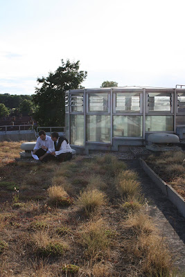
Actually, I’m a little unsure about the green roofs – the planting reminds me of the sort of thing you see sprouting from a disused runway.


Ambling along the waterside concourse is a very pleasant thing to do on a sunny, summer evening. Looking over the water to the backdrop of reeds, trees and wildlife – you could almost forget you’re in Nottingham! Whilst timber cladding has become rather passé, the palette of materials used is simple, well balanced and tasteful. You would feel proud to be a student here.


It’s actually some way into the campus before I get my first glimpse of MAKE’s phase 2 buildings, and then rather strangely half hidden behind a building and some car parking. The new buildings are certainly striking.

As you continue south, a new pathway leading to the phase 2 campus, cuts across the main concourse. Where the Hopkins designed campus is all calm and simplicity, this new path is a riot of colours, funky paving, water-features, stone cubes, trees and brightly coloured planting. Someone with a more base mind than I, could draw some sort of significance from the way this path ends in a fountain on the otherwise tranquil lake...

Look its "Aspire" (it’s a pun, it’s an inspiration, it’s a metaphor, it’s a giant ice cream cone).

Wandering round the campus, I had found myself defending MAKE’s buildings to a former colleague, who was convinced that they represented the worst excesses of “starchitects”. I cited Laver’s Law, that Universities should be about new, and optimistic, and finally that they are just ahead of their time. But as I get closer, I begin to doubt my arguments.

Close up and I can begin to understand why I want to like these buildings. Part of me is still the small child that grew up watching sci-fi films and is desperately disappointed by the modern world. Where are the flying cars? Where are the discos with uninhibited space chicks dancing in silver mini-skirts? And where is the lunar colony? MAKE’s buildings are a business park approximation of how I imagined 2010 should look and kind of wish it did. Unfortunately, for all their sci-fi styling, there are some seriously big problems with these buildings. For a start...

... they face straight onto a car park and the arse-end of other buildings (again I can imagine some might to want to use a crude metaphor for this. Not I, natch). Landscape architecture is all about context and setting, whereas these buildings give no regard to their setting and only seem to interact with what immediately surrounds them (notice how the planting is limited to just the building curtilage). When our guide “explained” the thinking behind MAKE’s design I could actually feel myself getting angry. Apparently, the coloured bands represent the underlying strata, planting is inspired by American studies, whilst the east-west axis extends the site... Rubbish. It’s just empty post rationalisation for doing whatever the hell they like.

Plonk architecture isn’t just confined to this scheme. Was the Gherkin designed especially for Swiss Re, or had it been sitting on Ken Shuttleworth’s (Mr MAKE) drawing board, just waiting for an somewhere to stick it? While architecture can create a new character for a place, I think a design is nearly always more successful when it gives some regard to it’s context and setting. Unfortunately, it seems to me that too many designers, driven by their ego, set out to create their own context. Worse still, I think that there is actually a school of thinking in architecture particularly, that wants to actively go against, subvert or contrast with it’s surroundings, because “Hey, it’s a juxtaposition!”

The Hopkins masterplan gives the campus a clear, simple layout and a calm, elegant environ, which MAKE completely disregard .While I want to love MAKE’s addition to the Jubilee campus for it’s futuristic style, it’s contempt for the surrounding context is everything I detest in the design of our built environment. Some may argue that taken out of context these buildings are terrific, but context is everything when dealing with the world we live in.

Weirdly though, as we trudged back to the car park, I found myself wishing that more buildings were shaped like aerodynamic wedges and clad in exotic metails. A few space chicks in mini skirts wouldn’t go amiss either.
Friday, 7 March 2014
5 1 GIS structuralism the birth the death and the life of planning
5.1 GIS, structuralism, the birth, the death and the life of planning
Contents list
A geographical information system (GIS) is able to represent the world in different ways for different purposes, by retrieving information from a computer-held
database. Structuralism recognizes that all information about the world enters the mind not as raw data but as abstract structures resulting from mental
transformations of sensory input. The birth of planning, as a specialized profession, developed from seeing the world in one particular way, on two-dimensional
drawings which privilege a certain aspect of the environment. As the death of planning, in this limited sense, is imminent, the future life of planning
lies with specialized plans, based on specialized surveys, stored within a GIS and assembled for defined purposes. These five points are the subject of
this essay.
Leonardo da Vincis Map of Imola (1502), one of the first precisely measured and accurately drawn maps, was a projection on a plane surface
5.2 The birth of the planner
Contents list
The oldest cities, one assumes, were made without the assistance of drawn plans, but using marks on the ground. When more sophisticated structures were
required, clay tablets and then drawings came into use. By the first century AD,
Vitruvius
considered that half the education of an architect should be spent becoming "skilful with the pencil, instructed in geometry and familiar with the special
departments of knowledge. Vitruvius wished the other half of his time to be spent "acquiring manual skill on building sites where work is done "according
to the design of a drawing (Vitruvius, 1914 edn). Small-scale maps were later made to assist trade, transport and conquest. In the chaos of the Dark Ages,
the Roman skill of drawing buildings, like the art of making bricks, was forgotten. Eventually, the arts of civilization returned to Europe, but many centuries
passed before there was a return to the practice of making maps and planning cities on paper. No design drawings for medieval cathedrals have been found,
but carvings exist on which a large pair of dividers is used as a symbol for the builders trade. Dividers were used to transfer dimensions and to set
out full-size working plans for masonry.
To plan is to make a projection on a horizontal plane (Figure
5.1)
; to de-sign is to put a sign on paper. Translation of Euclids Elements from Arabic into Latin, in 1482, revived interest in the ideas of design-by-drawing
and planning-by-drawing. In time, it became common for professionals with knowledge of geometry to produce plans, in offices, for the construction of towns
and buildings. Such plans had advantages. Roads could be made straight, broad and convenient; drains could be made to run downhill; land ownership disputes
could be settled; structural designs could be founded on mathematics. It was a great advance. During the Renaissance, drawings were used to help in planning
villas for the rich. Later, drawn maps were used in local and national planning. In the eighteenth century, maps were produced to define territories. National
borders came into existence. Louis XV observed that he lost more territory by accurate mapping than ever he gained by conquest. The largest example of
planning-by-drawing was the United States of America. The Land Ordinance of 1785 imposed a gigantic gridiron on the natural landscape. This was planning
in the sense of ordering the land, but it ignored the presence of rivers, forests, hills and valleys, which, at that time, had not been mapped in detail
(Reps, 1965).
5.2 Accurate surveys date from the nineteenth century. In Britain such maps (eg of Blackheath, above) are described as Ordnance Surveys, reminding us of
their military origin.
In Britain, detailed topographic maps have been published by the Ordnance Survey since 1801 (Figure 5.2). Ordnance, a variation of ordinance, is the means
of enforcing orders. According to the dictionary it includes: "mounted guns, cannon, and that branch of the government service dealing with military stores
and materials. Ordnance maps enable people to invade and defend territory. This was their purpose. As an unintended side-effect, they facilitated an invasive
and dictatorial variety of town and country planning. The engineering and surveying professions developed with mathematics and drawing as their defining
skills, and flourished under military patronage. Before maps and plans became common, towns were the work of builders, who made infrequent resort to plans.
Had the introduction of design-by-drawing and planning-by-drawing merely been technical changes, like the replacement of clay tablets with paper, they
would not merit our attention. In practice, the technique of paper planning had profound consequences for the product. Town planning and architecture became
epic examples of McLuhans dictum: "the medium is the message (McLuhan, 1967). Until recently, the medium was paper. In future, it will be a computer-held
database, currently known as a geographical information system, or GIS.
Classical geography, which was plan-based, conceived cities as physical entities, to be analysed in terms of size, density, land use, population, centricity,
axiality, and so forth. Early city planners therefore made unitary plans, showing roads, land uses and densities (Figure 3). These are now known as physical
plans and zoning plans. By the 1960s, geographers were increasingly regarding cities as the product of social and economic forces. Planning changed direction.
It became involved with economic growth, social deprivation, education and the environment. Marxist geographers came to see towns as the outcome of capitalist
accumulation and the class struggle. Postmodern geography, inspired by structuralism and post-structuralism, is branching out in all directions. It is
recognized that society is
contextualized and regionalized around a multi-layered nesting of supra-individual modal locales -- a home-base for collective nourishment and biological
reproduction, collection sites and territories for food and materials, ceremonial centres and places to plan, shared spaces and forbidden terrains, defensible
neighbourhoods and territorial enclosures. (Soja, 1989)
[FIG 5.3 ] Geographers and planners shared an interest in roads and densities – so that planning became a matter of planning roads and specifying densities.
This account, from Sojas Postmodern Geographies, points to the need for multiple world views, which GIS are eminently capable of managing. Structuralism
suggests the need for new world-views; computer-held databases facilitate their representation. Multiple ways of looking at the world will be paralleled
by multiple ways of looking at planning and design. There is no reason why one of them, the two-dimensional projection of physical structures onto a plane
surface, should take precedence as The City Plan, or The Master Plan for an urban development. Towns, roads, buildings and gardens, when planned on paper,
have a curious rigidity, like a squad on parade. The effect can be splendid -- but it should not be allowed to rule the world. The postmodern city needs
to be mapped as "a multi-layered nesting of supra-individual modal locales (Figure 4).
[FIG 5.4 ] The postmodern city is conceived as a multi-layered nesting of supra-individual modal locales.
Plan of Paris c1600
5.3 The death of the planner
Contents list
Consider an office park, photographed for a professional brochure (Figure 5.5). The implied offer is "Employ John Swish and Company; we make this kind of
place. Other photos might show a lake, sunlight sparkling on the water, a generous path winding along the shore and a bird poised on a sculpture. Beyond
this path is a clump of Rosa rugosa "Frau Dagmar Hastrup with soft pink flowers, offset by the dark green leaves of Prunus laurocerasus "Otto Luyken.
A gleaming high-tech building clad in bluish glass forms the backdrop. Who "designed this pleasant scene?
Certainly not John Swish. He retired many years ago, though his firm did some paving work. The new boss is an efficient manager with little zest for design
and no time for drawings. He won the commission by promising his client "a high-quality landscape. Then he passed the job to a junior partner, who employed
a succession of design assistants to do the work. Neither did Frau Hastrup or Herr Luyken make a direct contribution to the project.
The local planning committee was opposed to office development on this site but felt that "a well-landscaped park would be an acceptable compromise between
conservation and the urgent local need for jobs. The project was initiated by Robert J. Hurst II, an American whose father had started a real estate development
company. He knew Silicon Valley and was able to raise finance by drawing attention to the superior financial returns on prestige developments with blue
chip occupiers. The Hurst Corporations brochure contained photographs of high-tech buildings in parkland settings. The long-term costs of managing the
landscape were of some concern to tenants but it was explained that no grass area would be too steep for gang-mowing and that the landscapers would be
supplied with a list of low-maintenance shrubs from which to choose.
And so it goes on. Local highway engineers stipulated design criteria for road curves and visibility splays. The drainage authority required construction
of a storm detention pond, so that the rate of surface water run-off would not be increased. The local fire department insisted on a wide path between
the lake and the building. The architect was given the dimensions of a building and shown a photograph of a glass-clad building that the client firms
managing director liked. The artist was commissioned to produce "a representational sculpture of a girl. The materials were either manufactured, as paving
bricks and glass cladding, or, like the grass and plant varieties, bred for a special purpose. Although the landscape architect prepared drawings and specifications
for the earthmoving, pavements, seeding, planting, and lake edge details, which occupy over 50% of the photograph, she can hardly be said to have "designed
or "master planned the scene. Nor can any individual or profession take credit or blame for the overall conception. The further ones investigations are
carried, the less independence any of the actors appears to have had. The government set the legislative framework. The staff in the planning authority
and various consultant firms were guided by their employers and their professional institutions. There were numerous standards and codes of practice to
be followed. The "design concept came from another country.
Not only is it impossible to name the planner or the designer, there are many different ways of seeing the plan and the design, as indicated by photographs,
published with different captions in different magazines. In the Environmental Journal, it was a wanton act of "habitat destruction. In the Property Journal,
it was "a profitable investment. The Architecture Journal saw it as an example of the "new modern style. The Art Journal saw the sculpture as "New Realism.
The lake design was analysed in the Engineers Journal to illustrate a new technique of water retention. An amateur photographer noticed the irony of a
bird perching on the girls chest and received a prize from an amateur photographic magazine, which used the caption "Tit on tit.
5.5 Office Park
5.4 The birth of the layerer
Contents list
The argument of the preceding section is based on Roland Barthes celebrated essay, "The death of the author.
We know now that a text consists not of a line of words, releasing a single "theological meaning (the "message of the Author-God), but of a multi-dimensional
space in which are married and contested several writings, none of which is original: the text is a fabric of quotations, resulting from a thousand sources
of culture. (Barthes, 1977)
Barthes, who moved from structuralism to post-structuralism, supports his argument with a telling historical point:
The author is a modern character, no doubt produced by our society as it emerged from the Middle Ages, inflected by English empiricism, French rationalism
and the personal faith of the Reformation, thereby discovering the prestige of the individual, or, as we say more nobly, of the "human person. (Barthes,
1977)
The "author, the "designer and the "planner are modern inventions, the products of an individualist age. In tribal societies, in pre-Homeric Greece and
in medieval Europe, the names of artists were not recorded. The great European cathedrals were "built in heaven with living stones. Only God had the power
of creation. Even the authors of Beowulf are unknown to us. The modern Artist-God, the Author-God and the Planner-God are products of individualism and
romanticism.
The literary metaphor can be resumed, again with Barthes:
... if up until now we have looked at the text as a species of fruit with a kernel (an apricot, for example), the flesh being the form and the pit being
the content, it would be better to see it as an onion, a construction of layers (or levels, or systems) whose body contains, finally, no heart, no kernel,
no secret, no irreducible principle, nothing except the infinity of its own envelopes -- which envelop nothing other than the unity of its own surfaces.
(Barthes, 1971)
Similarly with town plans. If, until now, we have looked at the plan as an entity with a unitary structure, it would be better to see it as a construction
of layers with, finally, no heart, no kernel, no secret, no irreducible principle. Planning and design in the post-Postmodern world may become more like
planning and design in the Pre-modern world. Medieval cities did not have unitary town plans. Medieval cathedrals did not have master plans. Each craftsman
had an area of responsibility, and the church authorities were intimately involved with all the important decisions. When the cathedral was built, it could
be drawn. Mr Pecksniff, in Dickens Martin Chuzzlewit, trained his pupils by drawing Salisbury Cathedral "from the north. From the south. From the east.
From the south-east. From the norwest (Dickens, 1843). This account gave a misleading conception of design and planning procedures.
If a large number of drawings are produced for a project, then one drawing will be more general than all the others. It is a key plan, which "masters the
others by showing how they fit together. A machine, for example, may require separate drawings for each component, and an assembly drawing, which acts
as a "master plan. This mechanistic analogy implies a need for masters. In the seventeenth century, it was argued that as the world resembles a watch,
but with infinite complexity, there must be a grand watchmaker: God. The built environment equivalent of this argument may be described as "the watchmaker
argument for the existence of planners: as towns and landscapes are complicated structures, they must have master plans. Significantly, theorists of evolution
now speak of a "blind watchmaker.
Karl Popper launched a fundamental attack on the notion of master planning. Living in Vienna during the 1930s, he was horrified at the deaths of those who
fell victim to fascist and communist theories of historical destiny. As these tendencies grew into Nazism, Popper concluded that neither science nor politics
can establish general laws about what is right for society. He therefore rejected "blueprint planning in favour of a "piecemeal approach in which there
is no defined end-state (Faludi, 1986). Many social and natural scientists, reflecting on the twentieth centurys ghastly experience with totalitarianism,
have supported Poppers line. Christopher Alexander, who also lived in Vienna during the 1930s, extended the argument to environmental design. He developed
a powerful case for incrementalism (Figure 6) and for having a planning process instead of a master plan. With master plans, "The totality is too precise:
the details are not precise enough (Alexander, 1975). It becomes like filling in the blanks in a childs colouring book. Master plans make each user feel
like "a cog in someone elses machine. They tell us what will be right in the future, instead of what is right now. This results in expensive projects,
riddled with mistakes. As master plans tend to be obsolete before they are complete, society is better off without them.
[FIG 5.6 ] Each new pattern, represented by dotted rectangles, must link with existing patterns, represented by solid rectangles, and provide for the implantation
of future patterns.
The Death of the Master Plan can release an outpouring of creativity. It is like moving from a centrally planned organization to one that fosters individual
creativity. IBM would like to have retained control of the computer industry. A few bright young men working in garages in California upset their plans
by inventing the personal computer. The next development may arise from a monastery in Tibet. Designs can begin at different points and proceed by different
paths. The Crystal Palace is an interesting example. It began not with an architects master plan but with the development, by two gardeners, of the ridge-and-furrow
glazing system. Loudons and Paxtons inventions made it possible to build glazed roofs and walls. A barrel vault was added when the building moved from
Kensington to Sydenham. This unconventional procedure resulted in the most brilliantly original building of the nineteenth century. But the details came
before the plan.
Roland Barthes notion of the death of the author has encouraged novelists to be explicit in their use of incidents, characters and quotations from other
writers. News, geography, biography and images have joined with conventional writing. Poetry and photography have moved towards each other. Comparable
developments have taken place in architecture, planning and gardens. An enthusiasm for planning-by-layers is breathing new life into urban design and planning.
It is a development of great significance, and it is older than one might think.
Until now, the world has been conceived as an apricot
5.5 Planning-by-layers with GIS
Contents list
Three factors have stimulated interest in a layered approach to analysis and planning:
concern for the environment
structuralist philosophy
the use of computer-based maps and drawings for environmental analysis (GIS - Geographical Information Systems)
Structuralist philosophy
Environmental concern
GIS Computer analysis of the environment with GIS
5.6 The birth of the layerer
Contents list
Environmental layers
Patrick Geddes was a significant theoretical influence on the use of layers (Geddes, 1915). He believed that plans should be for "Place, Work, Folk, not
merely for roads, sewers and buildings. The history of planning-by-layers dates from his time, and has been traced by Carl Steinitz (Steinitz et al., 1976).
It began with analysis-by-layers. Steinitzs earliest example, from 1912, is of a series of maps, drawn to the same scale for comparative purposes, by
a one-time associate of Frederick Law Olmsted. They included maps of soils, vegetation and topography. Also in 1912, a series of five plans showing the
historic development of Düsseldorf was submitted for a design competition. Steinitz identifies a number of American and British plans, produced in the
three decades after 1912, that use thematic maps drawn to the same scale. The first explicit reference to an "overlay technique comes from a 1950 English
textbook on Town and Country Planning (Tyrwhitt, 1950). Jaqueline Tyrwhitt gives examples of thematic surveys and Jack Whittle discusses the advantages
of transparent overlays. In 1964, Christopher Alexander worked on a highway route location project that used a series of 26 weighted overlays. Ian McHarg
used a similar approach in selecting a route for the Richmond Parkway. This developed into a sophisticated overlay technique (Figure 7). As with Alexanders
work on route selection, it was genuine "planning by layers, rather than mere "analysis by layers.
Fig 5.7 A diagrammatic representation of McHarg’s layered approach to landscape planning.
In Design with Nature,
Ian McHarg
showed, more convincingly than had ever been done before, how natural resource information could be incorporated into the planning process (McHarg, 1971).
His book was published at the start of a great upsurge in environmental awareness, and was widely influential. McHargs overlays were hand-drawn but, as
he himself noted, there were great opportunities for using computers to make a better job of the overlay technique. In his 1976 article, Steinitz advised
"dont make hand-drawn data maps -- make data files instead... I believe that the days of drawing board drudgery are numbered. He was right. The development
of computer-based GIS was ideally suited to overlay map analysis. One of the best-known systems, ArcInfo, was in fact developed by a landscape architect
with an interest in this approach.
Reviewing the history of hand-drawn overlays, Steinitz observes that:
Their greatest role has been to help us realize that a better understanding of the whole is derived from a knowledge of the parts and how they relate to
each other. The applications have become more complex, diverse and technically sophisticated, but as we examine the use of the overlay approaches from
their early development to present applications, it is clear that the basic methodology and the underlying logic have changed little. We combine data maps
on soil, slope, and other elements in the same manner that Warren Manning probably did in 1912.
The aim, of studying "the parts and how they relate to each other, has an affinity with the structuralist interest in relationships between phenomena.
5.7 Structural layers
Contents list
Linguistic structuralism has provided another motivation for planning-by-layers. It developed out of semiotics, which is the study of signs. A sign comprises
a signifier and a signified. The sign "DOG is the signifier for the signified - which has four feet and can bark. Structuralists argued that language
is a surface structure, of signifiers, which lies above a deep structure, of signifieds. Lévi-Strauss used a geological analogy to explain the idea. Just
as the surface structure of the land tells us about deep geological structures, so language tells us about deep structures in the human mind. Post-structuralists
argued that the link between surface structures and deep structures is arbitrary and unstable. This led to the proposition that the "real world can be
a variety of different things, depending upon ones point of view. Richard Harland proposes superstructuralism as a general term for "the whole field of
Structuralists, Semioticians, Althusserian Marxists, Foucaultians, Post-Structuralists etc. (Harland, 1988). Superstructuralism inverts the ordinary surface-structure/deep-structure
model so that nature, for example, comes to be seen as a cultural construct, as do maps and plans.
Each view of the world can be described as a "landscape. Landscape was coined in Old English by adding the suffix -scape to the noun land. This converted
a concrete noun into an abstract noun. After slipping out of use, landscape re-entered English in the seventeenth century. It came from Dutch, as a painters
term. A landscape then meant an ideal view of the land, often assembled from several actual views. In the eighteenth century, landscape designers came
to use the term to mean an ideal place, resulting from a design. In modern English, painters use landscape to mean a view of the land, rather than the
land itself. Geographers took landscape into their vocabulary during the nineteenth century, to mean "the end product of topographic evolution, as in
the title of W.G. Hoskinss Making of the English Landscape. Considering this etymological history, it is reasonable to use "landscape to mean a particular
view of the world. Physically, landscapes are determined by ones geographical position. Psychologically, landscapes are determined by the mental structures
with which we interpret sensory data.
New ways of representing the world inevitably produce new approaches to design, as did Renaissance perspective. Jacques Derrida started from the Lévi-Strauss
argument that, in language as in geology, deep structures lie beneath surface structures. He then challenged, or deconstructed, the hierarchical relationship
between the structural elements. Inspired by these ideas, Bernard Tschumis plan for Parc de la Villette in Paris became one of the first examples of poststructuralist
planning and design. Tschumi was steeped in structuralism. In the introduction to Cinégramme Folie he observes that the limits between domains of thought
have gradually vanished, so that architecture can entertain relations with cinema, philosophy and psychoanalysis (Tschumi, 1987). Tschumi quotes Roland
Barthes on the "combinative nature of creative work and criticizes the "more traditional play between function or use and form or style. But he does
not shake off his own background as a physical designer. Tschumis interest was mainly in geometrical layers, not landscape layers (Figure 8). He wrote
of "the set of combinations and permutations that is possible among different categories of analysis (space, movement, event, technique, symbol etc).
Tschumis project for la Villette, which is the subject of another essay, stimulated enormous interest in design-by-layers.
Fig 5.8 Structuralist layers at Parc la Villette (see
Essay No. 18 )
5.8 CAD and GIS layers
Contents list
Digital computers have generated additional interest in planning-by-layers. The data structures that they use lend themselves to representing buildings
and places as layered structures. In AutoCad, a popular computer-aided design program, the Layer Control command enables the different entities of a drawing
to be grouped into layers. A single-storey building might use separate layers for foundations, floor surfacing, services, ceiling and roof. Multi-storey
buildings will use a great many more layers. Additional layers can be drawn for other components of the building: heating, ventilation, electrical cables,
structural frame and so forth. In ArcInfo, one of the most popular GIS programs, map layers are known as coverages, each of which is stored as a subdirectory.
If coverages have the same registration marks (TICS) it is easy to perform overlay, sieving and buffering operations. The LIST command, which is available
in both ArcInfo and Autocad, will show a database listing of coordinates for every node. LIST shows them in database format. From ArcInfo, it is possible
to transfer the data into a standard office database or spreadsheet program, such as dBase, Excel or Lotus.
Until recently, all architects and planners made their proposals on two-dimensional maps. Some still do, but the practice is unlikely to survive. It came
with the Renaissance, and computers have made it obsolete. The change is of profound operational and conceptual significance for architects, planners and
landscape designers. Environmentalism and structuralism make planning-by-layers conceptually appealing. Computers make it easy. If a CAD program is used,
the layers are likely to be geometrical. If a GIS program is used, the layers will also be thematic. When the boundaries between the two software technologies
begin to dissolve, there will be a very wide choice of what to show on layers. With three powerful reasons for adopting a layered approach, there can be
little doubt that the procedure has a long way to go.
5.9 Deterministic planning
Contents list
In these early days of planning-by-layers, the foremost danger is the belief that the computer can resolve the age-old problems of planning, by providing
a rationalist method leading to inevitable conclusions. McHarg, arguing in favour of planning-by-layers, wrote that:
It provided a method whereby the values employed were explicit, where the selection method was explicit -- where any man, assembling the same evidence,
would come to the same conclusion. (McHarg, 1971)
McHarg saw this as "environmental determinism: a method that allows "nature, instead of man, to take development decisions. His title, Design with Nature,
cleverly steps back from determinism, implying that nature will simply help man to take better decisions. The text is less cautious, as revealed by the
remark that "any man using the same method will come to the same conclusion.
Later advocates of GIS-based planning have seen the method as a "decision support system. This implies a method for using geographical information to help
planners, rather than a decision-making system. It is an attractive proposition, which takes us to the key question in GIS-based planning: which data should
be used?
Consider the case of a developer seeking a site for a new office building. Using a GIS, it is possible to find a site which is:
1. over 2000 square metres in size;
2. located on soils that are suitable for construction;
3. not located on forested land;
4. not located on land of high agricultural value;
5. within 300 metres of an existing sewer line;
6. not within 20 metres of a watercourse.
This example is taken from Understanding GIS: The Arc/Info Method (Environmental Systems Research Institute, 1993). It appears to offer a decision-making
procedure that is entirely based on verifiable criteria. If similar procedures were used for schools, housing, industry, transport, and every other land
use, one could produce a full land use plan. As every decision would rest upon objective criteria, everyone would support the plan, wouldnt they? Well,
they shouldnt. The following points indicate some of the flaws in the decision tree.
1. The size of ownership parcels can be changed, by land assembly.
2. With suitable foundation engineering, construction can take place on almost any substrate.
3. If one area of forest is lost, another can be allowed to grow.
4. With the current food surplus in developed countries, there is no need to preserve land of high agricultural value.
5. New sewer lines can be built.
6. Streams can be protected from pollution by filtration.
The idea that GIS enable a "rational planning procedure leading to "optimal land use allocations is wholly misconceived. GIS are no more capable of resolving
planning problems than a pocket calculator is capable of telling people how to vote. The contrary view rests on the old enlightenment dream that reason
can resolve all conflicts and solve all problems. I wish it could. Computers have merely given the dream a short lease of extended life, partly through
the magic of the machine and partly through the concept of layers. "Layers of what?, is the fundamental question. Easy analogies were drawn with layer-cakes
and sedimentary formations. Both are unitary structures; both have tops and bottoms (Figure 9). But, if planning is conceived in this way, which is the
top layer? Too much twentieth century planning was conducted in a top-down sequence:
1. begin with land ownership;
2. designate the land use;
3. engineer the roads;
4. subdivide the land;
5. design the buildings;
6. arrange the paving and the planting;
7. furnish the interiors.
Fig 5.9 If planning resembles a layer-cake, which layer should be on top?
After that, users and maintenance workers were left to make the best they could of a bad job. The whole procedure was tyrannical. And it was no more capable
of making good places than dictatorship is capable of providing good government. Both fail through lack of information. Both favour grim concrete jungles
with wide roads and boxy buildings. Central planning simply cannot cope with the wide universe of facts, values and beliefs. Democratic planning requires
fresh maps, fresh concepts, fresh information and fresh procedures.
untitled 1 frame
Amazon.com
cover
Design with Nature
Used $26.47!
(Prices May Change)
Privacy Information
untitled 1 frame end
5.10 The life of planning
Contents list
The perceived world is more like an onion than an apricot; more like a diamond than a layer cake. From every angle, one sees a different landscape pattern,
none of which has any superior claim to "reality. All are reflections and transparencies, hopes and fears. Each can be seen only with certain eyes, from
certain viewpoints, in certain light conditions. Deterministic planning developed from military maps. Democratic planning requires different maps. The
mole, the house-martin and the eel have views of the world that are invisible to us, as do children, old people and blind people. Each individual has a
mental map and a system of navigation. Human societies contain many interest groups that need special maps and plans. Only selected data can be shown on
a map, and there has to be a principle for making the selection. Normally, it will be a functional principle, relating to characteristics of the existing
environment or to a proposed future environment. Planning-by-layers may turn out to be the greatest invention since design-by-drawing.
Should an organization wish to conserve the worlds house-martin colonies, it will require a map. Should another organization wish to increase the worlds
eel stock, it will require maps of breeding routes and breeding grounds. If a water company wants to recharge the aquifers in which underground water is
stored, it must know where porous soils and rocks are located. If I want to avoid speed control cameras and park my car in Central London, I will need
special maps showing the location of camera positions and parking places. Old maps were produced for military purposes. Modern maps are no less purposive,
but the purposes are different. A moles map would not extend above ground level. A swallowss map would be of air currents and flying insects. An eels
map would show routes to and from the Sargasso Sea. The Society for the Protection of Birds may wish to prepare a City Bird Plan. The creation of new habitats
will be a central feature of this plan. They are likely to be beside railway lines and sewage works, in public parks, schools and gardens, and on flat
roofs. Cities have large numbers of flat roofs, which could have been planned as bird habitats.
Transport has long been a central aspect of planning. In some countries, like Switzerland, the various modes are fully integrated. In others, like Britain,
there are many discontinuities. Integration requires plans for the component subsystems and for the links. If the components are to function effectively,
they must have their own maps and their own design teams. If the links are to be effective, different groups of planners must sit together under democratic
umbrellas. Otherwise, cities cannot have footpaths and cyclepaths leading to sheltered places with coffee, newspapers and good connections to rail stations,
bus stations and airports. An Equestrian Society could make a convincing case for a Horse Transport Plan. A significant number of town dwellers own horses,
which do not get enough exercise. There could be bridleways running through those linear green wedges that landscape architects have been planning since
Olmsteds time. Most of them are underused. Commercial stables could be franchised to locate at the city centre ends of these wedges, near transport interchanges.
A Pedestrians Association may contribute to an overall Pedestrian Plan. They are likely to argue for a continuous pedestrian surface in cities. The paved
sidewalk was a mid-nineteenth century invention, which has been greatly overused.
Multimedia GIS should supply information to all the different groups and bodies that wish to make plans. Many of them will also be able to supply information
and contribute to the central database. Political bodies can take decisions when there are conflicts of interest, but democratic societies have proved
remarkably successful at accommodating individuals, provided they have the necessary information. If planning is to be reborn, planners need to focus their
minds on GIS, structuralism and planning-by-layers.
Read More..
Contents list
A geographical information system (GIS) is able to represent the world in different ways for different purposes, by retrieving information from a computer-held
database. Structuralism recognizes that all information about the world enters the mind not as raw data but as abstract structures resulting from mental
transformations of sensory input. The birth of planning, as a specialized profession, developed from seeing the world in one particular way, on two-dimensional
drawings which privilege a certain aspect of the environment. As the death of planning, in this limited sense, is imminent, the future life of planning
lies with specialized plans, based on specialized surveys, stored within a GIS and assembled for defined purposes. These five points are the subject of
this essay.
Leonardo da Vincis Map of Imola (1502), one of the first precisely measured and accurately drawn maps, was a projection on a plane surface
5.2 The birth of the planner
Contents list
The oldest cities, one assumes, were made without the assistance of drawn plans, but using marks on the ground. When more sophisticated structures were
required, clay tablets and then drawings came into use. By the first century AD,
Vitruvius
considered that half the education of an architect should be spent becoming "skilful with the pencil, instructed in geometry and familiar with the special
departments of knowledge. Vitruvius wished the other half of his time to be spent "acquiring manual skill on building sites where work is done "according
to the design of a drawing (Vitruvius, 1914 edn). Small-scale maps were later made to assist trade, transport and conquest. In the chaos of the Dark Ages,
the Roman skill of drawing buildings, like the art of making bricks, was forgotten. Eventually, the arts of civilization returned to Europe, but many centuries
passed before there was a return to the practice of making maps and planning cities on paper. No design drawings for medieval cathedrals have been found,
but carvings exist on which a large pair of dividers is used as a symbol for the builders trade. Dividers were used to transfer dimensions and to set
out full-size working plans for masonry.
To plan is to make a projection on a horizontal plane (Figure
5.1)
; to de-sign is to put a sign on paper. Translation of Euclids Elements from Arabic into Latin, in 1482, revived interest in the ideas of design-by-drawing
and planning-by-drawing. In time, it became common for professionals with knowledge of geometry to produce plans, in offices, for the construction of towns
and buildings. Such plans had advantages. Roads could be made straight, broad and convenient; drains could be made to run downhill; land ownership disputes
could be settled; structural designs could be founded on mathematics. It was a great advance. During the Renaissance, drawings were used to help in planning
villas for the rich. Later, drawn maps were used in local and national planning. In the eighteenth century, maps were produced to define territories. National
borders came into existence. Louis XV observed that he lost more territory by accurate mapping than ever he gained by conquest. The largest example of
planning-by-drawing was the United States of America. The Land Ordinance of 1785 imposed a gigantic gridiron on the natural landscape. This was planning
in the sense of ordering the land, but it ignored the presence of rivers, forests, hills and valleys, which, at that time, had not been mapped in detail
(Reps, 1965).
5.2 Accurate surveys date from the nineteenth century. In Britain such maps (eg of Blackheath, above) are described as Ordnance Surveys, reminding us of
their military origin.
In Britain, detailed topographic maps have been published by the Ordnance Survey since 1801 (Figure 5.2). Ordnance, a variation of ordinance, is the means
of enforcing orders. According to the dictionary it includes: "mounted guns, cannon, and that branch of the government service dealing with military stores
and materials. Ordnance maps enable people to invade and defend territory. This was their purpose. As an unintended side-effect, they facilitated an invasive
and dictatorial variety of town and country planning. The engineering and surveying professions developed with mathematics and drawing as their defining
skills, and flourished under military patronage. Before maps and plans became common, towns were the work of builders, who made infrequent resort to plans.
Had the introduction of design-by-drawing and planning-by-drawing merely been technical changes, like the replacement of clay tablets with paper, they
would not merit our attention. In practice, the technique of paper planning had profound consequences for the product. Town planning and architecture became
epic examples of McLuhans dictum: "the medium is the message (McLuhan, 1967). Until recently, the medium was paper. In future, it will be a computer-held
database, currently known as a geographical information system, or GIS.
Classical geography, which was plan-based, conceived cities as physical entities, to be analysed in terms of size, density, land use, population, centricity,
axiality, and so forth. Early city planners therefore made unitary plans, showing roads, land uses and densities (Figure 3). These are now known as physical
plans and zoning plans. By the 1960s, geographers were increasingly regarding cities as the product of social and economic forces. Planning changed direction.
It became involved with economic growth, social deprivation, education and the environment. Marxist geographers came to see towns as the outcome of capitalist
accumulation and the class struggle. Postmodern geography, inspired by structuralism and post-structuralism, is branching out in all directions. It is
recognized that society is
contextualized and regionalized around a multi-layered nesting of supra-individual modal locales -- a home-base for collective nourishment and biological
reproduction, collection sites and territories for food and materials, ceremonial centres and places to plan, shared spaces and forbidden terrains, defensible
neighbourhoods and territorial enclosures. (Soja, 1989)
[FIG 5.3 ] Geographers and planners shared an interest in roads and densities – so that planning became a matter of planning roads and specifying densities.
This account, from Sojas Postmodern Geographies, points to the need for multiple world views, which GIS are eminently capable of managing. Structuralism
suggests the need for new world-views; computer-held databases facilitate their representation. Multiple ways of looking at the world will be paralleled
by multiple ways of looking at planning and design. There is no reason why one of them, the two-dimensional projection of physical structures onto a plane
surface, should take precedence as The City Plan, or The Master Plan for an urban development. Towns, roads, buildings and gardens, when planned on paper,
have a curious rigidity, like a squad on parade. The effect can be splendid -- but it should not be allowed to rule the world. The postmodern city needs
to be mapped as "a multi-layered nesting of supra-individual modal locales (Figure 4).
[FIG 5.4 ] The postmodern city is conceived as a multi-layered nesting of supra-individual modal locales.
Plan of Paris c1600
5.3 The death of the planner
Contents list
Consider an office park, photographed for a professional brochure (Figure 5.5). The implied offer is "Employ John Swish and Company; we make this kind of
place. Other photos might show a lake, sunlight sparkling on the water, a generous path winding along the shore and a bird poised on a sculpture. Beyond
this path is a clump of Rosa rugosa "Frau Dagmar Hastrup with soft pink flowers, offset by the dark green leaves of Prunus laurocerasus "Otto Luyken.
A gleaming high-tech building clad in bluish glass forms the backdrop. Who "designed this pleasant scene?
Certainly not John Swish. He retired many years ago, though his firm did some paving work. The new boss is an efficient manager with little zest for design
and no time for drawings. He won the commission by promising his client "a high-quality landscape. Then he passed the job to a junior partner, who employed
a succession of design assistants to do the work. Neither did Frau Hastrup or Herr Luyken make a direct contribution to the project.
The local planning committee was opposed to office development on this site but felt that "a well-landscaped park would be an acceptable compromise between
conservation and the urgent local need for jobs. The project was initiated by Robert J. Hurst II, an American whose father had started a real estate development
company. He knew Silicon Valley and was able to raise finance by drawing attention to the superior financial returns on prestige developments with blue
chip occupiers. The Hurst Corporations brochure contained photographs of high-tech buildings in parkland settings. The long-term costs of managing the
landscape were of some concern to tenants but it was explained that no grass area would be too steep for gang-mowing and that the landscapers would be
supplied with a list of low-maintenance shrubs from which to choose.
And so it goes on. Local highway engineers stipulated design criteria for road curves and visibility splays. The drainage authority required construction
of a storm detention pond, so that the rate of surface water run-off would not be increased. The local fire department insisted on a wide path between
the lake and the building. The architect was given the dimensions of a building and shown a photograph of a glass-clad building that the client firms
managing director liked. The artist was commissioned to produce "a representational sculpture of a girl. The materials were either manufactured, as paving
bricks and glass cladding, or, like the grass and plant varieties, bred for a special purpose. Although the landscape architect prepared drawings and specifications
for the earthmoving, pavements, seeding, planting, and lake edge details, which occupy over 50% of the photograph, she can hardly be said to have "designed
or "master planned the scene. Nor can any individual or profession take credit or blame for the overall conception. The further ones investigations are
carried, the less independence any of the actors appears to have had. The government set the legislative framework. The staff in the planning authority
and various consultant firms were guided by their employers and their professional institutions. There were numerous standards and codes of practice to
be followed. The "design concept came from another country.
Not only is it impossible to name the planner or the designer, there are many different ways of seeing the plan and the design, as indicated by photographs,
published with different captions in different magazines. In the Environmental Journal, it was a wanton act of "habitat destruction. In the Property Journal,
it was "a profitable investment. The Architecture Journal saw it as an example of the "new modern style. The Art Journal saw the sculpture as "New Realism.
The lake design was analysed in the Engineers Journal to illustrate a new technique of water retention. An amateur photographer noticed the irony of a
bird perching on the girls chest and received a prize from an amateur photographic magazine, which used the caption "Tit on tit.
5.5 Office Park
5.4 The birth of the layerer
Contents list
The argument of the preceding section is based on Roland Barthes celebrated essay, "The death of the author.
We know now that a text consists not of a line of words, releasing a single "theological meaning (the "message of the Author-God), but of a multi-dimensional
space in which are married and contested several writings, none of which is original: the text is a fabric of quotations, resulting from a thousand sources
of culture. (Barthes, 1977)
Barthes, who moved from structuralism to post-structuralism, supports his argument with a telling historical point:
The author is a modern character, no doubt produced by our society as it emerged from the Middle Ages, inflected by English empiricism, French rationalism
and the personal faith of the Reformation, thereby discovering the prestige of the individual, or, as we say more nobly, of the "human person. (Barthes,
1977)
The "author, the "designer and the "planner are modern inventions, the products of an individualist age. In tribal societies, in pre-Homeric Greece and
in medieval Europe, the names of artists were not recorded. The great European cathedrals were "built in heaven with living stones. Only God had the power
of creation. Even the authors of Beowulf are unknown to us. The modern Artist-God, the Author-God and the Planner-God are products of individualism and
romanticism.
The literary metaphor can be resumed, again with Barthes:
... if up until now we have looked at the text as a species of fruit with a kernel (an apricot, for example), the flesh being the form and the pit being
the content, it would be better to see it as an onion, a construction of layers (or levels, or systems) whose body contains, finally, no heart, no kernel,
no secret, no irreducible principle, nothing except the infinity of its own envelopes -- which envelop nothing other than the unity of its own surfaces.
(Barthes, 1971)
Similarly with town plans. If, until now, we have looked at the plan as an entity with a unitary structure, it would be better to see it as a construction
of layers with, finally, no heart, no kernel, no secret, no irreducible principle. Planning and design in the post-Postmodern world may become more like
planning and design in the Pre-modern world. Medieval cities did not have unitary town plans. Medieval cathedrals did not have master plans. Each craftsman
had an area of responsibility, and the church authorities were intimately involved with all the important decisions. When the cathedral was built, it could
be drawn. Mr Pecksniff, in Dickens Martin Chuzzlewit, trained his pupils by drawing Salisbury Cathedral "from the north. From the south. From the east.
From the south-east. From the norwest (Dickens, 1843). This account gave a misleading conception of design and planning procedures.
If a large number of drawings are produced for a project, then one drawing will be more general than all the others. It is a key plan, which "masters the
others by showing how they fit together. A machine, for example, may require separate drawings for each component, and an assembly drawing, which acts
as a "master plan. This mechanistic analogy implies a need for masters. In the seventeenth century, it was argued that as the world resembles a watch,
but with infinite complexity, there must be a grand watchmaker: God. The built environment equivalent of this argument may be described as "the watchmaker
argument for the existence of planners: as towns and landscapes are complicated structures, they must have master plans. Significantly, theorists of evolution
now speak of a "blind watchmaker.
Karl Popper launched a fundamental attack on the notion of master planning. Living in Vienna during the 1930s, he was horrified at the deaths of those who
fell victim to fascist and communist theories of historical destiny. As these tendencies grew into Nazism, Popper concluded that neither science nor politics
can establish general laws about what is right for society. He therefore rejected "blueprint planning in favour of a "piecemeal approach in which there
is no defined end-state (Faludi, 1986). Many social and natural scientists, reflecting on the twentieth centurys ghastly experience with totalitarianism,
have supported Poppers line. Christopher Alexander, who also lived in Vienna during the 1930s, extended the argument to environmental design. He developed
a powerful case for incrementalism (Figure 6) and for having a planning process instead of a master plan. With master plans, "The totality is too precise:
the details are not precise enough (Alexander, 1975). It becomes like filling in the blanks in a childs colouring book. Master plans make each user feel
like "a cog in someone elses machine. They tell us what will be right in the future, instead of what is right now. This results in expensive projects,
riddled with mistakes. As master plans tend to be obsolete before they are complete, society is better off without them.
[FIG 5.6 ] Each new pattern, represented by dotted rectangles, must link with existing patterns, represented by solid rectangles, and provide for the implantation
of future patterns.
The Death of the Master Plan can release an outpouring of creativity. It is like moving from a centrally planned organization to one that fosters individual
creativity. IBM would like to have retained control of the computer industry. A few bright young men working in garages in California upset their plans
by inventing the personal computer. The next development may arise from a monastery in Tibet. Designs can begin at different points and proceed by different
paths. The Crystal Palace is an interesting example. It began not with an architects master plan but with the development, by two gardeners, of the ridge-and-furrow
glazing system. Loudons and Paxtons inventions made it possible to build glazed roofs and walls. A barrel vault was added when the building moved from
Kensington to Sydenham. This unconventional procedure resulted in the most brilliantly original building of the nineteenth century. But the details came
before the plan.
Roland Barthes notion of the death of the author has encouraged novelists to be explicit in their use of incidents, characters and quotations from other
writers. News, geography, biography and images have joined with conventional writing. Poetry and photography have moved towards each other. Comparable
developments have taken place in architecture, planning and gardens. An enthusiasm for planning-by-layers is breathing new life into urban design and planning.
It is a development of great significance, and it is older than one might think.
Until now, the world has been conceived as an apricot
5.5 Planning-by-layers with GIS
Contents list
Three factors have stimulated interest in a layered approach to analysis and planning:
concern for the environment
structuralist philosophy
the use of computer-based maps and drawings for environmental analysis (GIS - Geographical Information Systems)
Structuralist philosophy
Environmental concern
GIS Computer analysis of the environment with GIS
5.6 The birth of the layerer
Contents list
Environmental layers
Patrick Geddes was a significant theoretical influence on the use of layers (Geddes, 1915). He believed that plans should be for "Place, Work, Folk, not
merely for roads, sewers and buildings. The history of planning-by-layers dates from his time, and has been traced by Carl Steinitz (Steinitz et al., 1976).
It began with analysis-by-layers. Steinitzs earliest example, from 1912, is of a series of maps, drawn to the same scale for comparative purposes, by
a one-time associate of Frederick Law Olmsted. They included maps of soils, vegetation and topography. Also in 1912, a series of five plans showing the
historic development of Düsseldorf was submitted for a design competition. Steinitz identifies a number of American and British plans, produced in the
three decades after 1912, that use thematic maps drawn to the same scale. The first explicit reference to an "overlay technique comes from a 1950 English
textbook on Town and Country Planning (Tyrwhitt, 1950). Jaqueline Tyrwhitt gives examples of thematic surveys and Jack Whittle discusses the advantages
of transparent overlays. In 1964, Christopher Alexander worked on a highway route location project that used a series of 26 weighted overlays. Ian McHarg
used a similar approach in selecting a route for the Richmond Parkway. This developed into a sophisticated overlay technique (Figure 7). As with Alexanders
work on route selection, it was genuine "planning by layers, rather than mere "analysis by layers.
Fig 5.7 A diagrammatic representation of McHarg’s layered approach to landscape planning.
In Design with Nature,
Ian McHarg
showed, more convincingly than had ever been done before, how natural resource information could be incorporated into the planning process (McHarg, 1971).
His book was published at the start of a great upsurge in environmental awareness, and was widely influential. McHargs overlays were hand-drawn but, as
he himself noted, there were great opportunities for using computers to make a better job of the overlay technique. In his 1976 article, Steinitz advised
"dont make hand-drawn data maps -- make data files instead... I believe that the days of drawing board drudgery are numbered. He was right. The development
of computer-based GIS was ideally suited to overlay map analysis. One of the best-known systems, ArcInfo, was in fact developed by a landscape architect
with an interest in this approach.
Reviewing the history of hand-drawn overlays, Steinitz observes that:
Their greatest role has been to help us realize that a better understanding of the whole is derived from a knowledge of the parts and how they relate to
each other. The applications have become more complex, diverse and technically sophisticated, but as we examine the use of the overlay approaches from
their early development to present applications, it is clear that the basic methodology and the underlying logic have changed little. We combine data maps
on soil, slope, and other elements in the same manner that Warren Manning probably did in 1912.
The aim, of studying "the parts and how they relate to each other, has an affinity with the structuralist interest in relationships between phenomena.
5.7 Structural layers
Contents list
Linguistic structuralism has provided another motivation for planning-by-layers. It developed out of semiotics, which is the study of signs. A sign comprises
a signifier and a signified. The sign "DOG is the signifier for the signified - which has four feet and can bark. Structuralists argued that language
is a surface structure, of signifiers, which lies above a deep structure, of signifieds. Lévi-Strauss used a geological analogy to explain the idea. Just
as the surface structure of the land tells us about deep geological structures, so language tells us about deep structures in the human mind. Post-structuralists
argued that the link between surface structures and deep structures is arbitrary and unstable. This led to the proposition that the "real world can be
a variety of different things, depending upon ones point of view. Richard Harland proposes superstructuralism as a general term for "the whole field of
Structuralists, Semioticians, Althusserian Marxists, Foucaultians, Post-Structuralists etc. (Harland, 1988). Superstructuralism inverts the ordinary surface-structure/deep-structure
model so that nature, for example, comes to be seen as a cultural construct, as do maps and plans.
Each view of the world can be described as a "landscape. Landscape was coined in Old English by adding the suffix -scape to the noun land. This converted
a concrete noun into an abstract noun. After slipping out of use, landscape re-entered English in the seventeenth century. It came from Dutch, as a painters
term. A landscape then meant an ideal view of the land, often assembled from several actual views. In the eighteenth century, landscape designers came
to use the term to mean an ideal place, resulting from a design. In modern English, painters use landscape to mean a view of the land, rather than the
land itself. Geographers took landscape into their vocabulary during the nineteenth century, to mean "the end product of topographic evolution, as in
the title of W.G. Hoskinss Making of the English Landscape. Considering this etymological history, it is reasonable to use "landscape to mean a particular
view of the world. Physically, landscapes are determined by ones geographical position. Psychologically, landscapes are determined by the mental structures
with which we interpret sensory data.
New ways of representing the world inevitably produce new approaches to design, as did Renaissance perspective. Jacques Derrida started from the Lévi-Strauss
argument that, in language as in geology, deep structures lie beneath surface structures. He then challenged, or deconstructed, the hierarchical relationship
between the structural elements. Inspired by these ideas, Bernard Tschumis plan for Parc de la Villette in Paris became one of the first examples of poststructuralist
planning and design. Tschumi was steeped in structuralism. In the introduction to Cinégramme Folie he observes that the limits between domains of thought
have gradually vanished, so that architecture can entertain relations with cinema, philosophy and psychoanalysis (Tschumi, 1987). Tschumi quotes Roland
Barthes on the "combinative nature of creative work and criticizes the "more traditional play between function or use and form or style. But he does
not shake off his own background as a physical designer. Tschumis interest was mainly in geometrical layers, not landscape layers (Figure 8). He wrote
of "the set of combinations and permutations that is possible among different categories of analysis (space, movement, event, technique, symbol etc).
Tschumis project for la Villette, which is the subject of another essay, stimulated enormous interest in design-by-layers.
Fig 5.8 Structuralist layers at Parc la Villette (see
Essay No. 18 )
5.8 CAD and GIS layers
Contents list
Digital computers have generated additional interest in planning-by-layers. The data structures that they use lend themselves to representing buildings
and places as layered structures. In AutoCad, a popular computer-aided design program, the Layer Control command enables the different entities of a drawing
to be grouped into layers. A single-storey building might use separate layers for foundations, floor surfacing, services, ceiling and roof. Multi-storey
buildings will use a great many more layers. Additional layers can be drawn for other components of the building: heating, ventilation, electrical cables,
structural frame and so forth. In ArcInfo, one of the most popular GIS programs, map layers are known as coverages, each of which is stored as a subdirectory.
If coverages have the same registration marks (TICS) it is easy to perform overlay, sieving and buffering operations. The LIST command, which is available
in both ArcInfo and Autocad, will show a database listing of coordinates for every node. LIST shows them in database format. From ArcInfo, it is possible
to transfer the data into a standard office database or spreadsheet program, such as dBase, Excel or Lotus.
Until recently, all architects and planners made their proposals on two-dimensional maps. Some still do, but the practice is unlikely to survive. It came
with the Renaissance, and computers have made it obsolete. The change is of profound operational and conceptual significance for architects, planners and
landscape designers. Environmentalism and structuralism make planning-by-layers conceptually appealing. Computers make it easy. If a CAD program is used,
the layers are likely to be geometrical. If a GIS program is used, the layers will also be thematic. When the boundaries between the two software technologies
begin to dissolve, there will be a very wide choice of what to show on layers. With three powerful reasons for adopting a layered approach, there can be
little doubt that the procedure has a long way to go.
5.9 Deterministic planning
Contents list
In these early days of planning-by-layers, the foremost danger is the belief that the computer can resolve the age-old problems of planning, by providing
a rationalist method leading to inevitable conclusions. McHarg, arguing in favour of planning-by-layers, wrote that:
It provided a method whereby the values employed were explicit, where the selection method was explicit -- where any man, assembling the same evidence,
would come to the same conclusion. (McHarg, 1971)
McHarg saw this as "environmental determinism: a method that allows "nature, instead of man, to take development decisions. His title, Design with Nature,
cleverly steps back from determinism, implying that nature will simply help man to take better decisions. The text is less cautious, as revealed by the
remark that "any man using the same method will come to the same conclusion.
Later advocates of GIS-based planning have seen the method as a "decision support system. This implies a method for using geographical information to help
planners, rather than a decision-making system. It is an attractive proposition, which takes us to the key question in GIS-based planning: which data should
be used?
Consider the case of a developer seeking a site for a new office building. Using a GIS, it is possible to find a site which is:
1. over 2000 square metres in size;
2. located on soils that are suitable for construction;
3. not located on forested land;
4. not located on land of high agricultural value;
5. within 300 metres of an existing sewer line;
6. not within 20 metres of a watercourse.
This example is taken from Understanding GIS: The Arc/Info Method (Environmental Systems Research Institute, 1993). It appears to offer a decision-making
procedure that is entirely based on verifiable criteria. If similar procedures were used for schools, housing, industry, transport, and every other land
use, one could produce a full land use plan. As every decision would rest upon objective criteria, everyone would support the plan, wouldnt they? Well,
they shouldnt. The following points indicate some of the flaws in the decision tree.
1. The size of ownership parcels can be changed, by land assembly.
2. With suitable foundation engineering, construction can take place on almost any substrate.
3. If one area of forest is lost, another can be allowed to grow.
4. With the current food surplus in developed countries, there is no need to preserve land of high agricultural value.
5. New sewer lines can be built.
6. Streams can be protected from pollution by filtration.
The idea that GIS enable a "rational planning procedure leading to "optimal land use allocations is wholly misconceived. GIS are no more capable of resolving
planning problems than a pocket calculator is capable of telling people how to vote. The contrary view rests on the old enlightenment dream that reason
can resolve all conflicts and solve all problems. I wish it could. Computers have merely given the dream a short lease of extended life, partly through
the magic of the machine and partly through the concept of layers. "Layers of what?, is the fundamental question. Easy analogies were drawn with layer-cakes
and sedimentary formations. Both are unitary structures; both have tops and bottoms (Figure 9). But, if planning is conceived in this way, which is the
top layer? Too much twentieth century planning was conducted in a top-down sequence:
1. begin with land ownership;
2. designate the land use;
3. engineer the roads;
4. subdivide the land;
5. design the buildings;
6. arrange the paving and the planting;
7. furnish the interiors.
Fig 5.9 If planning resembles a layer-cake, which layer should be on top?
After that, users and maintenance workers were left to make the best they could of a bad job. The whole procedure was tyrannical. And it was no more capable
of making good places than dictatorship is capable of providing good government. Both fail through lack of information. Both favour grim concrete jungles
with wide roads and boxy buildings. Central planning simply cannot cope with the wide universe of facts, values and beliefs. Democratic planning requires
fresh maps, fresh concepts, fresh information and fresh procedures.
untitled 1 frame
Amazon.com
cover
Design with Nature
Used $26.47!
(Prices May Change)
Privacy Information
untitled 1 frame end
5.10 The life of planning
Contents list
The perceived world is more like an onion than an apricot; more like a diamond than a layer cake. From every angle, one sees a different landscape pattern,
none of which has any superior claim to "reality. All are reflections and transparencies, hopes and fears. Each can be seen only with certain eyes, from
certain viewpoints, in certain light conditions. Deterministic planning developed from military maps. Democratic planning requires different maps. The
mole, the house-martin and the eel have views of the world that are invisible to us, as do children, old people and blind people. Each individual has a
mental map and a system of navigation. Human societies contain many interest groups that need special maps and plans. Only selected data can be shown on
a map, and there has to be a principle for making the selection. Normally, it will be a functional principle, relating to characteristics of the existing
environment or to a proposed future environment. Planning-by-layers may turn out to be the greatest invention since design-by-drawing.
Should an organization wish to conserve the worlds house-martin colonies, it will require a map. Should another organization wish to increase the worlds
eel stock, it will require maps of breeding routes and breeding grounds. If a water company wants to recharge the aquifers in which underground water is
stored, it must know where porous soils and rocks are located. If I want to avoid speed control cameras and park my car in Central London, I will need
special maps showing the location of camera positions and parking places. Old maps were produced for military purposes. Modern maps are no less purposive,
but the purposes are different. A moles map would not extend above ground level. A swallowss map would be of air currents and flying insects. An eels
map would show routes to and from the Sargasso Sea. The Society for the Protection of Birds may wish to prepare a City Bird Plan. The creation of new habitats
will be a central feature of this plan. They are likely to be beside railway lines and sewage works, in public parks, schools and gardens, and on flat
roofs. Cities have large numbers of flat roofs, which could have been planned as bird habitats.
Transport has long been a central aspect of planning. In some countries, like Switzerland, the various modes are fully integrated. In others, like Britain,
there are many discontinuities. Integration requires plans for the component subsystems and for the links. If the components are to function effectively,
they must have their own maps and their own design teams. If the links are to be effective, different groups of planners must sit together under democratic
umbrellas. Otherwise, cities cannot have footpaths and cyclepaths leading to sheltered places with coffee, newspapers and good connections to rail stations,
bus stations and airports. An Equestrian Society could make a convincing case for a Horse Transport Plan. A significant number of town dwellers own horses,
which do not get enough exercise. There could be bridleways running through those linear green wedges that landscape architects have been planning since
Olmsteds time. Most of them are underused. Commercial stables could be franchised to locate at the city centre ends of these wedges, near transport interchanges.
A Pedestrians Association may contribute to an overall Pedestrian Plan. They are likely to argue for a continuous pedestrian surface in cities. The paved
sidewalk was a mid-nineteenth century invention, which has been greatly overused.
Multimedia GIS should supply information to all the different groups and bodies that wish to make plans. Many of them will also be able to supply information
and contribute to the central database. Political bodies can take decisions when there are conflicts of interest, but democratic societies have proved
remarkably successful at accommodating individuals, provided they have the necessary information. If planning is to be reborn, planners need to focus their
minds on GIS, structuralism and planning-by-layers.
Garden Studio notes Pricking Out Seedlings

Hold the seedling by a seed leaf and gently ease out of the compost with a dibber or plant label

Firm in gently and water from below

Garden Photography Close Up with the Nikon P510
 |
| Amaryllis with Nikon P510 We are snowed in here on Long Island with 19.8 inches and 3 foot drifts so I thought I would try out my new camera from the window. The camera I am using is the Nikon Coolpix P510 with 42X Zoom Lens. I mainly use my Canon Rebel EOS for all the photographs on this blog but was looking for an additional camera for taking close ups that would give me additional sharpness. I have only had this camera for a few days and am impressed with it so far. The first photograph is of my Amaryllis plant on the windowsill with the snow in the backdrop. The only enhancement done on this was a border added. I have been wanting to get a photograph of this bloom for several weeks now and this was a good opportunity. |
 |
| Knock Out Rose in Winters Snow |
Today I tried a second photograph of my snow covered Knock Out Roses through the side window with the snow in the backdrop. The lines you see in the background were not from editing but rather from the screens in the window. The snow in the backdrop has been providing the advantage of a clean white canvas.
 |
| Azalea Close-Up with Nikon P510 |
 |
| Amaryllis Cropped Photo Close Up of Flower |
Lastly, here is a cropped view of the original Amaryllis photograph to see how the clarity turns out. The resolution of the pictures on the new camera is higher allowing me a little more play with the originals.
The point-and-shoot cameras have come a long way and I am finding that I can zoom from quite a distance and get clear shots. Hope you enjoy the photos and for those of you snowed in...keep warm. I hope to venture back outside real soon and get more practice! This taking photos from the window is not an easy task and as soon as the plow gets here Im out! If you would like to check out some excellent photography visit Donna at Garden Walk Garden Talk. Thanks to Donna for writing an entry about the Nikon camera and recommending it!
As Always...Happy Gardening!
Author: Lee@A Guide To Northeastern Gardening, Copyright 2013. All rights reserved
Author: Lee@A Guide To Northeastern Gardening, Copyright 2013. All rights reserved

Large Custom Curved Burner

Check out this custom curved pan and curve welded 432K BTU Crossfire Burning system. Our chief welder James, cut notches in the piping, then bent and welded the pipe shut to achieve and even curve along the route of the burner.

The pan measures 12 8" long by 17" wide and the burner itself is 12 4".


If you are in the market for a custom fire pit or outdoor burning system, please contact us online, or call today. 1-877-556-5255.
Love Grass
Eragrostis
A group of perennial grasses that are great for massing, that prefer full sun.
Eragrostis spectabilis ( Purple Love Grass )
A fast growing clumping grass, reaching up to 2 x 2 feet with pink to purplish-red flower plumes during autumn.
Hardy zones 5 to 9 in full sun on well drained soil. It is extremely drought tolerant. It is not prone to pests or disease. Propagation is from seed and it may self sow if seed heads are not removed.
Eragrostis trichoides ( Sand Love Grass )
Reaches up to 5 feet with bronze colored flower inflorescences.
Hardy zones 5 to 9 in full sun.
Read More..
A group of perennial grasses that are great for massing, that prefer full sun.
Eragrostis spectabilis ( Purple Love Grass )
A fast growing clumping grass, reaching up to 2 x 2 feet with pink to purplish-red flower plumes during autumn.
Hardy zones 5 to 9 in full sun on well drained soil. It is extremely drought tolerant. It is not prone to pests or disease. Propagation is from seed and it may self sow if seed heads are not removed.
Eragrostis trichoides ( Sand Love Grass )
Reaches up to 5 feet with bronze colored flower inflorescences.
Hardy zones 5 to 9 in full sun.
GREAT GARDENS
A garden is…
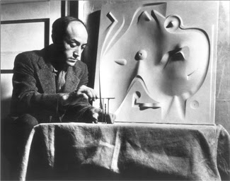
Isamu Noguchi has stated that “many landscapes are intentionally designed to communicate via a range of senses, which are absent when presented only two dimensionally. Does a two dimensional photo, illustration or painting capture the essence of a rose garden in June. You can visualize it, but can you smell it?” 1.
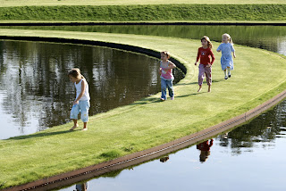
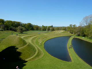
1. Isamu Noguchi, A Study of Space, Ana Marie Torres
Monacelli Press, 2000
Read More..
"Oh I have wordy definitions of a garden, al right. Lots of them. I even like one– particularly the one about a garden’s being sculpture. Not ordinary sculpture, of course, Not the kind of sculpture that someone makes in a studio and then you walk around it and admire it from all the different angles, and mostly you have to think away everything else, to see what the sculpture had in mind. I don’t mean that kind of sculpture. A garden is much bigger. Bigger in size, at least. You can walk thru it. You are inside something. You have to feel you are inside something, even though you are out of doors, instead of being outside of something trying to think everything else away. A garden is sculpture from any place you are in it, even while you are in motion, and there’s nothing outside that has to be thought away because that’s part of it too –just as you are." -James Rose, Gardens Make Me Smile 1953
To paraphrase Rose -- the trouble is that even the best definition of a garden through a photograph, video or illustration is not the thing itself – it is not the experience.
James Rose w. design maquette,
jamesrosecenter.org
Isamu Noguchi w. playground maquette,
Isamu Noguchi Foundation
Isamu Noguchi has stated that “many landscapes are intentionally designed to communicate via a range of senses, which are absent when presented only two dimensionally. Does a two dimensional photo, illustration or painting capture the essence of a rose garden in June. You can visualize it, but can you smell it?” 1.
Philosopher David Hume writes that the sense of experience, the perception of space through our “visceral interaction with the world forms our ideas about it. Like other art forms landscapes don’t always carry literal messages, but can trigger sensations.” Experiences based upon two-dimensional representations do not tell us much about first hand experiences with three dimensional landscapes and the specific attributes of these experiences. Many preference studies are based upon peoples experiences with two-dimensional pictures rather than experiences with actual landscapes, so they omit powerful dimensions of landscape experience, such as thermal comfort, smell sound, and tactile sensation.
Children experiencing Charles Jencks Garden of Cosmic Speculation
Picassa.com
Back to James Rose..
“A great garden is more like silence that like speech. It’s the luxury of not saying something. It’s the “something” between the lines.” 1. Isamu Noguchi, A Study of Space, Ana Marie Torres
Monacelli Press, 2000
EVOLUTION OF THE LAWN
A lush, verdant, unblemished green carpet of turfgrass in front of a suburban home is accepted as an iconic American image on par with apple pie. When in fact, it is a venerable notion of beauty adapted from another continent and era.
"A Neat Lawn", David Hockney 1967
christies.com
The Industrial Revolution along with trade catapulted many in England into a privileged aristocracy during the 16th and 17th centuries where upon they accumulated hundreds of acres of land, subsequently transforming their estates into an ideal romantic landscape. In a Brownian or Reptonian landscape (landscape designers Lancelot “Capability” Brown and Humphrey Repton), the lawn would virtually extend from the house out to a distant meadow. Mind you, grazing livestock (ie: sheep, rabbits) or a slew of workers with scythes would be working non-stop to trim its growth. When originally attempted back in the states, Americans were unsuccessful to replicate this. Two hundred years ago, native grasses seemed unsuitable for this function. Moreover, sufficient water and extremes of temperature worked counter to early efforts -- the climate in England being considerably different than in virtually all of the United States even though the rainfall and temperatures in the Northwest have some similarities.

Image from one of Reptons "red books".
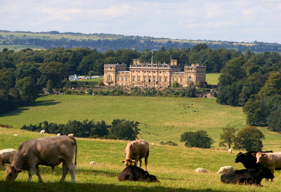
present day pasture on English estate,
flicker.com
Lawns began as a status symbol. The ability for an English or European landowner to have endless acres of fields as a playground rather than for production of food would truly be flaunting their excesses. Along with other “continental" tastes, perhaps this may be one of the reasons for the national aspiration to create these carpets. Even today, “grass has become for many a luxury item basic to being a satisfied and responsible homeowner.” (Bormann, Balmori, Geballe; Redesigning the American Lawn 2001)
From an evolutionary perspective, one could also suggest that our culture adheres to the prospect refuge theory of preferring clean open spaces, and we’ve been predisposed and conditioned to appreciate the open swath of green lawn.
As people of upper classes traveled off of the American continent, read books, viewed paintings and photos, the desire grew to emulate European aristocracy in their garden design. What truly made this a possibility for landowners was the invention of the push mower in 1830 by Edwin Budding. Still, for the most part, the manicured lawn remained the possession of the upper classes in the United States and other industrialized countries. Subsequently, the lawn was heavily promoted after the turn of the century by magazines, garden clubs, golf enthusiasts and the US Dept of Agriculture. Conforming to what your neighbor had (keeping up with the Jones’) and therefore acquiring status and acceptance, was the culture of the 1950’s and 60’s (and remains so today). During the post-war housing boom, track houses and developments (offering 3 1/2 %, 30 yr. fixed mortgages) were procured by servicemen returning home and identical homes sprung up everywhere. The notion of a postage size, perfectly manicured 2” high, “dandelion absent” lawn was ever-present. With the advent of affordable sprinkler systems, the lawn became very manageable for homeowners.
Father + son w. push mower, circa 1960
gettyimages.com
In “Second Nature”, the author Michael Pollan, relates his father’s ambivalent spirit toward maintaining their suburban lawn in 1960, what he refers to as “ the most characteristic institution of the American suburb.” It is part of the “collective landscape: while not exactly public land, it isn’t entirely private either”. “To maintain your portion of this democratic landscape was part of your civic duty. You voted each November, joined the PTA, and mowed the lawn every Saturday.”
As Pollen recollects, his father decided one summer to forego mowing his lawn, create a mini-meadow out of that half-size postage stamp front lawn. Cars and passerby’s would stop and stare in at this anomaly. Neighbors wondered if there was a death or the family was moving. As the weeks passed, a representative neighbor for the community was selected to deliver the message – CUT YOUR LAWN! Pollans fathers response was to mow his initials into the untamed lawn. S-M-P. That was the last time his father used the mower before moving the family to another town!

lawncareoftulsa.com
As the face of a neighborhood, during these years communities began to enact weed laws aimed at protecting the public from neglectful landowners whose littered yards they believed could attract rats, mosquitoes or present a fire hazard. But also to promote what Pollen refers to as “the collective face of suburbia,” reflecting a shared sense of acquired values. As our understanding of a healthy ecosystem has matured, these laws are still wrongfully enforced against natural landscapes. According to the E.P.A. “Natural landscapes are not a threat to safety or public health. More distressing, enforcement of local weed laws fosters an unnatural aesthetic conformity, by promoting and protecting monoculture laws, that furthers the malignant notion that humankind and Nature are independent.”
In the 1970s, the natural landscape movement emerged from infancy as it gained professional recognition and a modest measure of formal organization. In 1972, landscape architect Darrel Morrison, then a professor at the University of Wisconsin in Madison, WI, designed Walden Park in Madison as a predominately native landscape. Morrison continues to create noteworthy public (and private) native landscapes throughout the United States, emphasizing plant communities and the important clarification that selection of native plant material is only native if it is indigenous to that specific local area. Most recently, the New York Botanical Gardens installed one of his lyrical landscapes this past year.

2010 internet advertising
Lowes.com
"It is estimated that the total amount of monocultured lawn in the United States exceeds the size of the state of Pennsylvania." (National Gardening Association) Suffice to say, lawn covers a considerable amount of the United States. Currently the aesthetic and environmental pendulum has begun to swing in the opposite direction. Most horticulturalists, environmentalists and educated professionals in the landscape category who do not have economic ties to the lawn industry are well versed in the non –sustainable reasons behind minimizing or even elimination of this deficient ecosystem.
One irony of this evolution is that in 16th century England, wealthy landowners had lawns that were natural meadows with thousands of wildflowers. In those days, “grasses were hated weeds, and garden boys would creep along the flower lawns picking out the grass.” (Hatfield, A.W., How to Enjoy Your Weeds, 1971) . In the 20th and 21st centuries, this perception of the ideal lawn has been turned on its head. Dandelions and other flowers are despised. Turf grass became the vegetation of choice. Weed laws protected and promoted this "ideal".
A second irony is that to sustain these lawns homeowners burn millions of gallons of fuel powering inefficient mower engines, pouring chemicals into our lawns, creating an interpretation of a centuries old romantic dream of existing with nature ….as we assault it.
Pilgrimage to Rousham William Kents unspoilt masterpiece

The house was built in 1635 by Sir Robert Dormer and is still in the same family. The garden is open to the public but very quietly so - it needs no introduction to those that know, so the small hand painted yellow sign on a country lane is advert enough, and a refreshing change from the hideous Euro-style brown tourist signs that make a theme park out of our landscape.
An honesty machine takes your money and you are free to wander, map in hand, through the glades and shady walks down to the river Cherwell in the south, or into the exquisite walled kitchen garden nearer the house.
The upper cascade with Venus and cupids. Dedicated to an Englishmans best friend: Ringwood, an Otter Hound of extraordinary Sagacity
The Watery walk, a delight to stumble upon in the woods, as it leads you down to the Cold Bath
and on through to the open glade of the Octagon Pond.
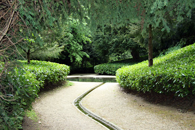

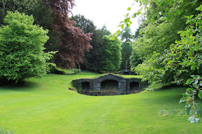
The view from the front of the house is imposing and as was the fashion in the 1730s was designed to Bring in the Countryside.
Laid out by Charles Bridgeman the garden was perfected by William Kent and is a stunning example of the first phase of the English Landscape period.
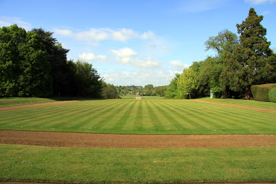
As the guide pamphlet says:
Rousham is uncommercial and unspoilt with no tea room and no shop. Bring a picnic, wear comfortable shoes and it is yours for the day.

The herbaceous borders are behind these walls, a different and delightful world, a purely sensorial antithesis to the more literary woodland journey.
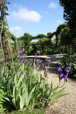
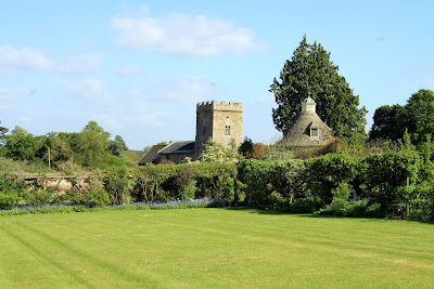
The 11th Century church is next door to the Dovecote - as I arrived they all swirled up into the air and away.
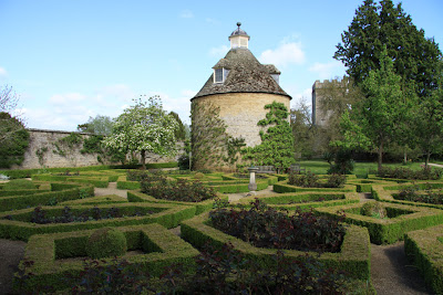
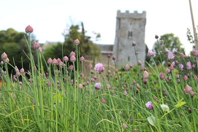
Subscribe to:
Posts (Atom)