Showing posts with label and. Show all posts
Showing posts with label and. Show all posts
Saturday, 8 March 2014
Jubilee Campus Juxtapositions and Plonk architecture

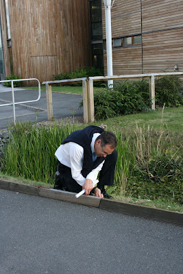
A couple of weeks ago, the East Midlands Branch of the Landscape Institute held their AGM at Nottingham University’s Jubilee Campus. Prior to the main event, where everyone tries to avoid being voted onto the committee (I must have lost again, as I’m still Branch Secretary), we had tour of the Campus itself.
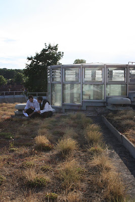
WARNING! The following Blog post contains graphic images of Landscape Architects.

While I’d passed by the campus a few times, and seen plenty of pictures in the architectural press coverage (much of which was highly critical), I was very keen to see it for myself. Contrary to many, I actually thought that the new buildings looked pretty cool.

What I hadn’t really remembered, is that the buildings by MAKE Architects are only a recent addition to the site. The original campus masterplan was produced by Michael Hopkins and Partners, who also designed the first phase of buildings, and opened in 1999. The scheme is based upon sustainable principles and was developed on a brown field site (the former Raleigh bicycle factory). The Djanogly LRC , with it’s single spiralling floor, is the most recognisable building here (and where I took a few rooftop snaps). However, the real focus of the scheme is on the artificial lakes which run through the heart of the campus.


The green credentials are also pretty impressive ; the lakes are used as a giant heatsink, whilst everywhere you look there are ventilation chimneys, swales, photovoltaic cells and green roofs.
Actually, I’m a little unsure about the green roofs – the planting reminds me of the sort of thing you see sprouting from a disused runway.


Ambling along the waterside concourse is a very pleasant thing to do on a sunny, summer evening. Looking over the water to the backdrop of reeds, trees and wildlife – you could almost forget you’re in Nottingham! Whilst timber cladding has become rather passé, the palette of materials used is simple, well balanced and tasteful. You would feel proud to be a student here.


It’s actually some way into the campus before I get my first glimpse of MAKE’s phase 2 buildings, and then rather strangely half hidden behind a building and some car parking. The new buildings are certainly striking.

As you continue south, a new pathway leading to the phase 2 campus, cuts across the main concourse. Where the Hopkins designed campus is all calm and simplicity, this new path is a riot of colours, funky paving, water-features, stone cubes, trees and brightly coloured planting. Someone with a more base mind than I, could draw some sort of significance from the way this path ends in a fountain on the otherwise tranquil lake...

Look its "Aspire" (it’s a pun, it’s an inspiration, it’s a metaphor, it’s a giant ice cream cone).

Wandering round the campus, I had found myself defending MAKE’s buildings to a former colleague, who was convinced that they represented the worst excesses of “starchitects”. I cited Laver’s Law, that Universities should be about new, and optimistic, and finally that they are just ahead of their time. But as I get closer, I begin to doubt my arguments.

Close up and I can begin to understand why I want to like these buildings. Part of me is still the small child that grew up watching sci-fi films and is desperately disappointed by the modern world. Where are the flying cars? Where are the discos with uninhibited space chicks dancing in silver mini-skirts? And where is the lunar colony? MAKE’s buildings are a business park approximation of how I imagined 2010 should look and kind of wish it did. Unfortunately, for all their sci-fi styling, there are some seriously big problems with these buildings. For a start...

... they face straight onto a car park and the arse-end of other buildings (again I can imagine some might to want to use a crude metaphor for this. Not I, natch). Landscape architecture is all about context and setting, whereas these buildings give no regard to their setting and only seem to interact with what immediately surrounds them (notice how the planting is limited to just the building curtilage). When our guide “explained” the thinking behind MAKE’s design I could actually feel myself getting angry. Apparently, the coloured bands represent the underlying strata, planting is inspired by American studies, whilst the east-west axis extends the site... Rubbish. It’s just empty post rationalisation for doing whatever the hell they like.

Plonk architecture isn’t just confined to this scheme. Was the Gherkin designed especially for Swiss Re, or had it been sitting on Ken Shuttleworth’s (Mr MAKE) drawing board, just waiting for an somewhere to stick it? While architecture can create a new character for a place, I think a design is nearly always more successful when it gives some regard to it’s context and setting. Unfortunately, it seems to me that too many designers, driven by their ego, set out to create their own context. Worse still, I think that there is actually a school of thinking in architecture particularly, that wants to actively go against, subvert or contrast with it’s surroundings, because “Hey, it’s a juxtaposition!”

The Hopkins masterplan gives the campus a clear, simple layout and a calm, elegant environ, which MAKE completely disregard .While I want to love MAKE’s addition to the Jubilee campus for it’s futuristic style, it’s contempt for the surrounding context is everything I detest in the design of our built environment. Some may argue that taken out of context these buildings are terrific, but context is everything when dealing with the world we live in.

Weirdly though, as we trudged back to the car park, I found myself wishing that more buildings were shaped like aerodynamic wedges and clad in exotic metails. A few space chicks in mini skirts wouldn’t go amiss either.
Friday, 7 March 2014
5 1 GIS structuralism the birth the death and the life of planning
5.1 GIS, structuralism, the birth, the death and the life of planning
Contents list
A geographical information system (GIS) is able to represent the world in different ways for different purposes, by retrieving information from a computer-held
database. Structuralism recognizes that all information about the world enters the mind not as raw data but as abstract structures resulting from mental
transformations of sensory input. The birth of planning, as a specialized profession, developed from seeing the world in one particular way, on two-dimensional
drawings which privilege a certain aspect of the environment. As the death of planning, in this limited sense, is imminent, the future life of planning
lies with specialized plans, based on specialized surveys, stored within a GIS and assembled for defined purposes. These five points are the subject of
this essay.
Leonardo da Vincis Map of Imola (1502), one of the first precisely measured and accurately drawn maps, was a projection on a plane surface
5.2 The birth of the planner
Contents list
The oldest cities, one assumes, were made without the assistance of drawn plans, but using marks on the ground. When more sophisticated structures were
required, clay tablets and then drawings came into use. By the first century AD,
Vitruvius
considered that half the education of an architect should be spent becoming "skilful with the pencil, instructed in geometry and familiar with the special
departments of knowledge. Vitruvius wished the other half of his time to be spent "acquiring manual skill on building sites where work is done "according
to the design of a drawing (Vitruvius, 1914 edn). Small-scale maps were later made to assist trade, transport and conquest. In the chaos of the Dark Ages,
the Roman skill of drawing buildings, like the art of making bricks, was forgotten. Eventually, the arts of civilization returned to Europe, but many centuries
passed before there was a return to the practice of making maps and planning cities on paper. No design drawings for medieval cathedrals have been found,
but carvings exist on which a large pair of dividers is used as a symbol for the builders trade. Dividers were used to transfer dimensions and to set
out full-size working plans for masonry.
To plan is to make a projection on a horizontal plane (Figure
5.1)
; to de-sign is to put a sign on paper. Translation of Euclids Elements from Arabic into Latin, in 1482, revived interest in the ideas of design-by-drawing
and planning-by-drawing. In time, it became common for professionals with knowledge of geometry to produce plans, in offices, for the construction of towns
and buildings. Such plans had advantages. Roads could be made straight, broad and convenient; drains could be made to run downhill; land ownership disputes
could be settled; structural designs could be founded on mathematics. It was a great advance. During the Renaissance, drawings were used to help in planning
villas for the rich. Later, drawn maps were used in local and national planning. In the eighteenth century, maps were produced to define territories. National
borders came into existence. Louis XV observed that he lost more territory by accurate mapping than ever he gained by conquest. The largest example of
planning-by-drawing was the United States of America. The Land Ordinance of 1785 imposed a gigantic gridiron on the natural landscape. This was planning
in the sense of ordering the land, but it ignored the presence of rivers, forests, hills and valleys, which, at that time, had not been mapped in detail
(Reps, 1965).
5.2 Accurate surveys date from the nineteenth century. In Britain such maps (eg of Blackheath, above) are described as Ordnance Surveys, reminding us of
their military origin.
In Britain, detailed topographic maps have been published by the Ordnance Survey since 1801 (Figure 5.2). Ordnance, a variation of ordinance, is the means
of enforcing orders. According to the dictionary it includes: "mounted guns, cannon, and that branch of the government service dealing with military stores
and materials. Ordnance maps enable people to invade and defend territory. This was their purpose. As an unintended side-effect, they facilitated an invasive
and dictatorial variety of town and country planning. The engineering and surveying professions developed with mathematics and drawing as their defining
skills, and flourished under military patronage. Before maps and plans became common, towns were the work of builders, who made infrequent resort to plans.
Had the introduction of design-by-drawing and planning-by-drawing merely been technical changes, like the replacement of clay tablets with paper, they
would not merit our attention. In practice, the technique of paper planning had profound consequences for the product. Town planning and architecture became
epic examples of McLuhans dictum: "the medium is the message (McLuhan, 1967). Until recently, the medium was paper. In future, it will be a computer-held
database, currently known as a geographical information system, or GIS.
Classical geography, which was plan-based, conceived cities as physical entities, to be analysed in terms of size, density, land use, population, centricity,
axiality, and so forth. Early city planners therefore made unitary plans, showing roads, land uses and densities (Figure 3). These are now known as physical
plans and zoning plans. By the 1960s, geographers were increasingly regarding cities as the product of social and economic forces. Planning changed direction.
It became involved with economic growth, social deprivation, education and the environment. Marxist geographers came to see towns as the outcome of capitalist
accumulation and the class struggle. Postmodern geography, inspired by structuralism and post-structuralism, is branching out in all directions. It is
recognized that society is
contextualized and regionalized around a multi-layered nesting of supra-individual modal locales -- a home-base for collective nourishment and biological
reproduction, collection sites and territories for food and materials, ceremonial centres and places to plan, shared spaces and forbidden terrains, defensible
neighbourhoods and territorial enclosures. (Soja, 1989)
[FIG 5.3 ] Geographers and planners shared an interest in roads and densities – so that planning became a matter of planning roads and specifying densities.
This account, from Sojas Postmodern Geographies, points to the need for multiple world views, which GIS are eminently capable of managing. Structuralism
suggests the need for new world-views; computer-held databases facilitate their representation. Multiple ways of looking at the world will be paralleled
by multiple ways of looking at planning and design. There is no reason why one of them, the two-dimensional projection of physical structures onto a plane
surface, should take precedence as The City Plan, or The Master Plan for an urban development. Towns, roads, buildings and gardens, when planned on paper,
have a curious rigidity, like a squad on parade. The effect can be splendid -- but it should not be allowed to rule the world. The postmodern city needs
to be mapped as "a multi-layered nesting of supra-individual modal locales (Figure 4).
[FIG 5.4 ] The postmodern city is conceived as a multi-layered nesting of supra-individual modal locales.
Plan of Paris c1600
5.3 The death of the planner
Contents list
Consider an office park, photographed for a professional brochure (Figure 5.5). The implied offer is "Employ John Swish and Company; we make this kind of
place. Other photos might show a lake, sunlight sparkling on the water, a generous path winding along the shore and a bird poised on a sculpture. Beyond
this path is a clump of Rosa rugosa "Frau Dagmar Hastrup with soft pink flowers, offset by the dark green leaves of Prunus laurocerasus "Otto Luyken.
A gleaming high-tech building clad in bluish glass forms the backdrop. Who "designed this pleasant scene?
Certainly not John Swish. He retired many years ago, though his firm did some paving work. The new boss is an efficient manager with little zest for design
and no time for drawings. He won the commission by promising his client "a high-quality landscape. Then he passed the job to a junior partner, who employed
a succession of design assistants to do the work. Neither did Frau Hastrup or Herr Luyken make a direct contribution to the project.
The local planning committee was opposed to office development on this site but felt that "a well-landscaped park would be an acceptable compromise between
conservation and the urgent local need for jobs. The project was initiated by Robert J. Hurst II, an American whose father had started a real estate development
company. He knew Silicon Valley and was able to raise finance by drawing attention to the superior financial returns on prestige developments with blue
chip occupiers. The Hurst Corporations brochure contained photographs of high-tech buildings in parkland settings. The long-term costs of managing the
landscape were of some concern to tenants but it was explained that no grass area would be too steep for gang-mowing and that the landscapers would be
supplied with a list of low-maintenance shrubs from which to choose.
And so it goes on. Local highway engineers stipulated design criteria for road curves and visibility splays. The drainage authority required construction
of a storm detention pond, so that the rate of surface water run-off would not be increased. The local fire department insisted on a wide path between
the lake and the building. The architect was given the dimensions of a building and shown a photograph of a glass-clad building that the client firms
managing director liked. The artist was commissioned to produce "a representational sculpture of a girl. The materials were either manufactured, as paving
bricks and glass cladding, or, like the grass and plant varieties, bred for a special purpose. Although the landscape architect prepared drawings and specifications
for the earthmoving, pavements, seeding, planting, and lake edge details, which occupy over 50% of the photograph, she can hardly be said to have "designed
or "master planned the scene. Nor can any individual or profession take credit or blame for the overall conception. The further ones investigations are
carried, the less independence any of the actors appears to have had. The government set the legislative framework. The staff in the planning authority
and various consultant firms were guided by their employers and their professional institutions. There were numerous standards and codes of practice to
be followed. The "design concept came from another country.
Not only is it impossible to name the planner or the designer, there are many different ways of seeing the plan and the design, as indicated by photographs,
published with different captions in different magazines. In the Environmental Journal, it was a wanton act of "habitat destruction. In the Property Journal,
it was "a profitable investment. The Architecture Journal saw it as an example of the "new modern style. The Art Journal saw the sculpture as "New Realism.
The lake design was analysed in the Engineers Journal to illustrate a new technique of water retention. An amateur photographer noticed the irony of a
bird perching on the girls chest and received a prize from an amateur photographic magazine, which used the caption "Tit on tit.
5.5 Office Park
5.4 The birth of the layerer
Contents list
The argument of the preceding section is based on Roland Barthes celebrated essay, "The death of the author.
We know now that a text consists not of a line of words, releasing a single "theological meaning (the "message of the Author-God), but of a multi-dimensional
space in which are married and contested several writings, none of which is original: the text is a fabric of quotations, resulting from a thousand sources
of culture. (Barthes, 1977)
Barthes, who moved from structuralism to post-structuralism, supports his argument with a telling historical point:
The author is a modern character, no doubt produced by our society as it emerged from the Middle Ages, inflected by English empiricism, French rationalism
and the personal faith of the Reformation, thereby discovering the prestige of the individual, or, as we say more nobly, of the "human person. (Barthes,
1977)
The "author, the "designer and the "planner are modern inventions, the products of an individualist age. In tribal societies, in pre-Homeric Greece and
in medieval Europe, the names of artists were not recorded. The great European cathedrals were "built in heaven with living stones. Only God had the power
of creation. Even the authors of Beowulf are unknown to us. The modern Artist-God, the Author-God and the Planner-God are products of individualism and
romanticism.
The literary metaphor can be resumed, again with Barthes:
... if up until now we have looked at the text as a species of fruit with a kernel (an apricot, for example), the flesh being the form and the pit being
the content, it would be better to see it as an onion, a construction of layers (or levels, or systems) whose body contains, finally, no heart, no kernel,
no secret, no irreducible principle, nothing except the infinity of its own envelopes -- which envelop nothing other than the unity of its own surfaces.
(Barthes, 1971)
Similarly with town plans. If, until now, we have looked at the plan as an entity with a unitary structure, it would be better to see it as a construction
of layers with, finally, no heart, no kernel, no secret, no irreducible principle. Planning and design in the post-Postmodern world may become more like
planning and design in the Pre-modern world. Medieval cities did not have unitary town plans. Medieval cathedrals did not have master plans. Each craftsman
had an area of responsibility, and the church authorities were intimately involved with all the important decisions. When the cathedral was built, it could
be drawn. Mr Pecksniff, in Dickens Martin Chuzzlewit, trained his pupils by drawing Salisbury Cathedral "from the north. From the south. From the east.
From the south-east. From the norwest (Dickens, 1843). This account gave a misleading conception of design and planning procedures.
If a large number of drawings are produced for a project, then one drawing will be more general than all the others. It is a key plan, which "masters the
others by showing how they fit together. A machine, for example, may require separate drawings for each component, and an assembly drawing, which acts
as a "master plan. This mechanistic analogy implies a need for masters. In the seventeenth century, it was argued that as the world resembles a watch,
but with infinite complexity, there must be a grand watchmaker: God. The built environment equivalent of this argument may be described as "the watchmaker
argument for the existence of planners: as towns and landscapes are complicated structures, they must have master plans. Significantly, theorists of evolution
now speak of a "blind watchmaker.
Karl Popper launched a fundamental attack on the notion of master planning. Living in Vienna during the 1930s, he was horrified at the deaths of those who
fell victim to fascist and communist theories of historical destiny. As these tendencies grew into Nazism, Popper concluded that neither science nor politics
can establish general laws about what is right for society. He therefore rejected "blueprint planning in favour of a "piecemeal approach in which there
is no defined end-state (Faludi, 1986). Many social and natural scientists, reflecting on the twentieth centurys ghastly experience with totalitarianism,
have supported Poppers line. Christopher Alexander, who also lived in Vienna during the 1930s, extended the argument to environmental design. He developed
a powerful case for incrementalism (Figure 6) and for having a planning process instead of a master plan. With master plans, "The totality is too precise:
the details are not precise enough (Alexander, 1975). It becomes like filling in the blanks in a childs colouring book. Master plans make each user feel
like "a cog in someone elses machine. They tell us what will be right in the future, instead of what is right now. This results in expensive projects,
riddled with mistakes. As master plans tend to be obsolete before they are complete, society is better off without them.
[FIG 5.6 ] Each new pattern, represented by dotted rectangles, must link with existing patterns, represented by solid rectangles, and provide for the implantation
of future patterns.
The Death of the Master Plan can release an outpouring of creativity. It is like moving from a centrally planned organization to one that fosters individual
creativity. IBM would like to have retained control of the computer industry. A few bright young men working in garages in California upset their plans
by inventing the personal computer. The next development may arise from a monastery in Tibet. Designs can begin at different points and proceed by different
paths. The Crystal Palace is an interesting example. It began not with an architects master plan but with the development, by two gardeners, of the ridge-and-furrow
glazing system. Loudons and Paxtons inventions made it possible to build glazed roofs and walls. A barrel vault was added when the building moved from
Kensington to Sydenham. This unconventional procedure resulted in the most brilliantly original building of the nineteenth century. But the details came
before the plan.
Roland Barthes notion of the death of the author has encouraged novelists to be explicit in their use of incidents, characters and quotations from other
writers. News, geography, biography and images have joined with conventional writing. Poetry and photography have moved towards each other. Comparable
developments have taken place in architecture, planning and gardens. An enthusiasm for planning-by-layers is breathing new life into urban design and planning.
It is a development of great significance, and it is older than one might think.
Until now, the world has been conceived as an apricot
5.5 Planning-by-layers with GIS
Contents list
Three factors have stimulated interest in a layered approach to analysis and planning:
concern for the environment
structuralist philosophy
the use of computer-based maps and drawings for environmental analysis (GIS - Geographical Information Systems)
Structuralist philosophy
Environmental concern
GIS Computer analysis of the environment with GIS
5.6 The birth of the layerer
Contents list
Environmental layers
Patrick Geddes was a significant theoretical influence on the use of layers (Geddes, 1915). He believed that plans should be for "Place, Work, Folk, not
merely for roads, sewers and buildings. The history of planning-by-layers dates from his time, and has been traced by Carl Steinitz (Steinitz et al., 1976).
It began with analysis-by-layers. Steinitzs earliest example, from 1912, is of a series of maps, drawn to the same scale for comparative purposes, by
a one-time associate of Frederick Law Olmsted. They included maps of soils, vegetation and topography. Also in 1912, a series of five plans showing the
historic development of Düsseldorf was submitted for a design competition. Steinitz identifies a number of American and British plans, produced in the
three decades after 1912, that use thematic maps drawn to the same scale. The first explicit reference to an "overlay technique comes from a 1950 English
textbook on Town and Country Planning (Tyrwhitt, 1950). Jaqueline Tyrwhitt gives examples of thematic surveys and Jack Whittle discusses the advantages
of transparent overlays. In 1964, Christopher Alexander worked on a highway route location project that used a series of 26 weighted overlays. Ian McHarg
used a similar approach in selecting a route for the Richmond Parkway. This developed into a sophisticated overlay technique (Figure 7). As with Alexanders
work on route selection, it was genuine "planning by layers, rather than mere "analysis by layers.
Fig 5.7 A diagrammatic representation of McHarg’s layered approach to landscape planning.
In Design with Nature,
Ian McHarg
showed, more convincingly than had ever been done before, how natural resource information could be incorporated into the planning process (McHarg, 1971).
His book was published at the start of a great upsurge in environmental awareness, and was widely influential. McHargs overlays were hand-drawn but, as
he himself noted, there were great opportunities for using computers to make a better job of the overlay technique. In his 1976 article, Steinitz advised
"dont make hand-drawn data maps -- make data files instead... I believe that the days of drawing board drudgery are numbered. He was right. The development
of computer-based GIS was ideally suited to overlay map analysis. One of the best-known systems, ArcInfo, was in fact developed by a landscape architect
with an interest in this approach.
Reviewing the history of hand-drawn overlays, Steinitz observes that:
Their greatest role has been to help us realize that a better understanding of the whole is derived from a knowledge of the parts and how they relate to
each other. The applications have become more complex, diverse and technically sophisticated, but as we examine the use of the overlay approaches from
their early development to present applications, it is clear that the basic methodology and the underlying logic have changed little. We combine data maps
on soil, slope, and other elements in the same manner that Warren Manning probably did in 1912.
The aim, of studying "the parts and how they relate to each other, has an affinity with the structuralist interest in relationships between phenomena.
5.7 Structural layers
Contents list
Linguistic structuralism has provided another motivation for planning-by-layers. It developed out of semiotics, which is the study of signs. A sign comprises
a signifier and a signified. The sign "DOG is the signifier for the signified - which has four feet and can bark. Structuralists argued that language
is a surface structure, of signifiers, which lies above a deep structure, of signifieds. Lévi-Strauss used a geological analogy to explain the idea. Just
as the surface structure of the land tells us about deep geological structures, so language tells us about deep structures in the human mind. Post-structuralists
argued that the link between surface structures and deep structures is arbitrary and unstable. This led to the proposition that the "real world can be
a variety of different things, depending upon ones point of view. Richard Harland proposes superstructuralism as a general term for "the whole field of
Structuralists, Semioticians, Althusserian Marxists, Foucaultians, Post-Structuralists etc. (Harland, 1988). Superstructuralism inverts the ordinary surface-structure/deep-structure
model so that nature, for example, comes to be seen as a cultural construct, as do maps and plans.
Each view of the world can be described as a "landscape. Landscape was coined in Old English by adding the suffix -scape to the noun land. This converted
a concrete noun into an abstract noun. After slipping out of use, landscape re-entered English in the seventeenth century. It came from Dutch, as a painters
term. A landscape then meant an ideal view of the land, often assembled from several actual views. In the eighteenth century, landscape designers came
to use the term to mean an ideal place, resulting from a design. In modern English, painters use landscape to mean a view of the land, rather than the
land itself. Geographers took landscape into their vocabulary during the nineteenth century, to mean "the end product of topographic evolution, as in
the title of W.G. Hoskinss Making of the English Landscape. Considering this etymological history, it is reasonable to use "landscape to mean a particular
view of the world. Physically, landscapes are determined by ones geographical position. Psychologically, landscapes are determined by the mental structures
with which we interpret sensory data.
New ways of representing the world inevitably produce new approaches to design, as did Renaissance perspective. Jacques Derrida started from the Lévi-Strauss
argument that, in language as in geology, deep structures lie beneath surface structures. He then challenged, or deconstructed, the hierarchical relationship
between the structural elements. Inspired by these ideas, Bernard Tschumis plan for Parc de la Villette in Paris became one of the first examples of poststructuralist
planning and design. Tschumi was steeped in structuralism. In the introduction to Cinégramme Folie he observes that the limits between domains of thought
have gradually vanished, so that architecture can entertain relations with cinema, philosophy and psychoanalysis (Tschumi, 1987). Tschumi quotes Roland
Barthes on the "combinative nature of creative work and criticizes the "more traditional play between function or use and form or style. But he does
not shake off his own background as a physical designer. Tschumis interest was mainly in geometrical layers, not landscape layers (Figure 8). He wrote
of "the set of combinations and permutations that is possible among different categories of analysis (space, movement, event, technique, symbol etc).
Tschumis project for la Villette, which is the subject of another essay, stimulated enormous interest in design-by-layers.
Fig 5.8 Structuralist layers at Parc la Villette (see
Essay No. 18 )
5.8 CAD and GIS layers
Contents list
Digital computers have generated additional interest in planning-by-layers. The data structures that they use lend themselves to representing buildings
and places as layered structures. In AutoCad, a popular computer-aided design program, the Layer Control command enables the different entities of a drawing
to be grouped into layers. A single-storey building might use separate layers for foundations, floor surfacing, services, ceiling and roof. Multi-storey
buildings will use a great many more layers. Additional layers can be drawn for other components of the building: heating, ventilation, electrical cables,
structural frame and so forth. In ArcInfo, one of the most popular GIS programs, map layers are known as coverages, each of which is stored as a subdirectory.
If coverages have the same registration marks (TICS) it is easy to perform overlay, sieving and buffering operations. The LIST command, which is available
in both ArcInfo and Autocad, will show a database listing of coordinates for every node. LIST shows them in database format. From ArcInfo, it is possible
to transfer the data into a standard office database or spreadsheet program, such as dBase, Excel or Lotus.
Until recently, all architects and planners made their proposals on two-dimensional maps. Some still do, but the practice is unlikely to survive. It came
with the Renaissance, and computers have made it obsolete. The change is of profound operational and conceptual significance for architects, planners and
landscape designers. Environmentalism and structuralism make planning-by-layers conceptually appealing. Computers make it easy. If a CAD program is used,
the layers are likely to be geometrical. If a GIS program is used, the layers will also be thematic. When the boundaries between the two software technologies
begin to dissolve, there will be a very wide choice of what to show on layers. With three powerful reasons for adopting a layered approach, there can be
little doubt that the procedure has a long way to go.
5.9 Deterministic planning
Contents list
In these early days of planning-by-layers, the foremost danger is the belief that the computer can resolve the age-old problems of planning, by providing
a rationalist method leading to inevitable conclusions. McHarg, arguing in favour of planning-by-layers, wrote that:
It provided a method whereby the values employed were explicit, where the selection method was explicit -- where any man, assembling the same evidence,
would come to the same conclusion. (McHarg, 1971)
McHarg saw this as "environmental determinism: a method that allows "nature, instead of man, to take development decisions. His title, Design with Nature,
cleverly steps back from determinism, implying that nature will simply help man to take better decisions. The text is less cautious, as revealed by the
remark that "any man using the same method will come to the same conclusion.
Later advocates of GIS-based planning have seen the method as a "decision support system. This implies a method for using geographical information to help
planners, rather than a decision-making system. It is an attractive proposition, which takes us to the key question in GIS-based planning: which data should
be used?
Consider the case of a developer seeking a site for a new office building. Using a GIS, it is possible to find a site which is:
1. over 2000 square metres in size;
2. located on soils that are suitable for construction;
3. not located on forested land;
4. not located on land of high agricultural value;
5. within 300 metres of an existing sewer line;
6. not within 20 metres of a watercourse.
This example is taken from Understanding GIS: The Arc/Info Method (Environmental Systems Research Institute, 1993). It appears to offer a decision-making
procedure that is entirely based on verifiable criteria. If similar procedures were used for schools, housing, industry, transport, and every other land
use, one could produce a full land use plan. As every decision would rest upon objective criteria, everyone would support the plan, wouldnt they? Well,
they shouldnt. The following points indicate some of the flaws in the decision tree.
1. The size of ownership parcels can be changed, by land assembly.
2. With suitable foundation engineering, construction can take place on almost any substrate.
3. If one area of forest is lost, another can be allowed to grow.
4. With the current food surplus in developed countries, there is no need to preserve land of high agricultural value.
5. New sewer lines can be built.
6. Streams can be protected from pollution by filtration.
The idea that GIS enable a "rational planning procedure leading to "optimal land use allocations is wholly misconceived. GIS are no more capable of resolving
planning problems than a pocket calculator is capable of telling people how to vote. The contrary view rests on the old enlightenment dream that reason
can resolve all conflicts and solve all problems. I wish it could. Computers have merely given the dream a short lease of extended life, partly through
the magic of the machine and partly through the concept of layers. "Layers of what?, is the fundamental question. Easy analogies were drawn with layer-cakes
and sedimentary formations. Both are unitary structures; both have tops and bottoms (Figure 9). But, if planning is conceived in this way, which is the
top layer? Too much twentieth century planning was conducted in a top-down sequence:
1. begin with land ownership;
2. designate the land use;
3. engineer the roads;
4. subdivide the land;
5. design the buildings;
6. arrange the paving and the planting;
7. furnish the interiors.
Fig 5.9 If planning resembles a layer-cake, which layer should be on top?
After that, users and maintenance workers were left to make the best they could of a bad job. The whole procedure was tyrannical. And it was no more capable
of making good places than dictatorship is capable of providing good government. Both fail through lack of information. Both favour grim concrete jungles
with wide roads and boxy buildings. Central planning simply cannot cope with the wide universe of facts, values and beliefs. Democratic planning requires
fresh maps, fresh concepts, fresh information and fresh procedures.
untitled 1 frame
Amazon.com
cover
Design with Nature
Used $26.47!
(Prices May Change)
Privacy Information
untitled 1 frame end
5.10 The life of planning
Contents list
The perceived world is more like an onion than an apricot; more like a diamond than a layer cake. From every angle, one sees a different landscape pattern,
none of which has any superior claim to "reality. All are reflections and transparencies, hopes and fears. Each can be seen only with certain eyes, from
certain viewpoints, in certain light conditions. Deterministic planning developed from military maps. Democratic planning requires different maps. The
mole, the house-martin and the eel have views of the world that are invisible to us, as do children, old people and blind people. Each individual has a
mental map and a system of navigation. Human societies contain many interest groups that need special maps and plans. Only selected data can be shown on
a map, and there has to be a principle for making the selection. Normally, it will be a functional principle, relating to characteristics of the existing
environment or to a proposed future environment. Planning-by-layers may turn out to be the greatest invention since design-by-drawing.
Should an organization wish to conserve the worlds house-martin colonies, it will require a map. Should another organization wish to increase the worlds
eel stock, it will require maps of breeding routes and breeding grounds. If a water company wants to recharge the aquifers in which underground water is
stored, it must know where porous soils and rocks are located. If I want to avoid speed control cameras and park my car in Central London, I will need
special maps showing the location of camera positions and parking places. Old maps were produced for military purposes. Modern maps are no less purposive,
but the purposes are different. A moles map would not extend above ground level. A swallowss map would be of air currents and flying insects. An eels
map would show routes to and from the Sargasso Sea. The Society for the Protection of Birds may wish to prepare a City Bird Plan. The creation of new habitats
will be a central feature of this plan. They are likely to be beside railway lines and sewage works, in public parks, schools and gardens, and on flat
roofs. Cities have large numbers of flat roofs, which could have been planned as bird habitats.
Transport has long been a central aspect of planning. In some countries, like Switzerland, the various modes are fully integrated. In others, like Britain,
there are many discontinuities. Integration requires plans for the component subsystems and for the links. If the components are to function effectively,
they must have their own maps and their own design teams. If the links are to be effective, different groups of planners must sit together under democratic
umbrellas. Otherwise, cities cannot have footpaths and cyclepaths leading to sheltered places with coffee, newspapers and good connections to rail stations,
bus stations and airports. An Equestrian Society could make a convincing case for a Horse Transport Plan. A significant number of town dwellers own horses,
which do not get enough exercise. There could be bridleways running through those linear green wedges that landscape architects have been planning since
Olmsteds time. Most of them are underused. Commercial stables could be franchised to locate at the city centre ends of these wedges, near transport interchanges.
A Pedestrians Association may contribute to an overall Pedestrian Plan. They are likely to argue for a continuous pedestrian surface in cities. The paved
sidewalk was a mid-nineteenth century invention, which has been greatly overused.
Multimedia GIS should supply information to all the different groups and bodies that wish to make plans. Many of them will also be able to supply information
and contribute to the central database. Political bodies can take decisions when there are conflicts of interest, but democratic societies have proved
remarkably successful at accommodating individuals, provided they have the necessary information. If planning is to be reborn, planners need to focus their
minds on GIS, structuralism and planning-by-layers.
Read More..
Contents list
A geographical information system (GIS) is able to represent the world in different ways for different purposes, by retrieving information from a computer-held
database. Structuralism recognizes that all information about the world enters the mind not as raw data but as abstract structures resulting from mental
transformations of sensory input. The birth of planning, as a specialized profession, developed from seeing the world in one particular way, on two-dimensional
drawings which privilege a certain aspect of the environment. As the death of planning, in this limited sense, is imminent, the future life of planning
lies with specialized plans, based on specialized surveys, stored within a GIS and assembled for defined purposes. These five points are the subject of
this essay.
Leonardo da Vincis Map of Imola (1502), one of the first precisely measured and accurately drawn maps, was a projection on a plane surface
5.2 The birth of the planner
Contents list
The oldest cities, one assumes, were made without the assistance of drawn plans, but using marks on the ground. When more sophisticated structures were
required, clay tablets and then drawings came into use. By the first century AD,
Vitruvius
considered that half the education of an architect should be spent becoming "skilful with the pencil, instructed in geometry and familiar with the special
departments of knowledge. Vitruvius wished the other half of his time to be spent "acquiring manual skill on building sites where work is done "according
to the design of a drawing (Vitruvius, 1914 edn). Small-scale maps were later made to assist trade, transport and conquest. In the chaos of the Dark Ages,
the Roman skill of drawing buildings, like the art of making bricks, was forgotten. Eventually, the arts of civilization returned to Europe, but many centuries
passed before there was a return to the practice of making maps and planning cities on paper. No design drawings for medieval cathedrals have been found,
but carvings exist on which a large pair of dividers is used as a symbol for the builders trade. Dividers were used to transfer dimensions and to set
out full-size working plans for masonry.
To plan is to make a projection on a horizontal plane (Figure
5.1)
; to de-sign is to put a sign on paper. Translation of Euclids Elements from Arabic into Latin, in 1482, revived interest in the ideas of design-by-drawing
and planning-by-drawing. In time, it became common for professionals with knowledge of geometry to produce plans, in offices, for the construction of towns
and buildings. Such plans had advantages. Roads could be made straight, broad and convenient; drains could be made to run downhill; land ownership disputes
could be settled; structural designs could be founded on mathematics. It was a great advance. During the Renaissance, drawings were used to help in planning
villas for the rich. Later, drawn maps were used in local and national planning. In the eighteenth century, maps were produced to define territories. National
borders came into existence. Louis XV observed that he lost more territory by accurate mapping than ever he gained by conquest. The largest example of
planning-by-drawing was the United States of America. The Land Ordinance of 1785 imposed a gigantic gridiron on the natural landscape. This was planning
in the sense of ordering the land, but it ignored the presence of rivers, forests, hills and valleys, which, at that time, had not been mapped in detail
(Reps, 1965).
5.2 Accurate surveys date from the nineteenth century. In Britain such maps (eg of Blackheath, above) are described as Ordnance Surveys, reminding us of
their military origin.
In Britain, detailed topographic maps have been published by the Ordnance Survey since 1801 (Figure 5.2). Ordnance, a variation of ordinance, is the means
of enforcing orders. According to the dictionary it includes: "mounted guns, cannon, and that branch of the government service dealing with military stores
and materials. Ordnance maps enable people to invade and defend territory. This was their purpose. As an unintended side-effect, they facilitated an invasive
and dictatorial variety of town and country planning. The engineering and surveying professions developed with mathematics and drawing as their defining
skills, and flourished under military patronage. Before maps and plans became common, towns were the work of builders, who made infrequent resort to plans.
Had the introduction of design-by-drawing and planning-by-drawing merely been technical changes, like the replacement of clay tablets with paper, they
would not merit our attention. In practice, the technique of paper planning had profound consequences for the product. Town planning and architecture became
epic examples of McLuhans dictum: "the medium is the message (McLuhan, 1967). Until recently, the medium was paper. In future, it will be a computer-held
database, currently known as a geographical information system, or GIS.
Classical geography, which was plan-based, conceived cities as physical entities, to be analysed in terms of size, density, land use, population, centricity,
axiality, and so forth. Early city planners therefore made unitary plans, showing roads, land uses and densities (Figure 3). These are now known as physical
plans and zoning plans. By the 1960s, geographers were increasingly regarding cities as the product of social and economic forces. Planning changed direction.
It became involved with economic growth, social deprivation, education and the environment. Marxist geographers came to see towns as the outcome of capitalist
accumulation and the class struggle. Postmodern geography, inspired by structuralism and post-structuralism, is branching out in all directions. It is
recognized that society is
contextualized and regionalized around a multi-layered nesting of supra-individual modal locales -- a home-base for collective nourishment and biological
reproduction, collection sites and territories for food and materials, ceremonial centres and places to plan, shared spaces and forbidden terrains, defensible
neighbourhoods and territorial enclosures. (Soja, 1989)
[FIG 5.3 ] Geographers and planners shared an interest in roads and densities – so that planning became a matter of planning roads and specifying densities.
This account, from Sojas Postmodern Geographies, points to the need for multiple world views, which GIS are eminently capable of managing. Structuralism
suggests the need for new world-views; computer-held databases facilitate their representation. Multiple ways of looking at the world will be paralleled
by multiple ways of looking at planning and design. There is no reason why one of them, the two-dimensional projection of physical structures onto a plane
surface, should take precedence as The City Plan, or The Master Plan for an urban development. Towns, roads, buildings and gardens, when planned on paper,
have a curious rigidity, like a squad on parade. The effect can be splendid -- but it should not be allowed to rule the world. The postmodern city needs
to be mapped as "a multi-layered nesting of supra-individual modal locales (Figure 4).
[FIG 5.4 ] The postmodern city is conceived as a multi-layered nesting of supra-individual modal locales.
Plan of Paris c1600
5.3 The death of the planner
Contents list
Consider an office park, photographed for a professional brochure (Figure 5.5). The implied offer is "Employ John Swish and Company; we make this kind of
place. Other photos might show a lake, sunlight sparkling on the water, a generous path winding along the shore and a bird poised on a sculpture. Beyond
this path is a clump of Rosa rugosa "Frau Dagmar Hastrup with soft pink flowers, offset by the dark green leaves of Prunus laurocerasus "Otto Luyken.
A gleaming high-tech building clad in bluish glass forms the backdrop. Who "designed this pleasant scene?
Certainly not John Swish. He retired many years ago, though his firm did some paving work. The new boss is an efficient manager with little zest for design
and no time for drawings. He won the commission by promising his client "a high-quality landscape. Then he passed the job to a junior partner, who employed
a succession of design assistants to do the work. Neither did Frau Hastrup or Herr Luyken make a direct contribution to the project.
The local planning committee was opposed to office development on this site but felt that "a well-landscaped park would be an acceptable compromise between
conservation and the urgent local need for jobs. The project was initiated by Robert J. Hurst II, an American whose father had started a real estate development
company. He knew Silicon Valley and was able to raise finance by drawing attention to the superior financial returns on prestige developments with blue
chip occupiers. The Hurst Corporations brochure contained photographs of high-tech buildings in parkland settings. The long-term costs of managing the
landscape were of some concern to tenants but it was explained that no grass area would be too steep for gang-mowing and that the landscapers would be
supplied with a list of low-maintenance shrubs from which to choose.
And so it goes on. Local highway engineers stipulated design criteria for road curves and visibility splays. The drainage authority required construction
of a storm detention pond, so that the rate of surface water run-off would not be increased. The local fire department insisted on a wide path between
the lake and the building. The architect was given the dimensions of a building and shown a photograph of a glass-clad building that the client firms
managing director liked. The artist was commissioned to produce "a representational sculpture of a girl. The materials were either manufactured, as paving
bricks and glass cladding, or, like the grass and plant varieties, bred for a special purpose. Although the landscape architect prepared drawings and specifications
for the earthmoving, pavements, seeding, planting, and lake edge details, which occupy over 50% of the photograph, she can hardly be said to have "designed
or "master planned the scene. Nor can any individual or profession take credit or blame for the overall conception. The further ones investigations are
carried, the less independence any of the actors appears to have had. The government set the legislative framework. The staff in the planning authority
and various consultant firms were guided by their employers and their professional institutions. There were numerous standards and codes of practice to
be followed. The "design concept came from another country.
Not only is it impossible to name the planner or the designer, there are many different ways of seeing the plan and the design, as indicated by photographs,
published with different captions in different magazines. In the Environmental Journal, it was a wanton act of "habitat destruction. In the Property Journal,
it was "a profitable investment. The Architecture Journal saw it as an example of the "new modern style. The Art Journal saw the sculpture as "New Realism.
The lake design was analysed in the Engineers Journal to illustrate a new technique of water retention. An amateur photographer noticed the irony of a
bird perching on the girls chest and received a prize from an amateur photographic magazine, which used the caption "Tit on tit.
5.5 Office Park
5.4 The birth of the layerer
Contents list
The argument of the preceding section is based on Roland Barthes celebrated essay, "The death of the author.
We know now that a text consists not of a line of words, releasing a single "theological meaning (the "message of the Author-God), but of a multi-dimensional
space in which are married and contested several writings, none of which is original: the text is a fabric of quotations, resulting from a thousand sources
of culture. (Barthes, 1977)
Barthes, who moved from structuralism to post-structuralism, supports his argument with a telling historical point:
The author is a modern character, no doubt produced by our society as it emerged from the Middle Ages, inflected by English empiricism, French rationalism
and the personal faith of the Reformation, thereby discovering the prestige of the individual, or, as we say more nobly, of the "human person. (Barthes,
1977)
The "author, the "designer and the "planner are modern inventions, the products of an individualist age. In tribal societies, in pre-Homeric Greece and
in medieval Europe, the names of artists were not recorded. The great European cathedrals were "built in heaven with living stones. Only God had the power
of creation. Even the authors of Beowulf are unknown to us. The modern Artist-God, the Author-God and the Planner-God are products of individualism and
romanticism.
The literary metaphor can be resumed, again with Barthes:
... if up until now we have looked at the text as a species of fruit with a kernel (an apricot, for example), the flesh being the form and the pit being
the content, it would be better to see it as an onion, a construction of layers (or levels, or systems) whose body contains, finally, no heart, no kernel,
no secret, no irreducible principle, nothing except the infinity of its own envelopes -- which envelop nothing other than the unity of its own surfaces.
(Barthes, 1971)
Similarly with town plans. If, until now, we have looked at the plan as an entity with a unitary structure, it would be better to see it as a construction
of layers with, finally, no heart, no kernel, no secret, no irreducible principle. Planning and design in the post-Postmodern world may become more like
planning and design in the Pre-modern world. Medieval cities did not have unitary town plans. Medieval cathedrals did not have master plans. Each craftsman
had an area of responsibility, and the church authorities were intimately involved with all the important decisions. When the cathedral was built, it could
be drawn. Mr Pecksniff, in Dickens Martin Chuzzlewit, trained his pupils by drawing Salisbury Cathedral "from the north. From the south. From the east.
From the south-east. From the norwest (Dickens, 1843). This account gave a misleading conception of design and planning procedures.
If a large number of drawings are produced for a project, then one drawing will be more general than all the others. It is a key plan, which "masters the
others by showing how they fit together. A machine, for example, may require separate drawings for each component, and an assembly drawing, which acts
as a "master plan. This mechanistic analogy implies a need for masters. In the seventeenth century, it was argued that as the world resembles a watch,
but with infinite complexity, there must be a grand watchmaker: God. The built environment equivalent of this argument may be described as "the watchmaker
argument for the existence of planners: as towns and landscapes are complicated structures, they must have master plans. Significantly, theorists of evolution
now speak of a "blind watchmaker.
Karl Popper launched a fundamental attack on the notion of master planning. Living in Vienna during the 1930s, he was horrified at the deaths of those who
fell victim to fascist and communist theories of historical destiny. As these tendencies grew into Nazism, Popper concluded that neither science nor politics
can establish general laws about what is right for society. He therefore rejected "blueprint planning in favour of a "piecemeal approach in which there
is no defined end-state (Faludi, 1986). Many social and natural scientists, reflecting on the twentieth centurys ghastly experience with totalitarianism,
have supported Poppers line. Christopher Alexander, who also lived in Vienna during the 1930s, extended the argument to environmental design. He developed
a powerful case for incrementalism (Figure 6) and for having a planning process instead of a master plan. With master plans, "The totality is too precise:
the details are not precise enough (Alexander, 1975). It becomes like filling in the blanks in a childs colouring book. Master plans make each user feel
like "a cog in someone elses machine. They tell us what will be right in the future, instead of what is right now. This results in expensive projects,
riddled with mistakes. As master plans tend to be obsolete before they are complete, society is better off without them.
[FIG 5.6 ] Each new pattern, represented by dotted rectangles, must link with existing patterns, represented by solid rectangles, and provide for the implantation
of future patterns.
The Death of the Master Plan can release an outpouring of creativity. It is like moving from a centrally planned organization to one that fosters individual
creativity. IBM would like to have retained control of the computer industry. A few bright young men working in garages in California upset their plans
by inventing the personal computer. The next development may arise from a monastery in Tibet. Designs can begin at different points and proceed by different
paths. The Crystal Palace is an interesting example. It began not with an architects master plan but with the development, by two gardeners, of the ridge-and-furrow
glazing system. Loudons and Paxtons inventions made it possible to build glazed roofs and walls. A barrel vault was added when the building moved from
Kensington to Sydenham. This unconventional procedure resulted in the most brilliantly original building of the nineteenth century. But the details came
before the plan.
Roland Barthes notion of the death of the author has encouraged novelists to be explicit in their use of incidents, characters and quotations from other
writers. News, geography, biography and images have joined with conventional writing. Poetry and photography have moved towards each other. Comparable
developments have taken place in architecture, planning and gardens. An enthusiasm for planning-by-layers is breathing new life into urban design and planning.
It is a development of great significance, and it is older than one might think.
Until now, the world has been conceived as an apricot
5.5 Planning-by-layers with GIS
Contents list
Three factors have stimulated interest in a layered approach to analysis and planning:
concern for the environment
structuralist philosophy
the use of computer-based maps and drawings for environmental analysis (GIS - Geographical Information Systems)
Structuralist philosophy
Environmental concern
GIS Computer analysis of the environment with GIS
5.6 The birth of the layerer
Contents list
Environmental layers
Patrick Geddes was a significant theoretical influence on the use of layers (Geddes, 1915). He believed that plans should be for "Place, Work, Folk, not
merely for roads, sewers and buildings. The history of planning-by-layers dates from his time, and has been traced by Carl Steinitz (Steinitz et al., 1976).
It began with analysis-by-layers. Steinitzs earliest example, from 1912, is of a series of maps, drawn to the same scale for comparative purposes, by
a one-time associate of Frederick Law Olmsted. They included maps of soils, vegetation and topography. Also in 1912, a series of five plans showing the
historic development of Düsseldorf was submitted for a design competition. Steinitz identifies a number of American and British plans, produced in the
three decades after 1912, that use thematic maps drawn to the same scale. The first explicit reference to an "overlay technique comes from a 1950 English
textbook on Town and Country Planning (Tyrwhitt, 1950). Jaqueline Tyrwhitt gives examples of thematic surveys and Jack Whittle discusses the advantages
of transparent overlays. In 1964, Christopher Alexander worked on a highway route location project that used a series of 26 weighted overlays. Ian McHarg
used a similar approach in selecting a route for the Richmond Parkway. This developed into a sophisticated overlay technique (Figure 7). As with Alexanders
work on route selection, it was genuine "planning by layers, rather than mere "analysis by layers.
Fig 5.7 A diagrammatic representation of McHarg’s layered approach to landscape planning.
In Design with Nature,
Ian McHarg
showed, more convincingly than had ever been done before, how natural resource information could be incorporated into the planning process (McHarg, 1971).
His book was published at the start of a great upsurge in environmental awareness, and was widely influential. McHargs overlays were hand-drawn but, as
he himself noted, there were great opportunities for using computers to make a better job of the overlay technique. In his 1976 article, Steinitz advised
"dont make hand-drawn data maps -- make data files instead... I believe that the days of drawing board drudgery are numbered. He was right. The development
of computer-based GIS was ideally suited to overlay map analysis. One of the best-known systems, ArcInfo, was in fact developed by a landscape architect
with an interest in this approach.
Reviewing the history of hand-drawn overlays, Steinitz observes that:
Their greatest role has been to help us realize that a better understanding of the whole is derived from a knowledge of the parts and how they relate to
each other. The applications have become more complex, diverse and technically sophisticated, but as we examine the use of the overlay approaches from
their early development to present applications, it is clear that the basic methodology and the underlying logic have changed little. We combine data maps
on soil, slope, and other elements in the same manner that Warren Manning probably did in 1912.
The aim, of studying "the parts and how they relate to each other, has an affinity with the structuralist interest in relationships between phenomena.
5.7 Structural layers
Contents list
Linguistic structuralism has provided another motivation for planning-by-layers. It developed out of semiotics, which is the study of signs. A sign comprises
a signifier and a signified. The sign "DOG is the signifier for the signified - which has four feet and can bark. Structuralists argued that language
is a surface structure, of signifiers, which lies above a deep structure, of signifieds. Lévi-Strauss used a geological analogy to explain the idea. Just
as the surface structure of the land tells us about deep geological structures, so language tells us about deep structures in the human mind. Post-structuralists
argued that the link between surface structures and deep structures is arbitrary and unstable. This led to the proposition that the "real world can be
a variety of different things, depending upon ones point of view. Richard Harland proposes superstructuralism as a general term for "the whole field of
Structuralists, Semioticians, Althusserian Marxists, Foucaultians, Post-Structuralists etc. (Harland, 1988). Superstructuralism inverts the ordinary surface-structure/deep-structure
model so that nature, for example, comes to be seen as a cultural construct, as do maps and plans.
Each view of the world can be described as a "landscape. Landscape was coined in Old English by adding the suffix -scape to the noun land. This converted
a concrete noun into an abstract noun. After slipping out of use, landscape re-entered English in the seventeenth century. It came from Dutch, as a painters
term. A landscape then meant an ideal view of the land, often assembled from several actual views. In the eighteenth century, landscape designers came
to use the term to mean an ideal place, resulting from a design. In modern English, painters use landscape to mean a view of the land, rather than the
land itself. Geographers took landscape into their vocabulary during the nineteenth century, to mean "the end product of topographic evolution, as in
the title of W.G. Hoskinss Making of the English Landscape. Considering this etymological history, it is reasonable to use "landscape to mean a particular
view of the world. Physically, landscapes are determined by ones geographical position. Psychologically, landscapes are determined by the mental structures
with which we interpret sensory data.
New ways of representing the world inevitably produce new approaches to design, as did Renaissance perspective. Jacques Derrida started from the Lévi-Strauss
argument that, in language as in geology, deep structures lie beneath surface structures. He then challenged, or deconstructed, the hierarchical relationship
between the structural elements. Inspired by these ideas, Bernard Tschumis plan for Parc de la Villette in Paris became one of the first examples of poststructuralist
planning and design. Tschumi was steeped in structuralism. In the introduction to Cinégramme Folie he observes that the limits between domains of thought
have gradually vanished, so that architecture can entertain relations with cinema, philosophy and psychoanalysis (Tschumi, 1987). Tschumi quotes Roland
Barthes on the "combinative nature of creative work and criticizes the "more traditional play between function or use and form or style. But he does
not shake off his own background as a physical designer. Tschumis interest was mainly in geometrical layers, not landscape layers (Figure 8). He wrote
of "the set of combinations and permutations that is possible among different categories of analysis (space, movement, event, technique, symbol etc).
Tschumis project for la Villette, which is the subject of another essay, stimulated enormous interest in design-by-layers.
Fig 5.8 Structuralist layers at Parc la Villette (see
Essay No. 18 )
5.8 CAD and GIS layers
Contents list
Digital computers have generated additional interest in planning-by-layers. The data structures that they use lend themselves to representing buildings
and places as layered structures. In AutoCad, a popular computer-aided design program, the Layer Control command enables the different entities of a drawing
to be grouped into layers. A single-storey building might use separate layers for foundations, floor surfacing, services, ceiling and roof. Multi-storey
buildings will use a great many more layers. Additional layers can be drawn for other components of the building: heating, ventilation, electrical cables,
structural frame and so forth. In ArcInfo, one of the most popular GIS programs, map layers are known as coverages, each of which is stored as a subdirectory.
If coverages have the same registration marks (TICS) it is easy to perform overlay, sieving and buffering operations. The LIST command, which is available
in both ArcInfo and Autocad, will show a database listing of coordinates for every node. LIST shows them in database format. From ArcInfo, it is possible
to transfer the data into a standard office database or spreadsheet program, such as dBase, Excel or Lotus.
Until recently, all architects and planners made their proposals on two-dimensional maps. Some still do, but the practice is unlikely to survive. It came
with the Renaissance, and computers have made it obsolete. The change is of profound operational and conceptual significance for architects, planners and
landscape designers. Environmentalism and structuralism make planning-by-layers conceptually appealing. Computers make it easy. If a CAD program is used,
the layers are likely to be geometrical. If a GIS program is used, the layers will also be thematic. When the boundaries between the two software technologies
begin to dissolve, there will be a very wide choice of what to show on layers. With three powerful reasons for adopting a layered approach, there can be
little doubt that the procedure has a long way to go.
5.9 Deterministic planning
Contents list
In these early days of planning-by-layers, the foremost danger is the belief that the computer can resolve the age-old problems of planning, by providing
a rationalist method leading to inevitable conclusions. McHarg, arguing in favour of planning-by-layers, wrote that:
It provided a method whereby the values employed were explicit, where the selection method was explicit -- where any man, assembling the same evidence,
would come to the same conclusion. (McHarg, 1971)
McHarg saw this as "environmental determinism: a method that allows "nature, instead of man, to take development decisions. His title, Design with Nature,
cleverly steps back from determinism, implying that nature will simply help man to take better decisions. The text is less cautious, as revealed by the
remark that "any man using the same method will come to the same conclusion.
Later advocates of GIS-based planning have seen the method as a "decision support system. This implies a method for using geographical information to help
planners, rather than a decision-making system. It is an attractive proposition, which takes us to the key question in GIS-based planning: which data should
be used?
Consider the case of a developer seeking a site for a new office building. Using a GIS, it is possible to find a site which is:
1. over 2000 square metres in size;
2. located on soils that are suitable for construction;
3. not located on forested land;
4. not located on land of high agricultural value;
5. within 300 metres of an existing sewer line;
6. not within 20 metres of a watercourse.
This example is taken from Understanding GIS: The Arc/Info Method (Environmental Systems Research Institute, 1993). It appears to offer a decision-making
procedure that is entirely based on verifiable criteria. If similar procedures were used for schools, housing, industry, transport, and every other land
use, one could produce a full land use plan. As every decision would rest upon objective criteria, everyone would support the plan, wouldnt they? Well,
they shouldnt. The following points indicate some of the flaws in the decision tree.
1. The size of ownership parcels can be changed, by land assembly.
2. With suitable foundation engineering, construction can take place on almost any substrate.
3. If one area of forest is lost, another can be allowed to grow.
4. With the current food surplus in developed countries, there is no need to preserve land of high agricultural value.
5. New sewer lines can be built.
6. Streams can be protected from pollution by filtration.
The idea that GIS enable a "rational planning procedure leading to "optimal land use allocations is wholly misconceived. GIS are no more capable of resolving
planning problems than a pocket calculator is capable of telling people how to vote. The contrary view rests on the old enlightenment dream that reason
can resolve all conflicts and solve all problems. I wish it could. Computers have merely given the dream a short lease of extended life, partly through
the magic of the machine and partly through the concept of layers. "Layers of what?, is the fundamental question. Easy analogies were drawn with layer-cakes
and sedimentary formations. Both are unitary structures; both have tops and bottoms (Figure 9). But, if planning is conceived in this way, which is the
top layer? Too much twentieth century planning was conducted in a top-down sequence:
1. begin with land ownership;
2. designate the land use;
3. engineer the roads;
4. subdivide the land;
5. design the buildings;
6. arrange the paving and the planting;
7. furnish the interiors.
Fig 5.9 If planning resembles a layer-cake, which layer should be on top?
After that, users and maintenance workers were left to make the best they could of a bad job. The whole procedure was tyrannical. And it was no more capable
of making good places than dictatorship is capable of providing good government. Both fail through lack of information. Both favour grim concrete jungles
with wide roads and boxy buildings. Central planning simply cannot cope with the wide universe of facts, values and beliefs. Democratic planning requires
fresh maps, fresh concepts, fresh information and fresh procedures.
untitled 1 frame
Amazon.com
cover
Design with Nature
Used $26.47!
(Prices May Change)
Privacy Information
untitled 1 frame end
5.10 The life of planning
Contents list
The perceived world is more like an onion than an apricot; more like a diamond than a layer cake. From every angle, one sees a different landscape pattern,
none of which has any superior claim to "reality. All are reflections and transparencies, hopes and fears. Each can be seen only with certain eyes, from
certain viewpoints, in certain light conditions. Deterministic planning developed from military maps. Democratic planning requires different maps. The
mole, the house-martin and the eel have views of the world that are invisible to us, as do children, old people and blind people. Each individual has a
mental map and a system of navigation. Human societies contain many interest groups that need special maps and plans. Only selected data can be shown on
a map, and there has to be a principle for making the selection. Normally, it will be a functional principle, relating to characteristics of the existing
environment or to a proposed future environment. Planning-by-layers may turn out to be the greatest invention since design-by-drawing.
Should an organization wish to conserve the worlds house-martin colonies, it will require a map. Should another organization wish to increase the worlds
eel stock, it will require maps of breeding routes and breeding grounds. If a water company wants to recharge the aquifers in which underground water is
stored, it must know where porous soils and rocks are located. If I want to avoid speed control cameras and park my car in Central London, I will need
special maps showing the location of camera positions and parking places. Old maps were produced for military purposes. Modern maps are no less purposive,
but the purposes are different. A moles map would not extend above ground level. A swallowss map would be of air currents and flying insects. An eels
map would show routes to and from the Sargasso Sea. The Society for the Protection of Birds may wish to prepare a City Bird Plan. The creation of new habitats
will be a central feature of this plan. They are likely to be beside railway lines and sewage works, in public parks, schools and gardens, and on flat
roofs. Cities have large numbers of flat roofs, which could have been planned as bird habitats.
Transport has long been a central aspect of planning. In some countries, like Switzerland, the various modes are fully integrated. In others, like Britain,
there are many discontinuities. Integration requires plans for the component subsystems and for the links. If the components are to function effectively,
they must have their own maps and their own design teams. If the links are to be effective, different groups of planners must sit together under democratic
umbrellas. Otherwise, cities cannot have footpaths and cyclepaths leading to sheltered places with coffee, newspapers and good connections to rail stations,
bus stations and airports. An Equestrian Society could make a convincing case for a Horse Transport Plan. A significant number of town dwellers own horses,
which do not get enough exercise. There could be bridleways running through those linear green wedges that landscape architects have been planning since
Olmsteds time. Most of them are underused. Commercial stables could be franchised to locate at the city centre ends of these wedges, near transport interchanges.
A Pedestrians Association may contribute to an overall Pedestrian Plan. They are likely to argue for a continuous pedestrian surface in cities. The paved
sidewalk was a mid-nineteenth century invention, which has been greatly overused.
Multimedia GIS should supply information to all the different groups and bodies that wish to make plans. Many of them will also be able to supply information
and contribute to the central database. Political bodies can take decisions when there are conflicts of interest, but democratic societies have proved
remarkably successful at accommodating individuals, provided they have the necessary information. If planning is to be reborn, planners need to focus their
minds on GIS, structuralism and planning-by-layers.
Thursday, 6 March 2014
Garden and Designed Landscape Types
Click the above link to see pictures.
Garden and Designed Landscape Types
Garden types relate to the purposes for which gardens are made. They are quite distinct from garden
design styles,
as are vehicle types (car, tank, truck) from vehicle design styles. A distinction should also be made between design styles and national styles (such as
Chinese Gardens
and
Japanese Gardens).
National styles exist but they have evolved over millennia. The distinction between designed gardens and designed landscapes is predominantly that between
private and public designed outdoor space.
Cottage Gardens
Castle Gardens
Palace Gardens
Hunting Park
Vegetable Garden
Domestic Garden
Public Park
Medicinal Garden
Scholar Garden
Encampment Garden
Paradise Garden
Academy Garden
Temple Garden
Zoological Garden
Sacred Grove
Beer Garden
Sculpture Garden
Cloister Garth
Hofgarten
Tomb Garden
Sport Park
Botanic Garden
Café Garden
Alpine Garden
City Park
Public Park
Flower Garden
Arboretum
National Nature Park
Chinese Garden Design Philosophy
See notes on:
Chinese Gardens to Visit
and
Chinese Garden Tours
and
Buddhist Gardens
and
Chronology of Chinese Garden Design
Maggie Keswick (The Chinese Garden: history, art and architecture, 1986, p.7), summarised the distinctive characteristics of Chinese and Japanese gardens
as follows:
A Japanese garden has: exquisite arrangements of stone and moss, its manicured pines and dry streams, and above all its sense of being so perfect in itself
that (as Mishima wrote) the visitor feels even the intrusion of his own senses onto the garden constitutes a violation. [See webpage on
Japanese garden design.]
A Chinese garden is confusing and dense, dominated by huge rock-piles and a great number of buildings all squeezed into innumerable, often very small spaces.
Her explanation is that Chinese gardens are cosmic diagrams, revealing a profound and ancient view of the world and of mans place in it. Yet they have
also been:
the background for a civilisation
places where great poets and painters have met and worked
full of laughter and jokes and the scenes of ribald parties, amorous assignations, and the status-seeking efforts of countless nouveaux riches
settings for peaceful contemplation
settings for family festivals and elaborate dramatics
a domain for a woman with bound feat... to steal away at night and slip into oblivion under the glassy surface of a garden pond [as in the Dream of the
Red Chamber and Pa Chins Family)
Dream of the Red Chamber (see
excerpt)
was written by Tsao Chan (1715–63) and describes the life of a rich merchant. The garden he brings to life belongs to the scholar garden tradition which
itself derives from the Buddhist tradition. Red stands for luck in Chinese culture.
It should be noted that much confusion about Chinese gardens results from a failure to distinguish three types of space. In western terms they can be
called [1] landscape parks [2] domestic courtyards [3] sacred gardens
[1] Chinese landscape parks
China had parks during the Shang Dynasty (1766-1111 BCE) in which the scenery was as much valued as the sport. But these were not gardens in the modern
sense - they were natural parks. The term hills and water was similar in meaning to the western landscape. The stones, an essential component of Chinese
gardens, came from Lake Tai, near Suzhou, and became a feature of
scholar gardens.
[2] Chinese domestic courtyards
In the strict sense of enclosed outdoor space the classic Chinese garden was a rectangular domestic courtyard attached to a dwelling. Even in neolithic
times it was customary for a dwelling to face south and for settlements to be on a north-south axis. [See websites on
Chinese courtyard housing
and on
Beijing courtyards].
The interest in orientation led, at a later date, to the art of feng shui. Courtyards were enclosed by buildings and, as at
Pompeii,
there were no windows on the outside walls and rich people had more than one courtyard. Richest of all, the Emperor of China had many courtyards with specialised
roles - and he too used the design principles of strict geometry with a north-south axis. In winter sun entered from the south; in winter the sun was too
high to gain entry.
3] Sacred Chinese gardens
The type of space which best merits the name Chinese garden was the product of Confucianism, Taoism and Buddhism. Scholars used these ideas to make private
gardens attached to their dwellings.
Confucianism is associated with the geometrical order of Chinese domestic and town planning. It grew out of Chinas ancient religion (ancestor worship)
and was known as the Way of Heaven (see note on
Shinto -
the Way of the Gods). Confucius (Kung-fu-tzu or Kongfuzi, 551-479 BCE) believed study improved man, particularly that of the noble arts: rites, music,
writing, mathematics, chariot driving and archery. These became the basis for educating the ‘good man’. They fostered the traditional Chinese virtues of
sensibility, self-control and harmony between man and the universe – which equipped a man to serve the government. Bureaucrats were scholars. The diagram
below show the
Forbidden City
in Beijing [Note1: the naturalistic areas within the Palace were made under the influence of Taoism and Buddhism, as described below. Note2: see Marco Polos
description of
the Forbidden City in 1275 AD).
Taoism is linked to Lao Tzu but did not develop until 200 years after his death (itself dated between 600 and 300 BCE). The Tao is the inexpressible source
of being, a divine principle which underlies the natural world. This evolved into a mystical religion which turned away from the artificialities and etiquette
of Confucius. The good man was seen as one whose life rested on naturalness, not wealth or status. This became associated with a more natural approach
to the design of gardens. Taoism was also associated with a search after the elixir of life, helped by journeys to the Isles of the Immortals in the Eastern
Sea. The Isles became an important theme in Chinese art and, later, Japanese art. They fitted easily into the older theme of woods and water painting.
Buddhism came to China from India (probably with merchants on the Silk Road). It was then adopted by the Emperor and transformed through contact with Chinese
civilisation. This brought a monastic tradition to China though it was not necessary to join a monastery. Laymen could hope for nirvana if they lived as
Buddhists - and nor did they have to deny the old religions. Two strands developed, with ten schools. Chingtu (Amide - or Amanda - Buddhism) emphasised
rebirth in the
Pure Land of the West
and Chan (similar to Japanese Zen Buddhism) emphasised meditation. Chinese gardens, like the rocks used to form them, were aids to meditation.
China had an assimilative attitude to religion. Confucian geometry was joined, through Buddhism and Taoism, to a mystical appreciation of nature in garden
design. Buddhist monastries began making idealised landscapes and, it appears, the imperial family followed their lead. The marriage of geometry and naturalism
can be seen in the drawings (below left) of a Buddhist monastery in Hangzhou (below right) and the imperial garden (
Jingshan Park)
north of the Forbidden City and on its axis. It was through Buddhism that the Chinese love of woods and water came to influence the design of vast landscape
parks (eg the
West Lake)
and the making of Chinese gardens in courtyards within the
Forbidden City.
See:
Chronology of Chinese Gardens
Hung Lou Meng; Or, The Dream Of The Red Chamber,
A Chinese Novel By Cao Xueqin, Translated By H. Bencraft Joly
The main entrance of the Garden of Concentrated Fragrance, adjoining the street, was opened wide; and on both sides were raised sheds for the musicians,
and two companies of players, dressed in blue, discoursed music at the proper times; while one pair after another of the paraphernalia was drawn out so
straight as if cut by a knife or slit by an axe.
The two residences of Ning and Jung were, in these days, it is true, divided by a small street, which served as a boundary line, and there was no communication
between them, but this narrow passage was also private property, and not in any way a government street, so that they could easily be connected, and as
in the garden of Concentrated Fragrance, there was already a stream of running water, which had been introduced through the corner of the Northern wall.
As soon as she pronounced the two words "insult me," her eyeballs at once were suffused with purple, and turning herself round she there and then walked
away; which filled Pao-yue with so much distress that he jumped forward to impede her progress, as he pleaded: "My dear cousin, I earnestly entreat you
to spare me this time! Ive indeed said what I shouldnt; but if I had any intention to insult you, Ill throw myself to-morrow into the pond, and let
the scabby-headed turtle eat me up, so that I become transformed into a large tortoise. And when you shall have by and by become the consort of an officer
of the first degree, and you shall have fallen ill from old age and returned to the west, Ill come to your tomb and bear your stone tablet for ever on
my back!"
Chinese Gardens (with selected garden history keydates and links to information for visitors)
Garden of Harmonious Pleasures - in the Summer Palace.
Chinas garden design tradition extends over more than 3,000 years and, it is often said, there were three famous garden types: palace gardens, temple gardens
and scholar gardens, each of which had a religious (symbolic) role.Three additional types can be added: the vegetable garden, the hunting park (though
none survive) and the domestic courtyard, as attached to private houses and palaces (eg in the Forbidden City).
Of the four most famous Chinese gardens, two are scholar gardens and two are imperial palace gardens: the Humble Administrators Garden (in Suzhou), the
Garden for Lingering (in Suzhou), the Imperial Summer Palace (in Beijing), and the Imperial Mountain Resort (in Chengde). In Europe, the Garden of Perfect
Brightness was the most famous in the eighteenth century.
Japanese Gardens
Shinto,
the traditional religion of Japan, had a powerful sense of gods and spirits in nature. This was fertile ground for the introduction of Buddhism and established
a Japanese tradition whereby foreign ideas were enthusiastically studied and then transformed into a Japanese version.
Several types of garden space can be distinguished (the word is not well-suited to the first two):
The sacred trees and forests in which Shinto gods were believed to reside.
The expanse of white gravel on which a Shinto shrine was placed
The domestic courtyard (earth surfaced niwa) for outdoor work
The space in front of an imperial palace, used for court events and surfaced in white gravel because the emperor was related to the gods
The sacred Buddhist spaces which the world knows as a Japanese Garden
A visit by Ono-no-Imoko to China (see
Timeline for Chinese gardens
and
Timeline for Japanese gardens)
is regarded as the starting point for the development of the Japanese gardens which survive. He brought to Japan both the idea of making gardens and a Buddhist
approach to their design. A book published c1100 [Sakutei-ki (notes on the making of gardens)] gives the principles of this approach:
make a symbolic re-recreation of an ideal landscape
create a vision of the Pure Land of the Buddha Amida
create an image of the Isles of the Immortals
help man to meditate - and take the road to spiritual awakening
ease the descent of tutelary spirits
stimulate feelings of a beautifully Japanese space peopled by divinities
Pierre and Susanne Rambach (on p.14 in Gardens of longevity, in China and Japan) see these objectives as belonging to the physical and spiritual search...
for longevity, using longevity to mean maintaining the state of youth [see note on
Taoism, Nature and the Isles of the Immortals].
The
Buddhist design approach
began with monks but was adopted by emperors and nobles, always with continuity and usually with change. The continuity was an emphasis on the role of meditation
in garden design. The changes had several causes: (1) the necessity to keep re-building palaces and gardens after their destruction by fire - Kyotos earthquakes
and lightening storms being a common cause of fire, (2) the
Shinto
belief that a death could pollute a building and make it necessary to build anew, (3) changing fashions and the imagination of designers, (4) the making
of gardens by the imperial family and the nobility - who were naturally more interested in pleasure than monks, and more so after real power was lost to
the shoguns, (5) contacts with China and, occasionally, other countries.
Three types of of Buddhist garden can be distinguished:
Influenced by Pure Land (Amida) Buddhism. The aim was to make a physical counterpart of the type of mandala which shows a Buddha sitting in front of a temple
and with a garden in the foreground. Gardens represented the Pure Land.
Influenced by Zen Buddhism. These gardens were for meditation. They were abstract compositions showing the world reduced to its essentials. Making and mainting
such gardens was a spiritual activity.
Monastery gardens. Because they were made on forested mountains (by the Shingon Buddhist sect) it was necessary to reach an accommodation between Shinto
(which treated trees as sacred) and Buddhism (which treated mountains as sacred). This was achieved by (1) doing without the walls which had enclosed Buddhist
temples (2) using expanses of white gravel in garden design.
The Tea Ceremony became an important factor in garden design and illustrates the changes. The ceremony was introduced to Japan from China in 1191, because
drinking tea was an aid to meditation. The tea ceremony involved a small group of companions drinking from the same cup. In the sixteenth century the ceremony
became formalised, in tea gardens and stroll gardens, with a specially designed path leading to special pavilions. Siting the pavilions became a prime
objective in garden design, with artistically placed stepping stones to protect the plants from stroller and the attire of the stroller. Tea gardens also
had stone lanterns to allow the ceremony to take place after dark.
The progression of Japanese gardens from religious to secular it mirrored by changes in their patronage:
monks
emperors
military lords
wealthy families
Cottage garden
In thirteenth century French a cote was a small shelter. This meaning came into English and the suffix-age was added to mean the entire property attached
to a cote.
To know what type of gardens were attached to such places during the Middle Ages, we must turn to what is known about medieval gardens: not much. But it
is known that most of the land was used for vegetables and if flowers were grown it was only if they a medicinal or culinary use. This applied even to
the rose and the lily.
It was not until the late nineteenth century, with the gilded vision of Arts and Crafts romantics, that a Cottage Garden became a thing to yearn for. Since
then, there has been no looking back. All the world loves a cottage and few remember the generations of grinding toil. The truth of the matter is that
the type of dwelling illustrated in the paintings belonged to prosperous members of the middle class. The rubble huts with earthen floors and leaking roofs
inhabited by the peasantry have all gone.
The icon of musical rebellion, Bob Dylan, confessed in his autobiography (Chronicles, 2004) that he wanted nothing more than what sounded like a cottage
with roses growing round the door.
Castle gardens
There are:
documentary records of gardens in medieval castles
spaces within castle walls which must have been garden sites
no medieval drawings or plans of castle gardens
a few renaissance drawings of gardens made within castle walls
The best hope of discovering more about castle gardens is pollen analysis.
See diagram for
Castle Garden
with links to examples in France (because France played a major role in the development of north European castles).
The gardens have gone by the
Castle of Saumur
still looks much as it did in the Tres Riches Heures
Palace Gardens
The word palace comes from the Palatine Hill in Rome, upon which the Roman emperors built their palatial homes. Its use has since been extended to cover
grand houses whoever they may belong to.
The form of the Palace of the Emperors on Romes Palatine Hill derived from the palaces of Mesopotamian, Egyptian, Minoan and Macedonian kings. Though vast,
it was a relatively dense building with internal courtyards. Such spaces could be used as external rooms. Their climate was better than open gardens and
they were much more secure.
As the Roman empire became stronger and safer, the emperors began to build palaces in outside Rome. The most famous is Hadrians Villa at Tivoli and it
differs from the palace complex on the Palatine. In addition to internal courtyards, it had parkland and gymnasia distributed over a large area. We might
call it an estate garden and it stands as a precedent for later palace gardens throughout Europe.
The palace on the Palatine Hill in Rome
Hadrians Villa at Tivoli, outside Rome
Hunting Park
So long as homo sapiens remained nomadic, there was no need or opportunity to make hunting parks.
But when significant areas of land became used for agriculture and settlement, people began to yearn for the pleasures of hunting and it became necessary
to fence large tracts of land as hunting parks. This was done in Ancient Mesopotamia and also in Ancient China.
The practice of making hunting parks spread to North Europe during the Middle Ages and many of the old hunting parks continue in use as deer parks.
The deer park at Woburn Abbey.
Deer in Richmond Park, London.
Vegetable gardens
It is logic, not archaeology, which claims the vegetable garden as the oldest of all garden types. Homo sapiens began as hunter gather, roaming Africa.
We settled for the purpose of tending crops. This probably began with wild grain. Cerals benefit from an enclosure but can be protected from grazing animals
by men and dogs. But for growing vegetables an enclosure have significant advantages: the wall keeps out beasts, fellow humans, cold winds and weed seeds.
The brave individuals who continue to grow their own vegetables are in noblest tradition and deserve more support than they normally receive from society.
Domestic garden
Domestic derives from the Sanskrit. damah, the Avestan demana,and the Greek. domos all meaning house. A domestic garden is therefore a garden attached
to a house.
The origin of domestic gardens lie beyond the reach of recorded history. Yet the oldest pictorial records of domestic gardens, from Ancient Egypt, show
them to have been astonishingly similar to modern domestic gardens. The gardens shown in Egyptian tomb paintings were, of course, the gardens of the rich.
Now that so many people are rich, we all want gardens like those of Egypts pharoahs: with shelters, pools, shady walks, pergolas and plants growing in
terracotta pots.
The accompanying photographs show modern gardens in rural Egypt. They are perhaps as close as we can get to the domestic gardens of the ancient world.
Public Park
The term public park dates from the early nineteenth century (see note on
city park)
and is associated with the public health movement. It was believed (wrongly as it turned out) that infectious diseases (eg cholera) could be prevented by
giving towns more fresh air.
The mistake about public health has had a bad effect on the planning and design of public parks. Providers have always felt the need for rules and regulations.
These are necessary for public health but in public parks their use should be restricted public safety and the protection of property.
Park managers also have a regrettable tendency to think of the park as theirs and of decisions about how money should be allocated as being for them to
decide.
If the park is really public then members of the public should have a real say in decision-making. Mere consultation is not enough! It results in loveless
and unloved municipal parks. London now takes the lead in this type of public park, as it once did in public parks for public health.
Medicinal gardens
Also known a herb garden and a garden of simples, specialised medicinal gardens have been made at least since the Middle Ages, though plants were grown
for medical purposes long before.
Many modern drugs are, of course, extracted from herbs and other plants. But modern herb gardens are used more for cooking than for medical purposes.
The
Orto Botanico
in Padua made to teach medical students about medicinal plants.
Scholar Gardens
Mi Fu (or Mi Fei 1051-1107), took a rock as his ‘brother’ and used to visit it and bow to it each day. He created the "Mi style" of ink-wash landscape painting
and was a great calligrapher.
Chinese civil servants used to be chosen on grounds of birth. Confucius believed they should, instead, be chosen by competitive examination. This led to
the development of a class of scholars. They were educated in philosophy, literature, music, poetry, calligraphy and painting. Since four of these arts
turned on nature, it was a natural development for scholars to turn to gardens. But their interest was not in growing vegetables (peasants work) or
in horticulture. It was in making symbolic places befitting their scholarship. The made places in which to meditate - on a highly intellectual representation
of nature. In the sticky heat of the representation of woods, water and mountains helped the scholar to meditate on cooler and fresher places.
Rocks were a vital component of scholar gardens, objects of reverence and study. They brought mountains into towns. Small rocks were used to rest calligraphy
brushes upon. Large stones were placed in gardens, often grouped to suggest the mountain peaks which featured in landscape paintings or placed by water
to suggest the Isles of the Immortals. The Chinese word for ‘landscape’ is shanshui, meaning ‘mountains and water’. The most famous garden stones came
from Lake Tai (Tai Hu) between Suzhou and Wuxi.
It seems probable that scholars led the way in developing this type of garden and that their design ideas were followed by emperors. A careful re-creation
of the garden type has been made at the
Sun Yat-Sen Classical Chinese Garden in Canada.
Encampment gardens
return toMughal Gardens
Palace Gardens
Tomb Gardens
Fruit and Flower Gardens
Doulatabad Garden in Yazd
The
Doulatabad Garden in Yazd,
Iran, has something of the character of an encampment garden - with carpeted sitting above ground level.
Ram Bagh in Agra
The
Ram Bagh in Agra
has raised walks with water channels. They were used to spread carpets above the mud insects and snakes at orchard level.
Bracket for canopy
Carpet spread on paving
Mughal encampment gardens were formed on Timurid lines
#_edn1.
The court needed the protection of an army when travelling from place to place and it was pleasant to have good camp sites on the route, gardens serving
this purpose well. The pavilion was a place for the emperor to sleep. Canals provided water. Planting provided succulent fruits and refreshing scents.
In addition to being places of resort and residence, the Shalimar Bagh gardens on the Grand Trunk Road, outside Delhi and Lahore, could be used to assemble
a caravan before its departure. Babur left the following account of how he selected the site of what is believed to be the Ram Bagh in Agra:
I always thought one of the chief faults of Hindustan was that there was no running water. Everywhere that was habitable it should be possible to construct
waterwheels, create running water, and make planned, geometric spaces … I crossed the Jumna with this plan in mind and scouted around for places to build
gardens, but everywhere I looked was so unpleasant and desolate that I crossed back in great disgust. Because the place was so ugly and disagreeable I
abandoned my dream of making a charbagh. Although there was no really suitable place near Agra, there was nothing to do but work with the space we had.
The foundation was the large well from which the water for the bathhouse came.
#_edn2
Babur thus explains a key feature of Mughal gardens. Their predecessors, in the lands which are now Uzbekistan and Afganistan, were fed by rushing water
from the mountains. This being impossible on the flat plains of North India, the gardens had to be supplied with water drawn by oxen from deep wells. Water
had to be conserved. Channels could only have shallow falls. They were formed on raised walkways with the space on either side used for fruit and vegetables
watered by flood irrigation. See note on
Mughal planting design.
Raised walks protected visitors from snakes and vermin. They could be spread with carpets and protected from the sun by canopies.
See note on
The Golden Road to Samarkand
for the context in which Timurid-Mughal gardens originated.
#_ednref1
Lisa Golombek ‘From Tamerlane to the Taj Mahal’ pp 315-327 in Monica Juneja Architecture in Medieval India Delhi: Permanent Black 2001
#_ednref2
The Baburnama: memoris of Babur, Prince and Emperor London and New York: Oxford University Press, 1996 p.359
Paradise Gardens
The old Persian word paradise means wall around and was originally used to describe a
hunting park.
The walled enclosures were then used as reserves for exotic plants and exotic animals. They were amongst the booty brought back from military expeditions.
It is likely that palaces were then located inside hunting parks and smaller walled encosures were made for the kings residence and his orchards. This too
was known as a paradise and one can still see Persian gardens with mud walls enclosing orchards and flowers. They also have networks of small canals which
functioned as a water supply as well as an ornamental feature. This combination became known as a paradise garden: a walled enclosure with plants, birds,
fruit trees and geometrical canals.
Note: The word paradise took on its present meaning (heaven) when it was adopted by the Greeks. The garden then became a symbol of heaven in the Abrahamic
religions (Judaism, Christianity and Islam).
Academy garden
In Ancient Greece, The Academy was a grove outside the walls of Athens, dedicated to the god Academus and used for teaching. Platos Academy was the grove
in which Plato taught philosophy.
In the modern world academy has a similar meaning to school - and very few schools are known for their good gardens. Stowe School in England should
be re-named Stowe Academy. It occupies the mansion of a famous landscape garden - which has a Grecian Grove and was, through a long chain of inheritance,
inspired by the landscape of Ancient Greece.
If all schools were set in Academy Gardens, it could make an important contribution to the education of good citizens with as keen an appreciation of aesthetic
qualities as of Reading, Writing and Arithmetic.
Platos Academy in Athens
Platos Academy in Athens
Stowe School in a landscape garden
Stowe School is a Grecian building in a classical landscape
Temple gardens
The first temples were built to protect statues of gods from the weather. They were not built for congregational worship.See information on
sacred groves.
When temples became large and important structures it began to look as though the surrounding space was a garden, attached to a temple as domestic garden
is attached to a house. This was especially so when temples were closed to public access and the space within the protective wall became a compound for
priests.
The Temples of
Hatshseput
and
Mentuhotep,
in Egypt, and the Temple of
Hephaistos,
in Greece, are of particular interest because planting positions have been located.
Buddhist Temples
also tend to have gardens because Buddha meditated in a park. They are found in India, China, Japan and elsewhere in South East Asia.
Zoological Gardens
The origin of zoos is similar to that of
botanical gardens.
They began as areas of imparked land in which kings and emperors made collections of exotic beasts. The Romans kept animals for use in arenas and wealthy
individuals kept animals as curiosities. The practice of maintaining animals collecstions fell into decline when the Roman Empire fell.
Modern zoo keeping is generally dated to the foundation of the Imperial Menagerie at Schonbrunn Palace but the Zoological Society of London claims to have
founded the first scientific animal collection in 1828.
In recent years there has been public opposition to zoos on animal welfare grounds. The alternatives are:
watch the animals on film or video
visit the countries in which the animals are native
Sacred Grove
It is likely that certain places in particular landscapes were first considered sacred (in the sense of believed to be holy; devoted to a deity or used
for a religious ceremony). Demarcated with a line of boulders or an enclosing wall, these places became sanctuaries and were supplied with additional
features: a statue of a god, a shelter for the god (a temple), a sacred lake and sacred trees. The term sacred grove can be used for:
the landscape in which the sanctuary is located
the area of the sanctuary
a group of trees within the sanctuary
See sections on
Sacred Gardens,
Sanctuaries,
Egyptian Sanctuaries,
Greek Sanctuaries
and
Roman Sanctuaries.
In Japan, whole forests were regarded as sacred to the gods.
Beer Garden
Beer is not a new drink. The Chinese brewed beer ‘Kui over 5,000 years ago. In Babylon, women brewers were also priestesses. The code of Hammuabi regulated
the brewing and distribution of been. Beer was an important food in Ancient Egyp and also had a sacred role. People gathered to drink in a ‘house of beer
and the probability is that house meant a walled enclosure part-roofed and part-garden. The Greeks taught the Romans to brew, and Julius Caesar, after
crossing the Rubicon in 49 BC used beer to toast his officers. Beer remained popular during the Middle Ages.
In modern Europe the country most closely associated with been gardens is Germany. They are found throughout German towns and are a popular feature of public
parks.
Hops deserve a place in every beer garden
Young and old enjoy beer in gardens
Sculpture garden
Sculpture was placed in
sacred groves.
In Egypt it stood out of doors. In Greece it was usually protected by a temple or grotto. The Romans plundered Greek sanctuaries and took the sculpture
to Italy for use in gardens. Large collections were amassed - and they are the origin of modern sculpture gardens.
During the Middle Ages, it appears that sculpture was not used in gardens. It was regarded as pagan and idolatrous.
In the renaissance period and thereafter sculpture was used extensively in gadens - in the Roman manner.
But the abstract art of the twentieth century split sculpture away from architecture and garden design. This was done both in the interets of abstraction
and for professional reasons. Indoor sculpture was placed in galleries and outdoor sculpture in gardens.
Installation art is going some way towards re-integrating sculpture with its surroundings and some sculptors are taking an interest in garden design, as
well they might.
Cloister garden (garth)
The word cloister means closed and was originally used for the part of a monastery which was closed to public access. When its main feature became a grass
square surrounded by an arcade, people began to use cloister to refer to the enclosing element: the arcade.
Cloisters are the most significant legacy of the ancient worlds peristyle gardens. They can be wonderful spaces:
beautiful
calm
perfectly proportioned
sheltered
able to provide sitting places which are warm in winter and cool in summer
It cannot be beyond the wit of the modern world to find a new use for such a brilliant garden type.
Islamic courtyards, as found in mosques and madrassahs, are related to cloister gardens. And they demonstrate how the building type is just as well suited
to a hot southern climate as a cold northern climate.
Hofgarten
In German a hof is a courtyard and thus a court garden. T S Eliot captured the atmosphere of a South German court garden as follows: ‘Summer surprised
us, coming over the Starnbergersee/With a shower of rain; we stopped in the colonnade,/And went on in sunlight, into the Hofgarten,/And drank coffee, and
talked for an hour.’
Mughal Tomb Gardens
return toMughal Gardens
Palace Gardens
Fruit and Flower Gardens
Encampment Gardens
Safdar Jangs Tomb Garden,
Delhi
Humayuns Tomb Garden, Delhi
Humayuns Tomb Garden, Delhi
Humayuns Tomb Garden, Delhi Humayuns Tomb Garden, Delhi
Tomb building was not a Hindu custom: bodies were cr emated. In the early days of Islam tombs were modest, because all men are equal before God, but they
were sometimes placed in outdoor enclosures for protection. The Seljuk Turks and the Timurids adopted Islam as their religion and began building elaborate
tombs, probably having brought the idea from Central Asia or China.
In the sixteenth century the Mughals began designing tomb enclosures as gardens. It was an original idea. A central mausoleum replaced the garden pavilion
and the chahar bagh layout was formalised into a perfectly symmetrical square plan. Khanserai et al see this as a Persian idea derived from ancient ceramics
and give the Balkuwara Palace in Iraq as an early example
#_edn1.
There is however no evidence for perfectly square gardens having been made before the Mughal period and a time gap of 1700 years seems excessively long
for ‘influence’. This leaves three alternatives for the origin if the square idea (1) it may have come, via mosque courts, from the cloister gardens of
Constantinople (2) it may have been inspired by the Buddhist mandala - a circle within a square (3) it may derive from the Islamic belief that paradise,
being perfect, must have perfect symmetry. The significant point is the religious character of each of these alternatives.
Percy Brown categorises Mughal construction as secular or religious, adding that ‘those of a religious nature consist of two kinds only – the mosque and
the tomb’
#_edn2.
But tomb gardens span his categories. They were places to pray but they were also places of resort for the nobility to sip rose-water sherbet and chilled
lemon juice, sitting on rich carpets in the cool of the night. The design of tomb gardens was also part-religious and part-secular. The Koran states that
‘surely those who guard (against evil) shall be in gardens and rivers ’
#_edn3.
Shah Jahan’s tomb in the Taj Mahal therefore has the inscription: ‘This is the illumined grave and sacred resting place of the Emperor... may it be sanctified
and may Paradise become his abode’
#_edn4.
The Taj Mahal is an earthly paradise and the outstanding example of a Mughal garden.
#_ednref1
M Khansari, M Reza Moghtader, Minouch Yavari The Persian Garden: Echos of Paradise Washington DC: Mage Publishers 1998 p.14 and p.167. Further, the excavation
report states specifically that ‘Herzfeld does not mention any evidence (irrigation systems, garden soil to replace the salinated surface material) to
justify a term [garden] that should be applied only to the so-called river garden to the west of the reception hall’ Thomas Leisten Excavation of Samarra
Vol 1 2003 Verlag Philipp von Sabern p.88.
#_ednref2
Percy Brown Indian Architecture (Islamic Period) Bombay: D B Taraporevala Sons & Co. 1956 p.3
#_ednref3
The Qur’an Sura 54:54)
#_ednref4
Elizabeth B Moynihan The Moonlight Garden: New discoveries at the Taj Mahal Washington: University of Washington Press 2000 p.31.
Sports parks
In Ancient Greece, sporting competitions were held near
sacred groves
(eg at
Olympia).
When the Roman Emperors declared themselves gods and began making what were effectively sacred groves in their palace gardens, they included sporting facilities.
The above history was remembered during the twentieth century when the Olympic Games were re-started and, more ominously, when governments began to see
physical fitness as a desirable quality in army recruits. The latter consideration led to the wholesale provision of sports facilities in public parks.
They may well contribute to public health objectives but they do little for garden or landscape design objectives.
The best example of a well-designed sport park, fully deserving the historical associations of its name, is the
Munich Olympiapark.
Botanic gardens
Botanic gardens are a great deal older than one might think. Chinese emperors, Egyptian pharaohs and Babylonian kings all formed plant collections in protected
enclosures. We may not consider them scientists in our sense but they were plainly influenced by the urge to collect. It is a powerful urge.
Botanical gardens in the modern sense date, like modern science, from the renaissance. The
Orto Botanico
in Padua is believed to be the oldest extant example.
During the baroque period, botanic gardens were made on the estates of kings and nobles, often combined with zoological gardens - as at
Schonbrunn
in Vienna and the
Wilhelma
in Stuttgart.
In the nineteenth century botanic gardens were made by rich men and, increasingly, by scientific institutions and public bodies. See
list of Botanic Gardens.
Cafe Garden
The word cafe derives from coffee. Coffee was introduced to Istanbul by the Ottoman Turks and the worlds first coffee shop opened there in 1475. A law
made it legal for a woman to divorce her husband if he failed to supply with a daily quota of coffee. From Istanbul coffee travelled to Italy and from
there to north Europe. Englands first coffee house opened in 1652. It the eighteenth century it became an expensive drink for the upper classes. In the
nineteenth century it spread to the middle classes and in the twentieth century to the entire population of Europe. The word cafe came into use as a place
to drink coffee. Some gardens but coffee has never been as closely associated with gardening as tea. Coffee remains a sophisticated drink for urban dwellers
seeking stimulation.
Alpine Gardens
As a type, the Alpine Garden was a nineteenth century invention, best understood as a product of the Romantic Movement.
The Movement Movement began with poets and scholars dreaming of far-off times. This was easily extended to dreams of far-away places. During the nineteenth
century it was not so easy to visit other countries unless you were intrepid plant collector. This led to people using plants to re-create the scenery
in which they had been collected. Humphry Repton favoured American Gardens and Reginald Farrer became famous writing about Alpine Gardens.
Today, there are Alpine Gardens even in the Alps.
City Parks
In considering the antiquity of city parks, one has to be careful about definitions. A city park can be
any green space within the city boundary
an urban green space used as an imparkment within which to keep animals (usually for hunting)
a private vegetated space within a settlment laid out for recreation
a public greenspace in a town owned by the crown and designed as a garden for public use
a public space in a town owned by the public and used for recreation and amenity horticulture
It is only in the last of these senses, which has become popular, that it is true to say that the city park was a nineteenth century invention. The fame
and influence of Central Park New York became so great that it virtually gave a new meaning to the word park. It is evidently a City Park - not a suburban
public park.
Flower gardens
In the sense of a garden devoted to growing flowers, the flower garden is an invention of the nineteenth century.
Flowers have been enjoyed in gardens since ancient times, but they were not the prime motive for making a garden. Today, many people believe flowers to
be raison detre of gardens. Leisure and hobbies are modern possibilities. In past times the prime reasons for making gardens were:
for the protection of animals at night
for growing fruit and vegetables
for outdoor working and eating
Using a broad brush, the history of flower gardens can be sketched as follows:
The practice of interspersing flowers in fruit gardens continued from ancient times at least until the renaissance.
During the
baroque period
planting for show (and everything else for show) became common.
In
landscape gardens,
which were intended to be less boastful and more natural, flowers tended to be grown in special areas, like vegetables.
By the early nineteenth century Repton and others were recommending different types of flower garden as components of the
Mixed Style.
At the end of the nineteenth century, protagonists of an
Arts and Crafts
approach to gardens were recommending that flowers be used in a garden like pigments in a paintbox. It was this approach which led to the development of
modern flower gardens.
Renaissance gardens had space in which flowers could be grown but growing flowers was not the reason for making the gardens.
Nor was growing flowers the main role of landscape gardens.
Victorian flower garden
Arts and Crafts flower garden
Arboretum
An arboretum is a collection of trees. It differs from a wood and a forest in that the prime aim is to collect and display a wide range of tree species.
One might expect the result of this idea to be no more beautiful than a collection of stamps or butterflies - and one would be regrettably close to the
truth.
But the designers of some arboretums (purists may prefer the spelling arboreta) have decided to arrange the species naturalistic groups. This idea can
be traced to John Claudius Loudons invention of the
Gardenesque Style
of garden design. Loudon wrote a multi-volume Arboretum et Fruticum Brittanicum with drawings and botanical information on the tree species which could
be grown in the British Isles.
Kew Gardens
was the logical consequence of his work.
National Parks and Nature Parks
Administratively, the idea dates to the formation of Americas National Parks.
Conceptually, the idea is far older. It can be traced to the sacred groves of the ancient world. They were places where humans could learn about the nature
of the gods. Egyptian temples did their best to explain how the world was created (by Amun-ra)) how life and death are linked and how the Earth was related
to the universe. Modern national parks and nature parks let us observe untouched nature so that we can understand, with the help of science, how the
physical and natural worlds evolved.
Read More..
Garden and Designed Landscape Types
Garden types relate to the purposes for which gardens are made. They are quite distinct from garden
design styles,
as are vehicle types (car, tank, truck) from vehicle design styles. A distinction should also be made between design styles and national styles (such as
Chinese Gardens
and
Japanese Gardens).
National styles exist but they have evolved over millennia. The distinction between designed gardens and designed landscapes is predominantly that between
private and public designed outdoor space.
Cottage Gardens
Castle Gardens
Palace Gardens
Hunting Park
Vegetable Garden
Domestic Garden
Public Park
Medicinal Garden
Scholar Garden
Encampment Garden
Paradise Garden
Academy Garden
Temple Garden
Zoological Garden
Sacred Grove
Beer Garden
Sculpture Garden
Cloister Garth
Hofgarten
Tomb Garden
Sport Park
Botanic Garden
Café Garden
Alpine Garden
City Park
Public Park
Flower Garden
Arboretum
National Nature Park
Chinese Garden Design Philosophy
See notes on:
Chinese Gardens to Visit
and
Chinese Garden Tours
and
Buddhist Gardens
and
Chronology of Chinese Garden Design
Maggie Keswick (The Chinese Garden: history, art and architecture, 1986, p.7), summarised the distinctive characteristics of Chinese and Japanese gardens
as follows:
A Japanese garden has: exquisite arrangements of stone and moss, its manicured pines and dry streams, and above all its sense of being so perfect in itself
that (as Mishima wrote) the visitor feels even the intrusion of his own senses onto the garden constitutes a violation. [See webpage on
Japanese garden design.]
A Chinese garden is confusing and dense, dominated by huge rock-piles and a great number of buildings all squeezed into innumerable, often very small spaces.
Her explanation is that Chinese gardens are cosmic diagrams, revealing a profound and ancient view of the world and of mans place in it. Yet they have
also been:
the background for a civilisation
places where great poets and painters have met and worked
full of laughter and jokes and the scenes of ribald parties, amorous assignations, and the status-seeking efforts of countless nouveaux riches
settings for peaceful contemplation
settings for family festivals and elaborate dramatics
a domain for a woman with bound feat... to steal away at night and slip into oblivion under the glassy surface of a garden pond [as in the Dream of the
Red Chamber and Pa Chins Family)
Dream of the Red Chamber (see
excerpt)
was written by Tsao Chan (1715–63) and describes the life of a rich merchant. The garden he brings to life belongs to the scholar garden tradition which
itself derives from the Buddhist tradition. Red stands for luck in Chinese culture.
It should be noted that much confusion about Chinese gardens results from a failure to distinguish three types of space. In western terms they can be
called [1] landscape parks [2] domestic courtyards [3] sacred gardens
[1] Chinese landscape parks
China had parks during the Shang Dynasty (1766-1111 BCE) in which the scenery was as much valued as the sport. But these were not gardens in the modern
sense - they were natural parks. The term hills and water was similar in meaning to the western landscape. The stones, an essential component of Chinese
gardens, came from Lake Tai, near Suzhou, and became a feature of
scholar gardens.
[2] Chinese domestic courtyards
In the strict sense of enclosed outdoor space the classic Chinese garden was a rectangular domestic courtyard attached to a dwelling. Even in neolithic
times it was customary for a dwelling to face south and for settlements to be on a north-south axis. [See websites on
Chinese courtyard housing
and on
Beijing courtyards].
The interest in orientation led, at a later date, to the art of feng shui. Courtyards were enclosed by buildings and, as at
Pompeii,
there were no windows on the outside walls and rich people had more than one courtyard. Richest of all, the Emperor of China had many courtyards with specialised
roles - and he too used the design principles of strict geometry with a north-south axis. In winter sun entered from the south; in winter the sun was too
high to gain entry.
3] Sacred Chinese gardens
The type of space which best merits the name Chinese garden was the product of Confucianism, Taoism and Buddhism. Scholars used these ideas to make private
gardens attached to their dwellings.
Confucianism is associated with the geometrical order of Chinese domestic and town planning. It grew out of Chinas ancient religion (ancestor worship)
and was known as the Way of Heaven (see note on
Shinto -
the Way of the Gods). Confucius (Kung-fu-tzu or Kongfuzi, 551-479 BCE) believed study improved man, particularly that of the noble arts: rites, music,
writing, mathematics, chariot driving and archery. These became the basis for educating the ‘good man’. They fostered the traditional Chinese virtues of
sensibility, self-control and harmony between man and the universe – which equipped a man to serve the government. Bureaucrats were scholars. The diagram
below show the
Forbidden City
in Beijing [Note1: the naturalistic areas within the Palace were made under the influence of Taoism and Buddhism, as described below. Note2: see Marco Polos
description of
the Forbidden City in 1275 AD).
Taoism is linked to Lao Tzu but did not develop until 200 years after his death (itself dated between 600 and 300 BCE). The Tao is the inexpressible source
of being, a divine principle which underlies the natural world. This evolved into a mystical religion which turned away from the artificialities and etiquette
of Confucius. The good man was seen as one whose life rested on naturalness, not wealth or status. This became associated with a more natural approach
to the design of gardens. Taoism was also associated with a search after the elixir of life, helped by journeys to the Isles of the Immortals in the Eastern
Sea. The Isles became an important theme in Chinese art and, later, Japanese art. They fitted easily into the older theme of woods and water painting.
Buddhism came to China from India (probably with merchants on the Silk Road). It was then adopted by the Emperor and transformed through contact with Chinese
civilisation. This brought a monastic tradition to China though it was not necessary to join a monastery. Laymen could hope for nirvana if they lived as
Buddhists - and nor did they have to deny the old religions. Two strands developed, with ten schools. Chingtu (Amide - or Amanda - Buddhism) emphasised
rebirth in the
Pure Land of the West
and Chan (similar to Japanese Zen Buddhism) emphasised meditation. Chinese gardens, like the rocks used to form them, were aids to meditation.
China had an assimilative attitude to religion. Confucian geometry was joined, through Buddhism and Taoism, to a mystical appreciation of nature in garden
design. Buddhist monastries began making idealised landscapes and, it appears, the imperial family followed their lead. The marriage of geometry and naturalism
can be seen in the drawings (below left) of a Buddhist monastery in Hangzhou (below right) and the imperial garden (
Jingshan Park)
north of the Forbidden City and on its axis. It was through Buddhism that the Chinese love of woods and water came to influence the design of vast landscape
parks (eg the
West Lake)
and the making of Chinese gardens in courtyards within the
Forbidden City.
See:
Chronology of Chinese Gardens
Hung Lou Meng; Or, The Dream Of The Red Chamber,
A Chinese Novel By Cao Xueqin, Translated By H. Bencraft Joly
The main entrance of the Garden of Concentrated Fragrance, adjoining the street, was opened wide; and on both sides were raised sheds for the musicians,
and two companies of players, dressed in blue, discoursed music at the proper times; while one pair after another of the paraphernalia was drawn out so
straight as if cut by a knife or slit by an axe.
The two residences of Ning and Jung were, in these days, it is true, divided by a small street, which served as a boundary line, and there was no communication
between them, but this narrow passage was also private property, and not in any way a government street, so that they could easily be connected, and as
in the garden of Concentrated Fragrance, there was already a stream of running water, which had been introduced through the corner of the Northern wall.
As soon as she pronounced the two words "insult me," her eyeballs at once were suffused with purple, and turning herself round she there and then walked
away; which filled Pao-yue with so much distress that he jumped forward to impede her progress, as he pleaded: "My dear cousin, I earnestly entreat you
to spare me this time! Ive indeed said what I shouldnt; but if I had any intention to insult you, Ill throw myself to-morrow into the pond, and let
the scabby-headed turtle eat me up, so that I become transformed into a large tortoise. And when you shall have by and by become the consort of an officer
of the first degree, and you shall have fallen ill from old age and returned to the west, Ill come to your tomb and bear your stone tablet for ever on
my back!"
Chinese Gardens (with selected garden history keydates and links to information for visitors)
Garden of Harmonious Pleasures - in the Summer Palace.
Chinas garden design tradition extends over more than 3,000 years and, it is often said, there were three famous garden types: palace gardens, temple gardens
and scholar gardens, each of which had a religious (symbolic) role.Three additional types can be added: the vegetable garden, the hunting park (though
none survive) and the domestic courtyard, as attached to private houses and palaces (eg in the Forbidden City).
Of the four most famous Chinese gardens, two are scholar gardens and two are imperial palace gardens: the Humble Administrators Garden (in Suzhou), the
Garden for Lingering (in Suzhou), the Imperial Summer Palace (in Beijing), and the Imperial Mountain Resort (in Chengde). In Europe, the Garden of Perfect
Brightness was the most famous in the eighteenth century.
Japanese Gardens
Shinto,
the traditional religion of Japan, had a powerful sense of gods and spirits in nature. This was fertile ground for the introduction of Buddhism and established
a Japanese tradition whereby foreign ideas were enthusiastically studied and then transformed into a Japanese version.
Several types of garden space can be distinguished (the word is not well-suited to the first two):
The sacred trees and forests in which Shinto gods were believed to reside.
The expanse of white gravel on which a Shinto shrine was placed
The domestic courtyard (earth surfaced niwa) for outdoor work
The space in front of an imperial palace, used for court events and surfaced in white gravel because the emperor was related to the gods
The sacred Buddhist spaces which the world knows as a Japanese Garden
A visit by Ono-no-Imoko to China (see
Timeline for Chinese gardens
and
Timeline for Japanese gardens)
is regarded as the starting point for the development of the Japanese gardens which survive. He brought to Japan both the idea of making gardens and a Buddhist
approach to their design. A book published c1100 [Sakutei-ki (notes on the making of gardens)] gives the principles of this approach:
make a symbolic re-recreation of an ideal landscape
create a vision of the Pure Land of the Buddha Amida
create an image of the Isles of the Immortals
help man to meditate - and take the road to spiritual awakening
ease the descent of tutelary spirits
stimulate feelings of a beautifully Japanese space peopled by divinities
Pierre and Susanne Rambach (on p.14 in Gardens of longevity, in China and Japan) see these objectives as belonging to the physical and spiritual search...
for longevity, using longevity to mean maintaining the state of youth [see note on
Taoism, Nature and the Isles of the Immortals].
The
Buddhist design approach
began with monks but was adopted by emperors and nobles, always with continuity and usually with change. The continuity was an emphasis on the role of meditation
in garden design. The changes had several causes: (1) the necessity to keep re-building palaces and gardens after their destruction by fire - Kyotos earthquakes
and lightening storms being a common cause of fire, (2) the
Shinto
belief that a death could pollute a building and make it necessary to build anew, (3) changing fashions and the imagination of designers, (4) the making
of gardens by the imperial family and the nobility - who were naturally more interested in pleasure than monks, and more so after real power was lost to
the shoguns, (5) contacts with China and, occasionally, other countries.
Three types of of Buddhist garden can be distinguished:
Influenced by Pure Land (Amida) Buddhism. The aim was to make a physical counterpart of the type of mandala which shows a Buddha sitting in front of a temple
and with a garden in the foreground. Gardens represented the Pure Land.
Influenced by Zen Buddhism. These gardens were for meditation. They were abstract compositions showing the world reduced to its essentials. Making and mainting
such gardens was a spiritual activity.
Monastery gardens. Because they were made on forested mountains (by the Shingon Buddhist sect) it was necessary to reach an accommodation between Shinto
(which treated trees as sacred) and Buddhism (which treated mountains as sacred). This was achieved by (1) doing without the walls which had enclosed Buddhist
temples (2) using expanses of white gravel in garden design.
The Tea Ceremony became an important factor in garden design and illustrates the changes. The ceremony was introduced to Japan from China in 1191, because
drinking tea was an aid to meditation. The tea ceremony involved a small group of companions drinking from the same cup. In the sixteenth century the ceremony
became formalised, in tea gardens and stroll gardens, with a specially designed path leading to special pavilions. Siting the pavilions became a prime
objective in garden design, with artistically placed stepping stones to protect the plants from stroller and the attire of the stroller. Tea gardens also
had stone lanterns to allow the ceremony to take place after dark.
The progression of Japanese gardens from religious to secular it mirrored by changes in their patronage:
monks
emperors
military lords
wealthy families
Cottage garden
In thirteenth century French a cote was a small shelter. This meaning came into English and the suffix-age was added to mean the entire property attached
to a cote.
To know what type of gardens were attached to such places during the Middle Ages, we must turn to what is known about medieval gardens: not much. But it
is known that most of the land was used for vegetables and if flowers were grown it was only if they a medicinal or culinary use. This applied even to
the rose and the lily.
It was not until the late nineteenth century, with the gilded vision of Arts and Crafts romantics, that a Cottage Garden became a thing to yearn for. Since
then, there has been no looking back. All the world loves a cottage and few remember the generations of grinding toil. The truth of the matter is that
the type of dwelling illustrated in the paintings belonged to prosperous members of the middle class. The rubble huts with earthen floors and leaking roofs
inhabited by the peasantry have all gone.
The icon of musical rebellion, Bob Dylan, confessed in his autobiography (Chronicles, 2004) that he wanted nothing more than what sounded like a cottage
with roses growing round the door.
Castle gardens
There are:
documentary records of gardens in medieval castles
spaces within castle walls which must have been garden sites
no medieval drawings or plans of castle gardens
a few renaissance drawings of gardens made within castle walls
The best hope of discovering more about castle gardens is pollen analysis.
See diagram for
Castle Garden
with links to examples in France (because France played a major role in the development of north European castles).
The gardens have gone by the
Castle of Saumur
still looks much as it did in the Tres Riches Heures
Palace Gardens
The word palace comes from the Palatine Hill in Rome, upon which the Roman emperors built their palatial homes. Its use has since been extended to cover
grand houses whoever they may belong to.
The form of the Palace of the Emperors on Romes Palatine Hill derived from the palaces of Mesopotamian, Egyptian, Minoan and Macedonian kings. Though vast,
it was a relatively dense building with internal courtyards. Such spaces could be used as external rooms. Their climate was better than open gardens and
they were much more secure.
As the Roman empire became stronger and safer, the emperors began to build palaces in outside Rome. The most famous is Hadrians Villa at Tivoli and it
differs from the palace complex on the Palatine. In addition to internal courtyards, it had parkland and gymnasia distributed over a large area. We might
call it an estate garden and it stands as a precedent for later palace gardens throughout Europe.
The palace on the Palatine Hill in Rome
Hadrians Villa at Tivoli, outside Rome
Hunting Park
So long as homo sapiens remained nomadic, there was no need or opportunity to make hunting parks.
But when significant areas of land became used for agriculture and settlement, people began to yearn for the pleasures of hunting and it became necessary
to fence large tracts of land as hunting parks. This was done in Ancient Mesopotamia and also in Ancient China.
The practice of making hunting parks spread to North Europe during the Middle Ages and many of the old hunting parks continue in use as deer parks.
The deer park at Woburn Abbey.
Deer in Richmond Park, London.
Vegetable gardens
It is logic, not archaeology, which claims the vegetable garden as the oldest of all garden types. Homo sapiens began as hunter gather, roaming Africa.
We settled for the purpose of tending crops. This probably began with wild grain. Cerals benefit from an enclosure but can be protected from grazing animals
by men and dogs. But for growing vegetables an enclosure have significant advantages: the wall keeps out beasts, fellow humans, cold winds and weed seeds.
The brave individuals who continue to grow their own vegetables are in noblest tradition and deserve more support than they normally receive from society.
Domestic garden
Domestic derives from the Sanskrit. damah, the Avestan demana,and the Greek. domos all meaning house. A domestic garden is therefore a garden attached
to a house.
The origin of domestic gardens lie beyond the reach of recorded history. Yet the oldest pictorial records of domestic gardens, from Ancient Egypt, show
them to have been astonishingly similar to modern domestic gardens. The gardens shown in Egyptian tomb paintings were, of course, the gardens of the rich.
Now that so many people are rich, we all want gardens like those of Egypts pharoahs: with shelters, pools, shady walks, pergolas and plants growing in
terracotta pots.
The accompanying photographs show modern gardens in rural Egypt. They are perhaps as close as we can get to the domestic gardens of the ancient world.
Public Park
The term public park dates from the early nineteenth century (see note on
city park)
and is associated with the public health movement. It was believed (wrongly as it turned out) that infectious diseases (eg cholera) could be prevented by
giving towns more fresh air.
The mistake about public health has had a bad effect on the planning and design of public parks. Providers have always felt the need for rules and regulations.
These are necessary for public health but in public parks their use should be restricted public safety and the protection of property.
Park managers also have a regrettable tendency to think of the park as theirs and of decisions about how money should be allocated as being for them to
decide.
If the park is really public then members of the public should have a real say in decision-making. Mere consultation is not enough! It results in loveless
and unloved municipal parks. London now takes the lead in this type of public park, as it once did in public parks for public health.
Medicinal gardens
Also known a herb garden and a garden of simples, specialised medicinal gardens have been made at least since the Middle Ages, though plants were grown
for medical purposes long before.
Many modern drugs are, of course, extracted from herbs and other plants. But modern herb gardens are used more for cooking than for medical purposes.
The
Orto Botanico
in Padua made to teach medical students about medicinal plants.
Scholar Gardens
Mi Fu (or Mi Fei 1051-1107), took a rock as his ‘brother’ and used to visit it and bow to it each day. He created the "Mi style" of ink-wash landscape painting
and was a great calligrapher.
Chinese civil servants used to be chosen on grounds of birth. Confucius believed they should, instead, be chosen by competitive examination. This led to
the development of a class of scholars. They were educated in philosophy, literature, music, poetry, calligraphy and painting. Since four of these arts
turned on nature, it was a natural development for scholars to turn to gardens. But their interest was not in growing vegetables (peasants work) or
in horticulture. It was in making symbolic places befitting their scholarship. The made places in which to meditate - on a highly intellectual representation
of nature. In the sticky heat of the representation of woods, water and mountains helped the scholar to meditate on cooler and fresher places.
Rocks were a vital component of scholar gardens, objects of reverence and study. They brought mountains into towns. Small rocks were used to rest calligraphy
brushes upon. Large stones were placed in gardens, often grouped to suggest the mountain peaks which featured in landscape paintings or placed by water
to suggest the Isles of the Immortals. The Chinese word for ‘landscape’ is shanshui, meaning ‘mountains and water’. The most famous garden stones came
from Lake Tai (Tai Hu) between Suzhou and Wuxi.
It seems probable that scholars led the way in developing this type of garden and that their design ideas were followed by emperors. A careful re-creation
of the garden type has been made at the
Sun Yat-Sen Classical Chinese Garden in Canada.
Encampment gardens
return toMughal Gardens
Palace Gardens
Tomb Gardens
Fruit and Flower Gardens
Doulatabad Garden in Yazd
The
Doulatabad Garden in Yazd,
Iran, has something of the character of an encampment garden - with carpeted sitting above ground level.
Ram Bagh in Agra
The
Ram Bagh in Agra
has raised walks with water channels. They were used to spread carpets above the mud insects and snakes at orchard level.
Bracket for canopy
Carpet spread on paving
Mughal encampment gardens were formed on Timurid lines
#_edn1.
The court needed the protection of an army when travelling from place to place and it was pleasant to have good camp sites on the route, gardens serving
this purpose well. The pavilion was a place for the emperor to sleep. Canals provided water. Planting provided succulent fruits and refreshing scents.
In addition to being places of resort and residence, the Shalimar Bagh gardens on the Grand Trunk Road, outside Delhi and Lahore, could be used to assemble
a caravan before its departure. Babur left the following account of how he selected the site of what is believed to be the Ram Bagh in Agra:
I always thought one of the chief faults of Hindustan was that there was no running water. Everywhere that was habitable it should be possible to construct
waterwheels, create running water, and make planned, geometric spaces … I crossed the Jumna with this plan in mind and scouted around for places to build
gardens, but everywhere I looked was so unpleasant and desolate that I crossed back in great disgust. Because the place was so ugly and disagreeable I
abandoned my dream of making a charbagh. Although there was no really suitable place near Agra, there was nothing to do but work with the space we had.
The foundation was the large well from which the water for the bathhouse came.
#_edn2
Babur thus explains a key feature of Mughal gardens. Their predecessors, in the lands which are now Uzbekistan and Afganistan, were fed by rushing water
from the mountains. This being impossible on the flat plains of North India, the gardens had to be supplied with water drawn by oxen from deep wells. Water
had to be conserved. Channels could only have shallow falls. They were formed on raised walkways with the space on either side used for fruit and vegetables
watered by flood irrigation. See note on
Mughal planting design.
Raised walks protected visitors from snakes and vermin. They could be spread with carpets and protected from the sun by canopies.
See note on
The Golden Road to Samarkand
for the context in which Timurid-Mughal gardens originated.
#_ednref1
Lisa Golombek ‘From Tamerlane to the Taj Mahal’ pp 315-327 in Monica Juneja Architecture in Medieval India Delhi: Permanent Black 2001
#_ednref2
The Baburnama: memoris of Babur, Prince and Emperor London and New York: Oxford University Press, 1996 p.359
Paradise Gardens
The old Persian word paradise means wall around and was originally used to describe a
hunting park.
The walled enclosures were then used as reserves for exotic plants and exotic animals. They were amongst the booty brought back from military expeditions.
It is likely that palaces were then located inside hunting parks and smaller walled encosures were made for the kings residence and his orchards. This too
was known as a paradise and one can still see Persian gardens with mud walls enclosing orchards and flowers. They also have networks of small canals which
functioned as a water supply as well as an ornamental feature. This combination became known as a paradise garden: a walled enclosure with plants, birds,
fruit trees and geometrical canals.
Note: The word paradise took on its present meaning (heaven) when it was adopted by the Greeks. The garden then became a symbol of heaven in the Abrahamic
religions (Judaism, Christianity and Islam).
Academy garden
In Ancient Greece, The Academy was a grove outside the walls of Athens, dedicated to the god Academus and used for teaching. Platos Academy was the grove
in which Plato taught philosophy.
In the modern world academy has a similar meaning to school - and very few schools are known for their good gardens. Stowe School in England should
be re-named Stowe Academy. It occupies the mansion of a famous landscape garden - which has a Grecian Grove and was, through a long chain of inheritance,
inspired by the landscape of Ancient Greece.
If all schools were set in Academy Gardens, it could make an important contribution to the education of good citizens with as keen an appreciation of aesthetic
qualities as of Reading, Writing and Arithmetic.
Platos Academy in Athens
Platos Academy in Athens
Stowe School in a landscape garden
Stowe School is a Grecian building in a classical landscape
Temple gardens
The first temples were built to protect statues of gods from the weather. They were not built for congregational worship.See information on
sacred groves.
When temples became large and important structures it began to look as though the surrounding space was a garden, attached to a temple as domestic garden
is attached to a house. This was especially so when temples were closed to public access and the space within the protective wall became a compound for
priests.
The Temples of
Hatshseput
and
Mentuhotep,
in Egypt, and the Temple of
Hephaistos,
in Greece, are of particular interest because planting positions have been located.
Buddhist Temples
also tend to have gardens because Buddha meditated in a park. They are found in India, China, Japan and elsewhere in South East Asia.
Zoological Gardens
The origin of zoos is similar to that of
botanical gardens.
They began as areas of imparked land in which kings and emperors made collections of exotic beasts. The Romans kept animals for use in arenas and wealthy
individuals kept animals as curiosities. The practice of maintaining animals collecstions fell into decline when the Roman Empire fell.
Modern zoo keeping is generally dated to the foundation of the Imperial Menagerie at Schonbrunn Palace but the Zoological Society of London claims to have
founded the first scientific animal collection in 1828.
In recent years there has been public opposition to zoos on animal welfare grounds. The alternatives are:
watch the animals on film or video
visit the countries in which the animals are native
Sacred Grove
It is likely that certain places in particular landscapes were first considered sacred (in the sense of believed to be holy; devoted to a deity or used
for a religious ceremony). Demarcated with a line of boulders or an enclosing wall, these places became sanctuaries and were supplied with additional
features: a statue of a god, a shelter for the god (a temple), a sacred lake and sacred trees. The term sacred grove can be used for:
the landscape in which the sanctuary is located
the area of the sanctuary
a group of trees within the sanctuary
See sections on
Sacred Gardens,
Sanctuaries,
Egyptian Sanctuaries,
Greek Sanctuaries
and
Roman Sanctuaries.
In Japan, whole forests were regarded as sacred to the gods.
Beer Garden
Beer is not a new drink. The Chinese brewed beer ‘Kui over 5,000 years ago. In Babylon, women brewers were also priestesses. The code of Hammuabi regulated
the brewing and distribution of been. Beer was an important food in Ancient Egyp and also had a sacred role. People gathered to drink in a ‘house of beer
and the probability is that house meant a walled enclosure part-roofed and part-garden. The Greeks taught the Romans to brew, and Julius Caesar, after
crossing the Rubicon in 49 BC used beer to toast his officers. Beer remained popular during the Middle Ages.
In modern Europe the country most closely associated with been gardens is Germany. They are found throughout German towns and are a popular feature of public
parks.
Hops deserve a place in every beer garden
Young and old enjoy beer in gardens
Sculpture garden
Sculpture was placed in
sacred groves.
In Egypt it stood out of doors. In Greece it was usually protected by a temple or grotto. The Romans plundered Greek sanctuaries and took the sculpture
to Italy for use in gardens. Large collections were amassed - and they are the origin of modern sculpture gardens.
During the Middle Ages, it appears that sculpture was not used in gardens. It was regarded as pagan and idolatrous.
In the renaissance period and thereafter sculpture was used extensively in gadens - in the Roman manner.
But the abstract art of the twentieth century split sculpture away from architecture and garden design. This was done both in the interets of abstraction
and for professional reasons. Indoor sculpture was placed in galleries and outdoor sculpture in gardens.
Installation art is going some way towards re-integrating sculpture with its surroundings and some sculptors are taking an interest in garden design, as
well they might.
Cloister garden (garth)
The word cloister means closed and was originally used for the part of a monastery which was closed to public access. When its main feature became a grass
square surrounded by an arcade, people began to use cloister to refer to the enclosing element: the arcade.
Cloisters are the most significant legacy of the ancient worlds peristyle gardens. They can be wonderful spaces:
beautiful
calm
perfectly proportioned
sheltered
able to provide sitting places which are warm in winter and cool in summer
It cannot be beyond the wit of the modern world to find a new use for such a brilliant garden type.
Islamic courtyards, as found in mosques and madrassahs, are related to cloister gardens. And they demonstrate how the building type is just as well suited
to a hot southern climate as a cold northern climate.
Hofgarten
In German a hof is a courtyard and thus a court garden. T S Eliot captured the atmosphere of a South German court garden as follows: ‘Summer surprised
us, coming over the Starnbergersee/With a shower of rain; we stopped in the colonnade,/And went on in sunlight, into the Hofgarten,/And drank coffee, and
talked for an hour.’
Mughal Tomb Gardens
return toMughal Gardens
Palace Gardens
Fruit and Flower Gardens
Encampment Gardens
Safdar Jangs Tomb Garden,
Delhi
Humayuns Tomb Garden, Delhi
Humayuns Tomb Garden, Delhi
Humayuns Tomb Garden, Delhi Humayuns Tomb Garden, Delhi
Tomb building was not a Hindu custom: bodies were cr emated. In the early days of Islam tombs were modest, because all men are equal before God, but they
were sometimes placed in outdoor enclosures for protection. The Seljuk Turks and the Timurids adopted Islam as their religion and began building elaborate
tombs, probably having brought the idea from Central Asia or China.
In the sixteenth century the Mughals began designing tomb enclosures as gardens. It was an original idea. A central mausoleum replaced the garden pavilion
and the chahar bagh layout was formalised into a perfectly symmetrical square plan. Khanserai et al see this as a Persian idea derived from ancient ceramics
and give the Balkuwara Palace in Iraq as an early example
#_edn1.
There is however no evidence for perfectly square gardens having been made before the Mughal period and a time gap of 1700 years seems excessively long
for ‘influence’. This leaves three alternatives for the origin if the square idea (1) it may have come, via mosque courts, from the cloister gardens of
Constantinople (2) it may have been inspired by the Buddhist mandala - a circle within a square (3) it may derive from the Islamic belief that paradise,
being perfect, must have perfect symmetry. The significant point is the religious character of each of these alternatives.
Percy Brown categorises Mughal construction as secular or religious, adding that ‘those of a religious nature consist of two kinds only – the mosque and
the tomb’
#_edn2.
But tomb gardens span his categories. They were places to pray but they were also places of resort for the nobility to sip rose-water sherbet and chilled
lemon juice, sitting on rich carpets in the cool of the night. The design of tomb gardens was also part-religious and part-secular. The Koran states that
‘surely those who guard (against evil) shall be in gardens and rivers ’
#_edn3.
Shah Jahan’s tomb in the Taj Mahal therefore has the inscription: ‘This is the illumined grave and sacred resting place of the Emperor... may it be sanctified
and may Paradise become his abode’
#_edn4.
The Taj Mahal is an earthly paradise and the outstanding example of a Mughal garden.
#_ednref1
M Khansari, M Reza Moghtader, Minouch Yavari The Persian Garden: Echos of Paradise Washington DC: Mage Publishers 1998 p.14 and p.167. Further, the excavation
report states specifically that ‘Herzfeld does not mention any evidence (irrigation systems, garden soil to replace the salinated surface material) to
justify a term [garden] that should be applied only to the so-called river garden to the west of the reception hall’ Thomas Leisten Excavation of Samarra
Vol 1 2003 Verlag Philipp von Sabern p.88.
#_ednref2
Percy Brown Indian Architecture (Islamic Period) Bombay: D B Taraporevala Sons & Co. 1956 p.3
#_ednref3
The Qur’an Sura 54:54)
#_ednref4
Elizabeth B Moynihan The Moonlight Garden: New discoveries at the Taj Mahal Washington: University of Washington Press 2000 p.31.
Sports parks
In Ancient Greece, sporting competitions were held near
sacred groves
(eg at
Olympia).
When the Roman Emperors declared themselves gods and began making what were effectively sacred groves in their palace gardens, they included sporting facilities.
The above history was remembered during the twentieth century when the Olympic Games were re-started and, more ominously, when governments began to see
physical fitness as a desirable quality in army recruits. The latter consideration led to the wholesale provision of sports facilities in public parks.
They may well contribute to public health objectives but they do little for garden or landscape design objectives.
The best example of a well-designed sport park, fully deserving the historical associations of its name, is the
Munich Olympiapark.
Botanic gardens
Botanic gardens are a great deal older than one might think. Chinese emperors, Egyptian pharaohs and Babylonian kings all formed plant collections in protected
enclosures. We may not consider them scientists in our sense but they were plainly influenced by the urge to collect. It is a powerful urge.
Botanical gardens in the modern sense date, like modern science, from the renaissance. The
Orto Botanico
in Padua is believed to be the oldest extant example.
During the baroque period, botanic gardens were made on the estates of kings and nobles, often combined with zoological gardens - as at
Schonbrunn
in Vienna and the
Wilhelma
in Stuttgart.
In the nineteenth century botanic gardens were made by rich men and, increasingly, by scientific institutions and public bodies. See
list of Botanic Gardens.
Cafe Garden
The word cafe derives from coffee. Coffee was introduced to Istanbul by the Ottoman Turks and the worlds first coffee shop opened there in 1475. A law
made it legal for a woman to divorce her husband if he failed to supply with a daily quota of coffee. From Istanbul coffee travelled to Italy and from
there to north Europe. Englands first coffee house opened in 1652. It the eighteenth century it became an expensive drink for the upper classes. In the
nineteenth century it spread to the middle classes and in the twentieth century to the entire population of Europe. The word cafe came into use as a place
to drink coffee. Some gardens but coffee has never been as closely associated with gardening as tea. Coffee remains a sophisticated drink for urban dwellers
seeking stimulation.
Alpine Gardens
As a type, the Alpine Garden was a nineteenth century invention, best understood as a product of the Romantic Movement.
The Movement Movement began with poets and scholars dreaming of far-off times. This was easily extended to dreams of far-away places. During the nineteenth
century it was not so easy to visit other countries unless you were intrepid plant collector. This led to people using plants to re-create the scenery
in which they had been collected. Humphry Repton favoured American Gardens and Reginald Farrer became famous writing about Alpine Gardens.
Today, there are Alpine Gardens even in the Alps.
City Parks
In considering the antiquity of city parks, one has to be careful about definitions. A city park can be
any green space within the city boundary
an urban green space used as an imparkment within which to keep animals (usually for hunting)
a private vegetated space within a settlment laid out for recreation
a public greenspace in a town owned by the crown and designed as a garden for public use
a public space in a town owned by the public and used for recreation and amenity horticulture
It is only in the last of these senses, which has become popular, that it is true to say that the city park was a nineteenth century invention. The fame
and influence of Central Park New York became so great that it virtually gave a new meaning to the word park. It is evidently a City Park - not a suburban
public park.
Flower gardens
In the sense of a garden devoted to growing flowers, the flower garden is an invention of the nineteenth century.
Flowers have been enjoyed in gardens since ancient times, but they were not the prime motive for making a garden. Today, many people believe flowers to
be raison detre of gardens. Leisure and hobbies are modern possibilities. In past times the prime reasons for making gardens were:
for the protection of animals at night
for growing fruit and vegetables
for outdoor working and eating
Using a broad brush, the history of flower gardens can be sketched as follows:
The practice of interspersing flowers in fruit gardens continued from ancient times at least until the renaissance.
During the
baroque period
planting for show (and everything else for show) became common.
In
landscape gardens,
which were intended to be less boastful and more natural, flowers tended to be grown in special areas, like vegetables.
By the early nineteenth century Repton and others were recommending different types of flower garden as components of the
Mixed Style.
At the end of the nineteenth century, protagonists of an
Arts and Crafts
approach to gardens were recommending that flowers be used in a garden like pigments in a paintbox. It was this approach which led to the development of
modern flower gardens.
Renaissance gardens had space in which flowers could be grown but growing flowers was not the reason for making the gardens.
Nor was growing flowers the main role of landscape gardens.
Victorian flower garden
Arts and Crafts flower garden
Arboretum
An arboretum is a collection of trees. It differs from a wood and a forest in that the prime aim is to collect and display a wide range of tree species.
One might expect the result of this idea to be no more beautiful than a collection of stamps or butterflies - and one would be regrettably close to the
truth.
But the designers of some arboretums (purists may prefer the spelling arboreta) have decided to arrange the species naturalistic groups. This idea can
be traced to John Claudius Loudons invention of the
Gardenesque Style
of garden design. Loudon wrote a multi-volume Arboretum et Fruticum Brittanicum with drawings and botanical information on the tree species which could
be grown in the British Isles.
Kew Gardens
was the logical consequence of his work.
National Parks and Nature Parks
Administratively, the idea dates to the formation of Americas National Parks.
Conceptually, the idea is far older. It can be traced to the sacred groves of the ancient world. They were places where humans could learn about the nature
of the gods. Egyptian temples did their best to explain how the world was created (by Amun-ra)) how life and death are linked and how the Earth was related
to the universe. Modern national parks and nature parks let us observe untouched nature so that we can understand, with the help of science, how the
physical and natural worlds evolved.
Subscribe to:
Posts (Atom)